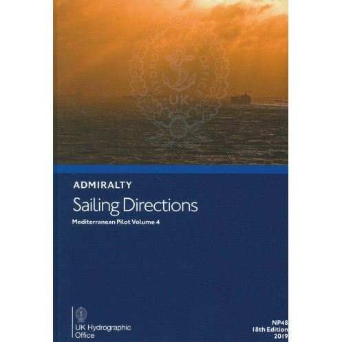




Navigate the Aegean Sea with confidence using this essential sailing guide. Covers Greece and Turkey’s coasts, detailing hazards, ports, weather, and currents for safe and efficient voyages.
Data sheet
Specific References
Navigating the Aegean Sea demands precision, local knowledge, and reliable data—exactly what this comprehensive nautical guide delivers. Designed for merchant mariners, commercial vessels, and professional navigators, this volume provides critical insights into one of the world’s most trafficked and strategically important maritime regions. From hidden shoals to seasonal weather patterns, this guide ensures you have the information needed to plan and execute voyages with confidence.
This publication offers exhaustive coverage of the Aegean Sea, including the adjacent coastlines of Greece and Turkey. It details key navigation hazards, buoyage systems, pilotage procedures, and local regulations, ensuring compliance and safety. Whether you’re transiting busy shipping lanes or approaching lesser-known ports, this guide provides the depth of information required for informed decision-making. It also includes essential data on port facilities, seasonal conditions, currents, ice formation, and climatic trends—all presented in a clear, accessible format.
This nautical instruction is not just a reference—it’s a tool built for the demands of modern maritime operations. Complementing standard nautical charts, it enhances situational awareness with high-quality color photographs, coastal views, and detailed diagrams. These visual aids allow navigators to cross-reference real-time conditions with documented landmarks, reducing risks and improving efficiency. As part of a global series of 74 to 76 volumes, it adheres to the highest standards of accuracy and reliability, trusted by mariners worldwide.
With roots tracing back to 1863, when the first edition focused on Crete, this guide has evolved into a cornerstone of maritime navigation. The 19th edition, published in 2025, reflects the latest hydrographic data and navigational best practices. Its lightweight, watermarked paper ensures durability in harsh marine environments, while its hardcover binding guarantees longevity. For professionals who cannot afford uncertainty, this publication is an indispensable resource for safe and efficient voyages in the Mediterranean.
Navigate the Aegean with Confidence
This essential nautical publication is your go-to resource for mastering the complexities of the Aegean Sea and its surrounding coastlines. Tailored for merchant mariners, commercial vessels, and professional navigators, it delivers unparalleled insights into navigation hazards, local regulations, and port facilities. Whether you're charting a course through busy shipping lanes or planning a stop at a lesser-known harbor, this guide ensures you have the critical data needed to navigate safely and efficiently.
Comprehensive Coverage for Professional Use
Covering the Aegean Sea and its approaches, including the coasts of Greece and Turkey, this volume provides detailed information on buoyage systems, pilotage procedures, and seasonal conditions. It also includes vital data on currents, ice formation, and climatic trends, all presented in a structured and easy-to-reference format. Designed to complement standard nautical charts, this guide enhances situational awareness with high-quality color photographs, coastal views, and diagrams, allowing navigators to cross-reference real-time conditions with documented landmarks.
Built for Durability and Reliability
Weighing just 1.9 kg, this paperback edition is crafted for the rigors of maritime use. Printed on lightweight, watermarked paper for durability, it features a hardcover binding to withstand the challenges of life at sea. As part of a global series of 74 to 76 volumes, it upholds the highest standards of accuracy and reliability, making it a trusted companion for mariners worldwide. The 19th edition, published in 2025, reflects the latest hydrographic data and navigational best practices, ensuring you have the most up-to-date information at your fingertips.
This nautical guide is a paperback edition in English, published in 2019 as the 19th edition. Weighing 1.9 kg, it is designed for durability with lightweight, watermarked paper and a hardcover binding. It covers the Aegean Sea and its approaches, including the adjacent coastlines of Greece and Turkey, providing essential data for safe and efficient navigation.
With a legacy spanning over a century, this series of nautical publications is renowned for its precision, reliability, and authority in maritime navigation. Trusted by professional mariners worldwide, these guides are developed using the latest hydrographic data and best practices, ensuring they meet the highest standards of accuracy and usability for safe and efficient voyages.
This volume covers the Aegean Sea and its approaches, including the adjacent coasts of Greece and Turkey, with detailed navigational information for safe passage.
Yes, it is designed for merchant navigators operating all types of ocean-going vessels, providing essential data for safe and efficient navigation.
The publication uses lightweight chart paper, watermarked by the United Kingdom Hydrographic Office, ensuring durability and clarity for nautical use.
Yes, it contains high-quality color photographs, views, and diagrams to enhance situational awareness during voyage planning and execution.
The publication is periodically updated, with the most recent edition being the 19th, published in 2025, ensuring the latest navigational data is available.
The publication weighs approximately 1.9 kg, making it manageable for onboard use while maintaining durability.
Yes, the volume provides comprehensive information on seasonal conditions, including currents, ice, and climatic factors relevant to the covered region.
You might also like


























































![Admiralty - NP054 - Sailing directions: North Sea [West]](https://www.nautic-way.com/68595-home_default/admiralty-np054-sailing-directions-north-sea-west-maritime-bookshop-nautic-way.jpg)
![Admiralty - NP055 - Sailing directions: North Sea [East]](https://www.nautic-way.com/90871-home_default/admiralty-np055-sailing-directions-north-sea-east-maritime-bookshop-nautic-way.jpg)





































































































