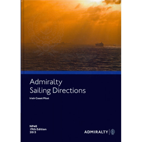




Master Ireland’s coastal navigation with this comprehensive guide. It includes vital data on hazards, port entries, weather, and regulations, ensuring safer and smoother voyages for all mariners.
Data sheet
Specific References
Navigate Ireland’s Coastal Waters with Precision and Confidence
Sailing Directions: Irish Coast NP040 is a vital navigational resource for commercial vessels operating along Ireland’s diverse and often challenging coastline. This paper publication provides an exhaustive compilation of essential maritime data, tailored to support safe and efficient navigation for ships of all sizes. From the Atlantic approaches to the Irish Sea to the intricate harbor entrances, this guide equips navigators with the critical information needed to plan and execute voyages with accuracy. Whether you're a captain, a maritime operator, or a navigation officer, this publication is designed to enhance your operational capabilities and ensure compliance with maritime regulations.
Comprehensive Coverage of Navigational Essentials
This guide offers detailed insights into every aspect of coastal and offshore navigation around Ireland. It includes precise descriptions of navigational hazards, such as submerged rocks, shallow waters, and unpredictable currents, allowing crews to avoid potential dangers. The publication also provides in-depth information on buoyage systems, pilotage requirements, and local regulations, ensuring vessels adhere to maritime standards. Additionally, it covers seasonal variations in weather, tides, and ice conditions, enabling navigators to adapt their routes and strategies based on real-time environmental factors. With high-quality color photographs and clear diagrams, the guide enhances situational awareness, making it easier to identify landmarks and navigate complex waterways.
Designed for Professional Maritime Operations
Sailing Directions: Irish Coast NP040 is specifically crafted for the demands of commercial shipping, offering practical guidance for port entries, anchorage procedures, and cargo operations. It includes detailed descriptions of port facilities, such as berth capacities, cargo handling equipment, and available services, ensuring vessels can plan their operations efficiently. The guide also provides insights into local pilotage services, tug availability, and regulatory requirements, helping crews streamline their port calls and minimize downtime. By integrating this publication with standard nautical charts, navigators can create a comprehensive navigational plan that addresses both macro and micro-level challenges.
Regularly Updated for Accuracy and Reliability
To maintain its relevance and accuracy, this publication is updated regularly through Admiralty Notices to Mariners (Section IV). These updates incorporate the latest hydrographic surveys, regulatory changes, and port developments, ensuring that navigators have access to the most current information. The 20th edition (2016) reflects the latest advancements in maritime safety and navigation, making it a trusted resource for vessels operating in Irish waters. Whether navigating the bustling ports of Dublin and Cork or the remote coastlines of the west, this guide provides the reliability and precision needed to ensure safe and efficient voyages.
Sailing Directions: Irish Coast NP040 is a paper publication weighing 1.9 kg, designed for professional maritime use. It covers the Irish coastline, including the Atlantic approaches to the Irish Sea, with detailed information on navigational hazards, buoyage, pilotage, and port facilities. Part of a global series of 74 volumes, this guide is updated regularly through Admiralty Notices to Mariners and includes high-quality color photographs and diagrams for enhanced situational awareness.
Published by a globally recognized authority in hydrographic data, this series of sailing directions is trusted by maritime professionals worldwide. With a legacy of providing accurate and reliable navigational resources, the publisher ensures that each volume is meticulously researched, regularly updated, and designed to meet the highest standards of maritime safety. The publications are an essential tool for commercial shipping, supporting safe and efficient navigation across the world’s oceans.
The sailing directions weigh 1.9 kg, making it suitable for onboard reference without adding excessive bulk.
New editions are published regularly, with recent editions including the 20th (2016), 21st (2019), and 22nd (2023). Updates are provided via Notices to Mariners.
This volume covers the Irish Coast, including routes to the Irish Sea from the Atlantic Ocean, port entries, and coastal navigation details.
Yes, it includes high-quality color photographs and coastal views to assist with navigation and port entry identification.
Details include available services, regulations, pilotage requirements, and guides for entering major ports along the Irish Coast.
Yes, it is designed to complement standard nautical charts by providing additional navigational details and context for safer voyages.
The sailing directions are available exclusively in English.
You might also like


























































![Admiralty - NP054 - Sailing directions: North Sea [West]](https://www.nautic-way.com/68595-home_default/admiralty-np054-sailing-directions-north-sea-west-maritime-bookshop-nautic-way.jpg)
![Admiralty - NP055 - Sailing directions: North Sea [East]](https://www.nautic-way.com/90871-home_default/admiralty-np055-sailing-directions-north-sea-east-maritime-bookshop-nautic-way.jpg)