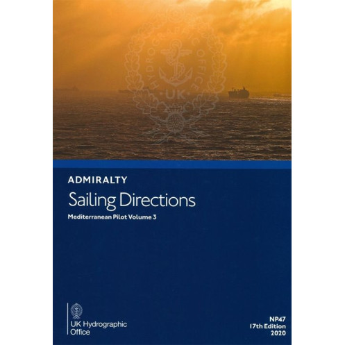




Essential for mariners, this sailing guide covers the Adriatic and Mediterranean regions with expert coastal and port entry details. Reliable, up-to-date, and designed for safe navigation.
Data sheet
Specific References
Navigate the Adriatic and surrounding Mediterranean regions with confidence using this comprehensive sailing guide. Designed for maritime professionals, this publication delivers critical coastal and port entry information for safe and efficient voyages. Covering key areas from the Adriatic Sea to adjacent waters, it ensures vessels of all sizes have the data needed for precise navigation in one of the world’s busiest maritime zones.
This volume is an indispensable tool for commercial mariners, providing detailed insights into coastal features, harbor approaches, and local maritime regulations. It bridges the gap between global charts and on-the-ground realities, offering practical guidance for navigating complex waterways, avoiding hazards, and optimizing route planning. Whether entering a major port or transiting narrow straits, this guide equips crews with the knowledge to make informed decisions.
From the northern Adriatic’s shallow waters to the intricate coastlines of Croatia, Albania, and Greece, this publication covers latitudes spanning 36.17°N to 47°N and longitudes from 10°E to 23.5°E. It includes up-to-date information on tides, currents, navigational aids, and port facilities, ensuring vessels comply with local requirements while minimizing risks. The 18th edition (2024) reflects the latest hydrographic data, making it a reliable resource for modern maritime operations.
Engineered for the demands of life at sea, this paperback edition is lightweight (1.9 kg) yet robust, designed to withstand frequent use in challenging environments. Its clear, concise format allows for quick reference, whether on the bridge or during pre-voyage planning. With a legacy dating back to 1861, this guide has evolved alongside maritime technology, maintaining its reputation as a cornerstone of safe navigation in the Mediterranean.
Maritime regulations require vessels to carry up-to-date navigational references, and this publication meets those standards for the covered regions. It complements electronic charts by providing contextual details that digital systems may overlook, such as local pilotage practices or seasonal variations in water depth. For shipping companies, port authorities, and naval operators, it’s a critical asset for maintaining operational efficiency and safety in one of the world’s most trafficked maritime corridors.
Master the Adriatic and Mediterranean with Unmatched Precision
Sailing Directions: Mediterranean Vol. 3 is the definitive paperback guide for navigating the Adriatic Sea and its surrounding regions, trusted by maritime professionals for over a century. This 18th edition (2024) delivers unparalleled accuracy, covering latitudes from 36.17°N to 47°N and longitudes from 10°E to 23.5°E—encompassing critical areas like Croatia’s Dalmatian Coast, Albania’s Ionian waters, and Greece’s western islands. Weighing just 1.9 kg, it’s designed for easy handling on the bridge while providing the depth of information needed for safe, compliant voyages.
Engineered for Real-World Maritime Challenges
This guide goes beyond basic charts, offering detailed insights into harbor approaches, tidal patterns, and local regulations that impact navigation. It’s tailored for commercial vessels, from cargo ships to naval fleets, ensuring crews can anticipate hazards, optimize routes, and comply with port-specific requirements. The 2024 edition incorporates the latest hydrographic data, reflecting changes in water depths, navigational aids, and coastal infrastructure—critical for avoiding groundings and delays in high-traffic zones.
Built on a Legacy of Reliability
With roots tracing back to 1861, this publication has evolved alongside maritime technology while maintaining its reputation as an essential tool for safe navigation. Its paperback format ensures durability in harsh marine environments, and the clear, structured layout allows for quick reference during time-sensitive operations. Whether transiting narrow straits or preparing for port entry, this guide provides the contextual details that digital systems often miss, making it a must-have for any vessel operating in the Mediterranean.
This 18th edition (2024) of Sailing Directions: Mediterranean Vol. 3 is a paperback publication in English, weighing 1.9 kg. It covers the Adriatic and surrounding regions, with precise coordinates spanning latitudes 36.17°N to 47°N and longitudes 10°E to 23.5°E. Updated with the latest hydrographic data, it provides critical information for safe navigation in high-traffic Mediterranean waters.
With a history dating back to the 18th century, this publisher is a global authority in maritime navigation, providing hydrographic data and publications used by commercial fleets, naval forces, and port authorities worldwide. Their guides are recognized for their accuracy, durability, and compliance with international maritime standards, making them a trusted resource for professionals navigating complex waterways.
This volume covers the Adriatic Sea and surrounding regions, including detailed coastal and port entry information for safe navigation.
Yes, it provides detailed sailing directions and navigational information applicable to all types of ships.
The printed version weighs 1.9 kg.
This is the 18th edition, published in 2024, with data updated as of 2020.
Yes, the guide includes precise latitude and longitude coordinates in decimal degrees for key navigational points.
It focuses on coastal navigation and port entries in the specified Mediterranean regions, not open international waters.
You might also like


























































![Admiralty - NP054 - Sailing directions: North Sea [West]](https://www.nautic-way.com/68595-home_default/admiralty-np054-sailing-directions-north-sea-west-maritime-bookshop-nautic-way.jpg)
![Admiralty - NP055 - Sailing directions: North Sea [East]](https://www.nautic-way.com/90871-home_default/admiralty-np055-sailing-directions-north-sea-east-maritime-bookshop-nautic-way.jpg)





































































































