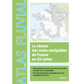
Vagnon river guide
Vagnon inland waterway guides support leisure boaters and navigators when preparing and carrying out navigation on rivers, canals and other navigable waterways. They provide practical information for understanding inland navigation rules, buoyage, locks, waterways structures, navigation conditions and the main characteristics of inland routes. Depending on the area covered, a Vagnon guide can help prepare a cruise on the Seine, Loire, Rhône, Saône or Garonne, as well as on French and European canal networks. These publications are particularly useful for beginners, experienced boaters, candidates preparing for inland-waterway qualifications, boat owners and crews planning a route. Vagnon guides can also complement inland waterway charts and other nautical publications used for voyage planning. They provide a practical reference for learning navigation techniques, preparing an itinerary and understanding the specific requirements of inland navigation in France and Europe.

Vagnon Inland Waterway Guide
The Vagnon inland waterway guide is designed to support the planning and practice of inland navigation in France. Intended for recreational boaters, navigators, inland boat owners and users of navigable waterways, it provides a structured overview of the French inland waterway network and useful information for planning routes on rivers, canals and other navigable waterways. The Vagnon Navigation range combines cartographic information, practical guidance and technical data to make the specific constraints of inland navigation easier to understand.
The Vagnon Inland Waterway Atlas is particularly useful as a reference for travelling throughout the French navigable waterway network. It helps users plan a river cruise, organise the different stages of a journey and identify the main infrastructure encountered along a route. Its cartography is designed to remain clear and practical both during voyage preparation and for onboard consultation.
What is a Vagnon inland waterway guide used for?
Inland navigation involves different constraints from those encountered at sea. Navigators must take locks, bridges, tunnels, weirs, reaches, changes in water level, available draught and permitted air draught into account. Understanding the waterway network is therefore essential when planning a route that is compatible with the characteristics of the vessel.
A Vagnon inland waterway guide can be used to:
-
identify navigable waterways and their connections;
-
plan a route between two ports or regions;
-
locate locks and major structures;
-
identify summit levels and tunnels;
-
locate turning basins and mooring areas;
-
understand the general characteristics of a waterway section;
-
check restrictions relating to draught, air draught, length and beam;
-
organise the different stages of an inland cruise;
-
understand the structure of the French navigable waterway network.
This approach is particularly useful for navigators who want to anticipate the constraints of a route before departure rather than discover them progressively during the voyage.
The Vagnon Inland Waterway Atlas and the French network
The Vagnon Inland Waterway Atlas provides cartographic coverage of the French navigable waterway network. It brings together 53 maps, allowing users to move from an overall view of the network to a more detailed view of individual areas.
A general map first provides an understanding of the main French inland waterways. The map index and page cross-references can then be used to quickly access the section corresponding to a planned route.
This organisation is especially useful for journeys involving several connected waterways. An itinerary may link a river to a canal and then another canal to a river. In such cases, the navigator needs to understand how the different sections connect.
Vagnon inland waterway charts can therefore be used when planning routes on or around major waterways such as the Seine, Loire, Rhône, Saône and Garonne and their associated networks.
Understanding waterway characteristics
An important feature of inland navigation is the need to check the available waterway dimensions before entering a particular section.
The permitted dimensions determine whether a vessel can safely pass through the various structures and navigate a particular waterway. Navigators must consider:
-
draught;
-
air draught;
-
maximum vessel length;
-
maximum beam;
-
lock dimensions;
-
clearance beneath bridges;
-
turning possibilities;
-
restrictions affecting specific sections.
This information is particularly important for inland boats, residential barges, river cruisers and vessels used for inland cruising.
For example, a vessel with a high air draught needs to anticipate low bridge clearances. Conversely, a vessel with significant draught must check available depth along the route, particularly where water levels can change.
Locks, reaches and inland waterway structures
Locks are one of the defining features of inland navigation in France. They allow vessels to overcome differences in water level between successive sections of a waterway.
A route containing numerous locks requires specific preparation. Navigators need to understand their location, sequence and the general characteristics of the waterway section. Summit levels, tunnels and turning basins may also influence the preparation of an individual stage.
An inland waterway guide therefore does more than represent a waterway as a simple line between two ports. It helps the navigator understand how the waterway functions and anticipate the structures that shape the route.
This information is particularly useful when undertaking a first voyage on a canal or engineered river.
Navigation on French rivers, canals and waterways
France has a highly varied inland waterway network. Navigation conditions can differ considerably depending on the type of waterway.
The Seine provides routes through the Paris region and Normandy towards the port areas of Rouen and Le Havre. The Loire presents a different environment, with specific navigable sections rather than a continuously navigable river. The Rhône and Saône form an important inland navigation axis linking northern and southeastern France. The Garonne and Gironde also have particular characteristics because of their maritime influence and hydrological conditions.
Canals connect different river basins and make longer inland journeys possible. The Canal du Midi is a well-known route for river cruising, while other canal systems connect the Seine, Loire, Rhône and Saône basins.
For every route, the inland waterway guide should be used as a planning tool to understand the sequence of waterway sections and structures.
Planning an inland cruise with Vagnon
Before departure, planning involves establishing the route, identifying the main stages and checking that the vessel is compatible with the characteristics of the waterways to be used.
An effective approach is to:
-
determine the departure point and destination;
-
identify suitable navigable waterways;
-
locate changes of basin or canal;
-
analyse locks and structures along the route;
-
check maximum permitted dimensions;
-
identify ports and mooring locations;
-
divide the journey into daily stages;
-
anticipate technical passages;
-
complement the preparation with current regulatory information.
The Vagnon inland waterway guide is particularly useful during this preparation stage. It provides a structured overview of the route and allows practical documentation to remain available onboard.
A tool for recreational inland navigation
Recreational inland navigation requires different documentation from offshore navigation. The main issues concern knowledge of the network, infrastructure, vessel dimensions and organisation of daily stages.
The Vagnon Inland Waterway Atlas is particularly relevant to:
-
recreational inland boaters;
-
inland boat owners;
-
crews of residential river boats;
-
people planning their first river cruise;
-
experienced navigators exploring a new waterway network;
-
inland navigation schools and instructors;
-
users looking for an overview of the French navigable waterway network.
The practical information can also be useful for travellers who want to combine navigation with discovering the heritage of the towns and regions along the route.
Inland navigation and regional discovery
An inland waterway guide is not only used to determine a route. Inland cruising also provides access to towns, villages, engineering structures and historical sites located along navigable waterways.
The Vagnon Inland Waterway Atlas includes information that can help enrich a journey with ideas for visits and activities in towns along the waterways. This is particularly appropriate for river tourism, where shore excursions are an important part of the experience.
Routes can therefore combine navigation, cultural heritage, local food, sightseeing and discovery of the landscapes encountered along the way.
Complementarity with other nautical publications
A Vagnon inland waterway guide is a planning and navigation publication for inland waterways. It does not necessarily replace all regulatory documents, notices or operational information applicable at the time of a voyage.
Depending on the type of navigation and the area concerned, navigators may need to complement their documentation with information from waterway authorities, local regulations, navigation notices and current information concerning temporary restrictions.
For areas affected by maritime navigation, Shom hydrographic publications can provide additional information. In other international contexts, Admiralty, NGA and national hydrographic offices may meet specific documentation requirements.
The combination of cartography, regulations and current operational information remains essential for serious voyage preparation.
Why use specialised inland waterway charts?
A road map cannot adequately support inland navigation. Navigation on a waterway depends on specific parameters that are not represented in sufficient detail on conventional land maps.
Specialised inland waterway cartography makes it possible to:
-
visualise the navigable network;
-
identify structures;
-
understand connections between waterways;
-
anticipate vessel dimension restrictions;
-
plan daily stages;
-
locate mooring opportunities;
-
reduce route-planning errors;
-
organise an inland cruise more effectively.
The Vagnon inland waterway guide therefore has an operational purpose: turning general knowledge of the waterway network into a coherent navigable route.
Onboard use
The guide or atlas should remain easily accessible onboard. It can be consulted before each stage to check the area ahead and then used during navigation to locate information relating to structures and individual sections of the waterway.
Advance consultation also makes it possible to compare the length of a planned stage with the vessel's capabilities and the time available. On routes involving numerous locks, this preparation is particularly important.
Paper cartography retains a practical advantage in this context: it does not depend on batteries, connectivity or a screen and provides a broad overview of the route.
Vagnon inland waterway guide: technical yet accessible documentation
The value of the Vagnon inland waterway guide lies in the balance between technical information and ease of use. Inland navigation requires a considerable amount of data, but this information must remain directly usable by the navigator.
The purpose is not simply to represent a waterway geographically. It is to provide an operational understanding of the route, its infrastructure and its main constraints.
This approach makes the Vagnon Inland Waterway Atlas relevant both for planning a first river cruise and for organising more complex journeys across several French regions.
Conclusion
The Vagnon inland waterway guide and Inland Waterway Atlas provide practical documentation for planning inland navigation in France. Cartographic coverage of the navigable network, together with information on locks, reaches, tunnels, turning basins, mooring areas and waterway dimensions, helps navigators anticipate the constraints of a route.
For navigation on the Seine, Loire, Rhône, Saône, Garonne and the many French canals, specialised inland waterway cartography makes route preparation and stage planning easier. It should nevertheless be complemented, when necessary, with the latest regulatory and operational information.
The Vagnon inland waterway guide therefore forms part of a practical, technical and accessible documentation set for anyone wishing to understand the French navigable waterway network and prepare an inland navigation voyage under suitable conditions.
FAQ – Vagnon Inland Waterway Guide
What is a Vagnon inland waterway guide used for?
A Vagnon inland waterway guide is used to prepare and support navigation on French rivers, canals and navigable waterways. It helps users understand the network, locate structures and organise the stages of a route.
What does the Vagnon Inland Waterway Atlas contain?
The Vagnon Inland Waterway Atlas presents the French navigable waterway network through organised cartography. It includes information on locks, summit levels, tunnels, turning basins, mooring locations and the main characteristics of navigable waterways.
Does the Vagnon Inland Waterway Atlas provide waterway dimensions?
Yes. Information includes air draught, draught and permitted vessel lengths and widths for the relevant sections.
Is the Vagnon guide suitable for an inland cruise?
Yes. It is particularly suitable for planning cruises on French inland waterways, including route planning, daily stages and technical passages.
Is the Vagnon guide intended only for professionals?
No. It is also intended for recreational boaters, inland boat owners, crews and people preparing an inland navigation voyage.
Can Vagnon be used for canal navigation?
Yes. Canals form part of the French navigable waterway network covered by the Vagnon Inland Waterway Atlas. The cartography is particularly useful when planning routes involving locks and other structures.
Does the Vagnon inland waterway guide replace regulatory information?
No. It provides cartographic and practical information. Navigators must also consult current regulatory and operational information and check for temporary restrictions affecting their route.
Which French waterways can be planned with a Vagnon atlas?
The Vagnon Inland Waterway Atlas covers the French navigable waterway network and can be used when planning routes involving the Seine, Loire, Rhône, Saône, Garonne and numerous canals.
Is Vagnon information useful onboard?
Yes. The atlas is organised for practical consultation during route preparation and while navigating the waterway.
Why use an inland waterway atlas instead of a road map?
An inland waterway atlas provides navigation-specific information such as locks, vessel dimensions, draught, air draught, structures, navigable sections and mooring opportunities.