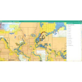
I am looking for a Primar ENC (S57 / S63) digital nautical chart for ECDIS.
Are you looking for a PRIMAR ENC digital marine chart in S-57 or S-63 format for your ECDIS? ENC (Electronic Navigational Charts) are vector electronic charts designed for compatible navigation systems, particularly ECDIS used in professional maritime navigation. PRIMAR data covers numerous maritime areas and provides essential information such as soundings, depths, hazards, aids to navigation, lights, wrecks, channels, ports and regulated areas. S-57 defines the standard data structure for ENC charts, while S-63 provides data protection and encrypted distribution. The choice of PRIMAR ENC cells depends on the navigation area, ECDIS type, cells required and desired licence period. Nautic Way can assist you in identifying the ENC data suitable for your equipment and professional navigation area, with the option of providing the references required to prepare a quotation.

I’m Looking for a PRIMAR ENC S-57 / S-63 Digital Marine Chart for ECDIS
Are you looking for a PRIMAR ENC digital marine chart in S-57 or S-63 format for your ECDIS? Electronic Navigational Charts (ENCs) are vector electronic charts designed for compatible navigation systems, particularly ECDIS used in professional maritime navigation. They display essential hydrographic and navigational information in digital form, including soundings, depths, depth contours, hazards, wrecks, rocks, aids to navigation, lights, channels, ports, regulated areas and other charted features.
Choosing an ENC is not simply a matter of selecting a geographical area. The ECDIS model, data producer, required ENC cells, data format, data protection system and licence period must also be taken into account.
What Is an ENC Marine Chart?
ENC stands for Electronic Navigational Chart. An ENC is a digital vector marine chart made up of structured data. Unlike a raster chart, which essentially reproduces a chart as an image, an ENC contains individual chart objects that the ECDIS can interpret and display according to different scales and display settings.
The S-57 standard of the International Hydrographic Organization (IHO) defines the structure used for the exchange of digital hydrographic data and is the traditional standard used for S-57 ENC production.
An ENC may contain:
-
soundings and depths;
-
depth contours;
-
wrecks;
-
rocks and underwater hazards;
-
buoys and beacons;
-
navigation lights;
-
lighthouses and landmarks;
-
channels;
-
ports and harbour facilities;
-
anchorage areas;
-
regulated areas;
-
traffic separation schemes;
-
maritime boundaries and hydrographic information.
The ECDIS uses this data to build the electronic chart display presented to the navigator.
What Is PRIMAR?
PRIMAR is an ENC data distribution service used for electronic navigation. ENC data is organised into cells corresponding to defined geographical areas.
For professional navigation, the selection of an ENC cell therefore depends directly on the area in which the vessel is expected to operate. A commercial route, coastal navigation or international voyage may require several cells and different compilation scales.
The navigator or navigation department therefore needs to identify the cells corresponding to the intended route rather than simply searching for a “marine chart” in the traditional sense.
What Is the Difference Between S-57 and S-63?
The terms S-57 and S-63 are frequently associated with ENC charts for ECDIS, but they perform different functions.
S-57 is the IHO standard for the transfer of digital hydrographic data. It forms the historical technical basis for S-57 ENCs and defines how hydrographic data is structured and encoded.
S-63 is the IHO data protection scheme. It provides mechanisms to protect ENC data against unauthorised use, control access to licensed cells and authenticate data from approved sources.
The distinction can therefore be summarised as follows:
-
S-57: structure and format of ENC hydrographic data;
-
S-63: protection and secure distribution of S-57 ENC data;
-
ECDIS: electronic navigation system capable of displaying and processing compatible ENC data.
This distinction is important when determining why certain ENC files, licences or installation parameters are required.
Why Use an S-63 ENC with an ECDIS?
In a professional navigation environment, ENC data can be protected and distributed using the S-63 scheme.
The S-63 protection system provides three important functions:
-
protection against unauthorised use of the data;
-
selective access to licensed ENC cells;
-
authentication of the data source.
S-63 therefore uses a licensing and encryption mechanism designed for the secure distribution of ENC data to compatible systems.
This means that simply copying an ENC file does not necessarily make it usable on an ECDIS. Installation must comply with the relevant protection mechanisms and parameters associated with the navigation system.
What Is an ENC Cell?
An ENC cell is a geographical unit of electronic chart data.
Rather than providing a single chart covering an enormous area, ENC data is organised into cells corresponding to specific geographical areas and different levels of detail.
A maritime route may therefore require several ENC cells.
For example, a vessel sailing from Rotterdam to the Mediterranean may require cells covering the North Sea, English Channel, Atlantic approaches, Strait of Gibraltar and different areas of the Mediterranean.
The number of cells required depends on the route, scales and geographical areas involved.
Different ENC Scales and Levels of Detail
ENCs can be produced at different compilation scales or levels of detail.
The objective is to provide chart information appropriate to the navigation situation.
Navigation within a port or restricted channel, for example, requires considerably more detailed information than ocean navigation offshore.
The ECDIS selects and displays available data according to the selected scale and display settings.
It is therefore essential to have the ENC cells appropriate for the intended route and the different navigation areas.
PRIMAR ENC for Professional Navigation
PRIMAR ENC data can be used for professional navigation when the data and ECDIS system meet the applicable requirements.
For vessels subject to SOLAS carriage requirements, the IHO indicates that an ECDIS used for this purpose must, among other requirements, be type-approved, use up-to-date ENC data, be maintained in accordance with applicable standards and have appropriate backup arrangements.
The choice of chart data should therefore be considered as part of the vessel's complete electronic navigation system rather than simply as the purchase of a digital chart.
Which PRIMAR ENC Should I Choose for My ECDIS?
Selecting S-57/S-63 ENC data requires several technical details.
Before requesting ENC data, it is useful to identify:
-
ECDIS manufacturer and model;
-
ECDIS software version;
-
system manufacturer or supplier;
-
geographical navigation area;
-
intended route;
-
required ENC cells;
-
required licence type;
-
licence duration;
-
update requirements.
ECDIS compatibility is essential. Correctly produced ENC data may nevertheless require specific configuration to be used by a particular navigation system.
ENC Charts for Commercial Ships
Commercial vessels often operate on routes covering several maritime areas and may require a significant number of ENC cells.
Chart preparation should take the complete voyage into account, including port approaches, straits, coastal waters and areas with heavy maritime traffic.
Careful chart preparation helps prevent gaps in ENC coverage during a voyage.
For an international route, charting requirements may change throughout the voyage. ENC cells should therefore be selected according to the actual route and the levels of detail required.
ENC Updates and Electronic Navigation
Keeping ENC data up to date is an essential part of professional use.
Nautical information can change over time, including navigation marks, depths, hazards, port infrastructure, channels and regulations.
The IHO states that an ECDIS used to satisfy SOLAS chart carriage requirements must use up-to-date ENCs.
ENC updating should therefore be incorporated into the vessel's chart and document management procedures.
S-57, S-63 and the Transition to S-100
Electronic charting is progressively moving towards the new generation of IHO S-100 standards.
S-100 provides a universal hydrographic data model designed to support new digital hydrographic products and services. The IHO nevertheless continues to maintain S-57 and associated systems during the transition towards S-100 technologies.
For users of S-57 ECDIS systems, this means that compatibility with currently applicable standards remains an important consideration when selecting chart data and navigation equipment.
It is therefore useful to distinguish between:
-
S-57 ENC;
-
S-63 data protection;
-
compatible S-57 ECDIS;
-
new S-100-based products;
-
future ECDIS developments.
How Do I Prepare a PRIMAR ENC Request?
To identify the required ENC cells accurately, the following information is particularly useful:
-
vessel name and type;
-
ECDIS manufacturer and model;
-
system version;
-
departure port;
-
ports of call;
-
destination port;
-
navigation route or geographical area;
-
required licence duration;
-
update requirements, if applicable;
-
references of ENC cells already in use, where available.
With this information, the required ENC coverage can be determined more precisely.
Key Points to Remember About PRIMAR ENC Charts
When choosing a PRIMAR ENC digital marine chart for ECDIS, the main points to remember are:
-
an ENC is a vector electronic navigational chart;
-
S-57 defines the structure of ENC data;
-
S-63 provides protection for S-57 ENC data;
-
ENC data is organised into geographical cells;
-
several cells may be required for a single route;
-
the choice depends on the ECDIS system;
-
geographical coverage must be checked;
-
the licence duration must be defined;
-
updates are essential for professional navigation;
-
applicable regulatory requirements must be taken into account when the ECDIS is used for SOLAS purposes.
Conclusion
A PRIMAR ENC digital marine chart in S-57/S-63 format is professional electronic chart data designed for use within a compatible electronic navigation environment, particularly ECDIS.
Selecting an ENC is not simply a matter of choosing a geographical area. The required cells must be identified, ECDIS compatibility verified, S-63 data protection requirements taken into account and the licence duration and update requirements defined.
For professional navigation, ENC preparation should form part of the vessel's overall voyage planning process. Appropriate chart coverage, up-to-date data and a correctly configured ECDIS are essential components of an electronic navigation system.
FAQ – PRIMAR ENC, S-57, S-63 and ECDIS
What is a PRIMAR ENC chart?
A PRIMAR ENC is a vector electronic navigational chart distributed through the PRIMAR ENC service. It contains structured hydrographic data designed to be used by compatible electronic navigation systems.
What does ENC mean?
ENC stands for Electronic Navigational Chart. It is a vector electronic chart containing nautical objects and information that can be interpreted by a compatible ECDIS.
What is the difference between S-57 and S-63?
S-57 is the IHO standard used for the structure and transfer of digital hydrographic ENC data. S-63 is the IHO data protection scheme used for S-57 ENCs, including licensing, encryption and authentication mechanisms.
What is an S-63 ENC used for?
S-63 protects ENC data against unauthorised use, controls access to licensed cells and provides mechanisms for authenticating distributed ENC data.
Will a PRIMAR ENC work with every ECDIS?
Compatibility depends on the ECDIS system, its configuration and the standards it supports. The ECDIS model and software version should be checked before selecting ENC data.
What is an ENC cell?
An ENC cell is a geographical unit of electronic chart data. A maritime route may require several cells covering different areas and levels of detail.
How many ENC cells are required for a maritime route?
The number depends on the route, geographical coverage, required scales and areas crossed. An international route can require a large number of ENC cells.
Which PRIMAR ENC should I choose for a commercial vessel?
The choice depends on the vessel's route, geographical areas, installed ECDIS, required cells and licence duration. Applicable professional navigation requirements must also be taken into account.
Are PRIMAR ENCs suitable for SOLAS navigation?
When an ECDIS is used to meet SOLAS chart carriage requirements, the IHO indicates that it must, among other requirements, be type-approved and use up-to-date ENCs. Compliance depends on the complete ECDIS system, the data used and the applicable requirements.
Why do ENC charts need to be updated?
Nautical information can change, including navigation marks, depths, hazards, channels and port infrastructure. For ECDIS used to meet SOLAS carriage requirements, the IHO requires the use of up-to-date ENCs.
What is the difference between S-57 ENC and the new S-100 ENC standards?
S-57 is the traditional standard used for conventional ENCs. S-100 is the IHO's universal hydrographic data model developed for a new generation of digital hydrographic products and services. Both technologies coexist during the transition towards S-100-based systems.
Can an S-57 file be used directly in an ECDIS?
This depends on the system and the way the data is distributed. ENC data intended for ECDIS can be protected using the S-63 scheme, including licensing and authentication mechanisms.
What information is required to obtain PRIMAR ENC data?
It is useful to provide the ECDIS model and software version, navigation area or route, relevant ports, any ENC cells already in use and the required licence duration.
Is an ENC a raster marine chart?
No. An ENC is a vector electronic navigational chart. Its information is structured as objects and attributes that the ECDIS can interpret and display.
Why use an ENC instead of a standard digital marine chart?
ENCs are produced according to specific standards for use in compatible electronic navigation systems. They allow the ECDIS to process structured chart data and integrate it into its navigation functions.
Are PRIMAR ENCs intended only for professional vessels?
ENCs and ECDIS are particularly associated with professional maritime navigation, including regulated navigation environments. Their use depends on the navigation system, licence and requirements applicable to the vessel.