Imray Manual
The Imray manual is nautical documentation designed for sailors and navigators who want to deepen their knowledge and prepare their passages using reliable technical information. Imray manuals cover various aspects of sailing and motor cruising, from cruise planning to coastal and offshore navigation. They complement nautical charts used in the English Channel, the North Sea, the Mediterranean Sea, the Atlantic Ocean, the Caribbean Sea and the Pacific Ocean. Depending on the route, they can support planning stopovers in Brest, Saint-Malo, La Rochelle, Cherbourg, Lisbon, Gibraltar, Palma de Mallorca, Las Palmas or Fort-de-France. For comprehensive nautical documentation, an Imray manual can be used alongside paper and digital charts from Shom, Admiralty, Imray or NV Charts, as well as sailing guides and pilot books. These publications provide practical explanations of navigation techniques, route planning, maritime safety and the use of nautical equipment.

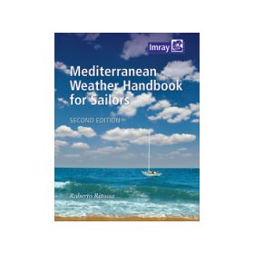
Imray Handbook: Developing Your Knowledge and Preparing for Navigation
An Imray handbook is nautical documentation designed for sailors who want to deepen their knowledge, improve their practical skills and prepare for coastal sailing, cruises or passages using a structured approach. Unlike a nautical guide or pilot book, which mainly describes a geographical area, an Imray handbook focuses more on the techniques, principles and knowledge required to understand and practise maritime navigation.
Imray publications cover a wide range of subjects, including navigation, seamanship, weather, tides, passage planning, safety, rigging, knots, maintenance, regulations and training. The Imray collection distinguishes handbooks and manuals from cruising guides and pilot books, with numerous publications devoted to navigation and sailing skills.
An Imray handbook is suitable both for sailors who want to improve their skills and for experienced navigators looking to deepen their knowledge of a particular subject. It can be used before departure, at the chart table, while preparing an ocean passage or as a reference book on board.
What Is an Imray Handbook?
An Imray handbook is primarily a technical and educational publication. It explains a method, phenomenon or practical aspect of navigation, whereas an Imray pilot book mainly describes a geographical area, its ports, anchorages and local characteristics.
Depending on the subject, a handbook may cover:
-
coastal and offshore navigation;
-
passage planning;
-
navigation techniques;
-
marine meteorology;
-
tides and currents;
-
safety at sea;
-
seamanship;
-
sailing or motorboat handling;
-
knots, ropes and ropework;
-
rigging and maintenance;
-
cruise preparation;
-
offshore navigation;
-
navigator training.
This approach makes it possible to understand not only what to do, but also why and how to do it.
Imray Handbook and Learning Navigation
A navigation handbook is particularly useful for acquiring solid foundations or improving existing skills.
Modern navigation relies on many electronic instruments, but understanding the fundamental principles remains essential. Position, heading, course over ground, leeway, current, bearing, speed, distance, tide and weather must all be interpreted correctly.
An Imray handbook can therefore help sailors progressively develop the skills required to:
-
analyse a navigation situation;
-
plan a route;
-
identify risks;
-
anticipate weather changes;
-
account for wind and current;
-
choose a passage strategy;
-
monitor the vessel's position;
-
respond to an unusual situation.
This approach is particularly valuable for sailors who want to become more autonomous and avoid relying exclusively on electronic systems.
Imray Handbook and Passage Planning
Preparing for a passage requires a comprehensive understanding of navigation.
Before leaving a port such as Brest, La Rochelle, Lisbon or Las Palmas, the navigator must analyse the route, weather conditions, currents, possible stopovers and potential difficulties.
An Imray handbook devoted to navigation or passage planning can help structure this preparation.
For example, an Atlantic crossing may involve several stages: Europe, Madeira or the Canary Islands, Cape Verde and then the Caribbean. Conditions are not the same in the Bay of Biscay, the North Atlantic, tropical regions or approaches to Martinique and Guadeloupe.
The handbook provides the general knowledge required to interpret information from charts, weather forecasts and nautical publications.
Imray Handbook and Navigation in the English Channel
The English Channel is an excellent example of why technical knowledge is important.
Between Cherbourg, Saint-Malo, Le Havre, Portsmouth, Southampton and Plymouth, sailors must deal with strong tidal streams, dense commercial traffic, numerous shoals and sometimes complex harbour approaches.
A handbook covering navigation, tides or seamanship can help sailors understand the phenomena encountered in this region.
These skills can then be applied using Shom nautical charts for French waters and Admiralty charts from the UK Hydrographic Office for British waters.
The handbook explains the principles; the chart provides the precise data required for navigation in the area concerned.
Imray Handbook for the North Sea and Baltic Sea
The North Sea presents specific challenges, including banks, shallow waters, currents, heavy commercial traffic and rapidly changing weather.
A navigation handbook can help sailors understand how to prepare a passage in this environment, particularly between the French, British, Belgian, Dutch and German coasts.
The Baltic Sea presents different challenges. Archipelagos, islands, narrow passages and shallow-water areas require a good understanding of coastal navigation.
The general knowledge provided by an Imray handbook can be applied using charts from national hydrographic services as well as Admiralty, NV Charts or other charting suitable for the area.
Imray Handbook and Mediterranean Navigation
The Mediterranean is another important area in which the technical knowledge developed through navigation handbooks can be applied.
Between Marseille, Toulon, Ajaccio, Bonifacio, Palma de Mallorca, Barcelona, Genoa, Naples, Corfu and Athens, sailing conditions can vary considerably.
Navigators need to understand the influence of wind, local effects, currents, weather and coastal relief.
In the western Mediterranean, the effects of the Mistral, Tramontane and other regional winds can significantly alter sailing conditions. In the Aegean Sea, understanding prevailing wind patterns and their effects on passages between islands is also essential.
Imray handbooks provide the general knowledge required to interpret these phenomena, while Shom, Admiralty, Imray or NV Charts provide the corresponding geographical and navigational context.
Imray Handbook and Marine Meteorology
Weather is a fundamental component of every voyage.
A handbook dedicated to marine meteorology can help sailors understand pressure systems, fronts, winds, local effects caused by terrain, convective phenomena and changing weather patterns.
This knowledge is particularly important before crossing the Bay of Biscay, sailing in the English Channel or undertaking an Atlantic passage.
It also helps sailors interpret marine weather forecasts more effectively and distinguish between favourable conditions and situations requiring a change of route.
Weather should therefore not be regarded simply as information received on a phone or computer. Understanding meteorological processes enables the navigator to make better decisions.
Imray Handbook, Tides and Currents
Understanding tides and currents is essential in many sailing areas.
It is particularly important in the English Channel, Iroise Sea, Celtic Sea, Bay of Biscay and North Sea.
A handbook devoted to navigation techniques can explain how to incorporate currents into route planning, how to distinguish between heading and course over ground, and how to anticipate the vessel's set and drift.
This knowledge is then applied using tide tables, current atlases and nautical charts appropriate to the sailing area.
Imray Handbook and Maritime Safety
Safety is another essential area of nautical documentation.
Preparing for a voyage is not only about determining a route. Sailors must also consider degraded situations such as engine failure, rigging damage, man overboard, reduced visibility, heavy weather, flooding or communication problems.
Technical publications help develop a culture of prevention and appropriate responses.
They can help sailors:
-
identify the main risks;
-
prepare safety equipment;
-
organise onboard procedures;
-
anticipate emergency situations;
-
improve crew coordination;
-
prepare a backup navigation plan;
-
respond more effectively to equipment failure.
Imray Handbook and Seamanship
The term seamanship refers to a broad range of practical knowledge related to handling and managing a vessel.
It includes manoeuvring, rigging, ropes, knots, mooring, anchoring, boat handling in different conditions and routine maintenance.
This practical dimension explains why Imray handbooks are particularly useful for sailors who want to progress beyond simply operating electronic navigation equipment.
Seamanship is explicitly represented among the subjects covered by Imray's nautical publications.
Imray Handbook and Electronic Navigation
Traditional navigation knowledge remains complementary to modern electronic systems.
GPS, AIS, radar, electronic charting and navigation software provide a considerable amount of information, but they do not replace an understanding of navigation.
A handbook can help sailors understand:
-
the limitations of GPS;
-
how to interpret a position;
-
the difference between heading and course;
-
the influence of current;
-
how to read a nautical chart;
-
how to manage a route;
-
basic radar principles;
-
the risks of excessive dependence on electronic equipment.
This approach is particularly important for offshore navigation and ocean passages.
Imray Handbook for Beginners and Experienced Sailors
An Imray handbook can be useful at different levels of experience.
For beginners, it provides educational support for gradually acquiring the fundamentals.
For experienced sailors, it can serve as a technical reference for reviewing a method, developing a particular skill or preparing for a specific voyage.
It can also be used in a training environment, particularly when studying maritime navigation, meteorology or seamanship.
Imray Handbook: Paper or Digital?
Imray offers different formats of nautical documentation. Part of its collection is also available in digital formats, including PDF, alongside printed editions.
Paper books nevertheless retain obvious advantages on board: they do not depend on a battery, remain immediately accessible and can be consulted easily at the chart table.
Digital publications can make searching for a term easier and allow several books to be carried without the physical weight of printed volumes.
The choice therefore depends on the type of navigation, the sailor's habits and the organisation of onboard documentation.
How to Choose an Imray Handbook
The choice of handbook primarily depends on the sailor's experience and the subject to be studied.
It is useful to consider:
-
the subject required;
-
the desired technical level;
-
the navigator's experience;
-
the type of vessel;
-
the planned sailing area;
-
coastal or offshore navigation;
-
the importance of meteorology;
-
safety requirements;
-
traditional navigation knowledge;
-
the use of electronic equipment.
For a coastal cruise in the English Channel, a handbook covering navigation, tides or seamanship may be particularly useful. For an Atlantic crossing, meteorology, passage planning and offshore navigation become more important.
Imray Handbook and Other Nautical Documentation
A handbook should not be confused with other types of maritime documentation.
A cruising guide or pilot book describes a geographical area.
Sailing directions provide detailed descriptions of coastlines, hazards and navigational features.
An almanac provides practical and time-related information, including tidal information depending on the publication.
A nautical chart represents depths, hazards, navigation aids and other cartographic information.
A handbook, by contrast, explains the techniques, principles and methods required by the navigator.
These different sources are therefore complementary rather than interchangeable.
Updating Imray Handbooks and Nautical Documentation
Keeping nautical documentation up to date remains an important principle. Imray publishes supplements and corrections for much of its cruising and pilot documentation and accepts reports from sailors concerning changes or corrections.
For handbooks, the need for updating depends more strongly on the subject. Fundamental principles of navigation or seamanship may remain valid for many years, while information concerning regulations, equipment or techniques can evolve more rapidly.
Navigators should therefore distinguish between general knowledge, which is relatively durable, and operational information that should be checked against the latest available publications.
Conclusion
An Imray handbook is technical and educational nautical documentation designed to improve understanding of maritime navigation and develop practical sailing skills. It complements cruising guides, pilot books, nautical charts, sailing directions and other publications used on board.
Navigation, seamanship, meteorology, tides, safety, passage planning and navigation techniques are among the subjects represented in the Imray collection.
Whether sailing in the English Channel between Brest and Cherbourg, in the North Sea towards Rotterdam, in the Mediterranean between Marseille and Corsica, in the Aegean Sea around the Cyclades or offshore between Las Palmas and the Caribbean, technical knowledge remains essential for correctly interpreting available information and making appropriate decisions.
An Imray handbook therefore helps sailors move beyond simply operating navigation equipment towards a genuine understanding of maritime navigation, whether they are beginners or experienced sailors preparing for a cruise or long-distance ocean passage.
FAQ – Imray Handbook
What is an Imray handbook?
An Imray handbook is a technical or educational publication covering maritime navigation, seamanship, meteorology, tides, safety or other skills useful to sailors.
What is the difference between an Imray handbook and an Imray guide?
An Imray guide or pilot book mainly describes a geographical area, its ports, anchorages, passages and local characteristics. An Imray handbook focuses more on navigation techniques and general knowledge.
Who are Imray handbooks intended for?
They are intended for beginner and experienced recreational sailors, offshore navigators, crew members and, depending on the publication, people undertaking maritime training.
Is an Imray handbook useful for learning navigation?
Yes. Some publications help sailors acquire or strengthen the fundamental knowledge required to plan and conduct a voyage.
Do Imray handbooks cover meteorology?
Yes. Meteorology is one of the subjects represented in Imray's nautical documentation. This knowledge is particularly useful for coastal sailing and ocean passages.
Do Imray handbooks explain tides and currents?
Some publications cover tides, currents and their influence on navigation. This knowledge should then be applied using tide and current information specific to the sailing area.
Is an Imray handbook useful for an Atlantic crossing?
Yes. Knowledge of offshore navigation, weather, passage planning, safety and boat management is particularly important for an ocean crossing.
Is an Imray handbook useful in the Mediterranean?
Yes. Navigation, meteorology and route-planning principles are directly applicable to Mediterranean sailing, including routes between Marseille, Corsica, the Balearic Islands, Italy, Greece and the Adriatic.
Does an Imray handbook replace a nautical chart?
No. The handbook provides technical and methodological knowledge, while the nautical chart provides the geographical and navigational information required for a specific area.
Which nautical charts can be used with an Imray handbook?
Depending on the sailing area, the knowledge provided by the handbook can be applied using Shom, Admiralty, NV Charts or the relevant national hydrographic service's charts.
Are Imray handbooks suitable for beginners?
Some are particularly suitable for beginners. The appropriate publication should be selected according to the sailor's technical level, the subject and previous experience.
Are Imray handbooks only intended for sailing yachts?
No. Many principles relating to navigation, meteorology, safety and passage planning also apply to motorboats.
Is an Imray handbook useful for electronic navigation?
Yes. Understanding navigation principles remains essential even when a vessel uses GPS, AIS, radar or electronic charting software.
Are Imray handbooks available in digital format?
Part of the Imray collection is available in digital formats, including PDF, alongside printed editions.
Do Imray handbooks need to be updated?
It depends on the subject. Fundamental principles change little, while regulatory, technical and operational information may require more recent documentation.
Why use an Imray handbook with a nautical guide?
The handbook explains navigation techniques and principles, while the guide describes the characteristics of a specific sailing area. The two types of documentation therefore provide complementary information.