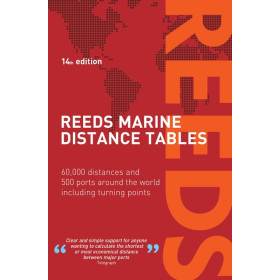
Reeds Almanac and Astronomy
The Reeds Almanac is an international reference for nautical documentation, designed to help sailors plan coastal navigation, ocean passages and stopovers in Europe and beyond. It provides practical information on ports, marinas, anchorages, tides, currents, port services, regulations and access conditions. It covers areas including the English Channel, North Sea, Baltic Sea, Atlantic Ocean, Mediterranean Sea and parts of the Caribbean, with ports such as Portsmouth, Southampton, Dover, Rotterdam, Amsterdam, Gibraltar, Lisbon, La Coruña and Las Palmas. For comprehensive route planning, the Reeds Almanac complements paper and digital nautical charts from Shom, Admiralty, Imray or NV Charts, as well as pilot books and sailing guides. Whether sailing or motor cruising, it helps sailors check port information, tide times, available services and local features before a stopover. This nautical publication is a practical complement to nautical charts for both coastal and offshore navigation.

 Click here to open our interactive map and select your charts