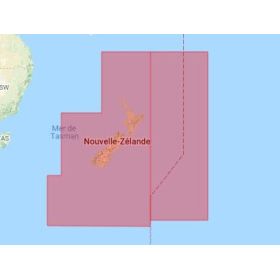
C-Map Discover Large on SD card - micro SD
C-MAP DISCOVER Large digital marine cartography on an SD or microSD card is designed for sailors looking for extensive coverage to plan and monitor their navigation on a compatible GPS chartplotter. Depending on the selected chart reference and geographic area, a C-MAP DISCOVER Large marine chart can provide detailed nautical information such as depths, soundings, depth contours, coastlines, ports, marinas, channels, navigation aids, obstacles and hazards. Available on SD or microSD media, this digital cartography makes it easy to use C-MAP data on compatible navigation equipment. It is particularly suitable for coastal navigation, cruising, recreational boating and navigation across large geographic areas. Choosing a C-MAP DISCOVER Large chart depends on the navigation area, required coverage, chartplotter model, supported card format and system version. Before purchasing, it is recommended to check the exact coverage and compatibility with your navigation equipment.

 Click here to open our interactive map and select your charts