



ENC digital vector nautical Chart (S57 / S63)
Data sheet
Specific References
Voici la traduction anglaise, en conservant la structure, le vocabulaire technique maritime et les termes S-57/S-63/S-101 :
S-57 / S-63 ENC charts are available by quotation only. Please contact us before placing any order.
The price displayed on this product page is indicative only. The final price depends on:
the hydrographic office that publishes the chart;
the geographical area concerned;
the number of ENC cells ordered;
the licence duration and update period: 3, 6 or 12 months.
We primarily supply S-57 ENC charts protected by the S-63 encryption system. We do not systematically offer unencrypted S-57 data.
The term ENC (Electronic Navigational Chart) refers to a vector electronic nautical chart.
The S-57 standard, defined by the International Hydrographic Organization (IHO), describes the structure and format of the data used for electronic navigational charts.
Unlike a raster chart, which is a digital image of a paper chart, an ENC consists of structured vector data.
It may contain, among other things:
coastlines;
depths and soundings;
depth contours;
buoys and beacons;
lighthouses and lights;
routes and channels;
regulated areas;
navigational hazards and obstacles;
maritime boundaries and nautical information.
Vector data allows navigation software to display information dynamically and adapt it to the selected zoom level.
The S-63 standard is used to provide protection and encryption for ENC charts.
It is designed to:
protect data against unauthorised copying;
authenticate chart data;
manage usage licences;
secure chart distribution;
control updates.
Commercial ENC charts used in many professional environments are generally distributed as S-57 data protected by the S-63 system.
| Standard | Description |
|---|---|
| S-57 | Format and data structure for vector electronic navigational charts (ENCs) |
| S-63 | Encryption, protection and licence management system for ENCs |
| S-101 | Next-generation ENC product specification intended to progressively replace S-57 |
👉 In summary: S-57 defines the vector chart data, while S-63 provides its protection and licence management.
There is no single worldwide ENC package. However, some providers offer regional packages, covering large geographical areas.
ENCs are produced by the various national hydrographic offices around the world.
Depending on the navigation area, data may be supplied by hydrographic offices such as:
SHOM;
Admiralty / UKHO;
and many other international hydrographic offices.
Each hydrographic office has its own commercial terms and pricing structure.
The price of an ENC primarily depends on:
the ENC cell number;
the publishing hydrographic office;
the geographical area;
the licence duration;
the selected update period.
👉 To provide you with an accurate quotation, we need to know the exact references of the charts or ENC cells you require.
The oceans and navigation areas are divided into numerous chart cells, published by different hydrographic offices.
Please therefore provide us with the number(s) of the ENC cell(s) you require so that we can quote the corresponding price.
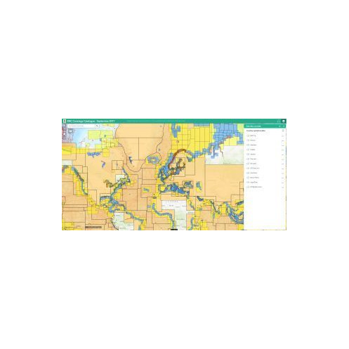
You can search for ENC cells in the international catalogue containing electronic charts from numerous hydrographic offices.
Worldwide S-57 / S-63 ENC Chart Catalogue
ENC charts are generally sold individually.
ENC charts may be supplied with an update period of:
3 months;
6 months;
12 months.
There is no subscription period longer than 12 months. If you wish to receive updates for several years, you will need to renew the subscription period. For example, to receive updates for five years, you would need five successive 12-month periods.
The price varies according to the selected duration.
During the selected subscription period, charts may receive the available updates.
At the end of this period:
the charts may potentially remain usable depending on the navigation system;
updates will no longer be available;
a new subscription may be required to continue receiving updates.
⚠️ On some ECDIS systems, charts may no longer be usable once the subscription period has expired. We therefore recommend checking compatibility and operating conditions with your navigation system.
To use ENC charts protected by the S-63 system, a USER PERMIT is generally required.
The USER PERMIT is a 28-character alphanumeric code. It associates chart licences with your navigation software or system.
👉 Before placing an order, we therefore need to receive your USER PERMIT.
You can generally find it in your software or navigation system under a section such as:
Help;
About;
System Information;
Licence;
User Permit.
Before ordering your charts, we ask you to provide details of the system you use to read the charts.
This may include:
an ECDIS;
navigation software installed on a computer;
another system compatible with S-57 / S-63 ENCs.
This information allows us to check the compatibility of the charts and protection system with your equipment.
Your software or ECDIS has a licence allowing it to use S-57 ENC charts protected by the S-63 system. In this case, we can supply the commercial ENC charts corresponding to your navigation area.
These solutions are mainly used for professional navigation.
You will need to provide us with:
your USER PERMIT;
the references of the ENC cells required;
the duration of the update period;
the name of your software or ECDIS system.
You do not have an S-63-compatible system and are looking for unprotected S-57 data, for example for use with certain navigation software such as OpenCPN.
In this case, availability depends on:
the geographical area;
the hydrographic office concerned;
the applicable data distribution conditions.
A specific request may be required from the relevant supplier or hydrographic office.
We therefore cannot guarantee in advance that the requested data will be available.
A quotation is required beforehand.
An ENC contains the nautical information corresponding to the data published for the relevant area, but it consists of vector data.
Unlike a raster chart, individual chart objects can be displayed dynamically by the software.
You can, for example:
zoom in on specific areas;
show or hide certain information;
adapt the display to your navigation system.
⚠️ Zooming in does not, however, create additional chart detail.
If the original data does not contain a particular level of detail for a port or area, simply zooming in will not provide additional information.
You can purchase several ENC cells to cover your navigation programme.
For example:
a cell covering an approach area;
a larger-scale cell for a coastal area;
a detailed cell for entering a port.
Your navigation software can then manage the different cells and automatically display the appropriate information according to the area and scale being used.
As with traditional nautical charts, the level of detail depends on the scale of the chart or ENC cell.
A chart covering a large area generally contains less detail than a chart designed for coastal navigation or port approaches.
To obtain more detail, it is therefore often necessary to use an ENC cell corresponding to a larger scale.
S-57 / S-63 ENC charts are particularly used by:
professional mariners;
vessels equipped with ECDIS;
shipping companies;
maritime administrations and organisations;
some navigators using professional navigation software on computers.
ENCs are now an essential charting solution for professional electronic navigation.
They are used in particular with systems and software compatible with ENCs, including certain ECDIS and professional navigation software.
ENC charts are generally sold cell by cell.
You can therefore build your own chart coverage by selecting only the areas required for your navigation.
This differs from certain commercial solutions, such as Navionics or C-MAP, which generally offer regional coverage combining numerous charts and scales.
With ENCs, you can select precisely the cells corresponding to your route.
ENC charts are generally supplied relatively quickly.
Please allow approximately 24 to 48 hours, subject to data availability and validation of the information required to create the licence.
Delivery may include:
a link to download the chart data;
the files required for installation;
the licence or permit file associated with your USER PERMIT.
Worldwide S-57 / S-63 ENC Chart Catalogue
Use the available search tools and filters to identify the cells corresponding to your navigation area.
You can, for example:
select your geographical area;
use the available filters;
query the cells displayed on the map.
Please provide us with:
the number(s) of the ENC cell(s) required;
your navigation area.
If you wish to cover an entire route, you can send us all the required cell references.
Choose a period of:
3 months;
6 months;
12 months.
This period determines how long you will be able to receive the updates associated with your subscription.
For charts protected by S-63, you must provide your 28-character USER PERMIT.
This number is required to create the licence corresponding to your system.
Please tell us which system you use to read the charts:
ECDIS;
navigation software on a computer;
another compatible system.
We can then check compatibility before supplying the charts.
S-57 chart data can be used by various compatible software applications.
Certain cartographic and GIS software can also be used to view or analyse some chart data.
For example, software such as QGIS or Global Mapper can be used for cartographic or geographic purposes.
⚠️ These applications are primarily mapping and geographic analysis tools and are not necessarily maritime navigation solutions.
Compatibility with S-63-protected data depends on the software used and its ability to manage the encryption system and associated licences.
All nautical charts, whether paper or digital, are supplied or prepared to order and benefit from the latest updates available at the time of preparation.
Due to their specific nature and updating requirements, these products are prepared individually for each order.
In accordance with Article L221-28 of the French Consumer Code, the right of withdrawal does not apply in the cases provided for by the applicable regulations, particularly for certain products or digital content supplied under the specific conditions applicable to them.
Charts ordered, prepared or licensed specifically for the customer therefore cannot be returned or exchanged after they have been supplied.
J’ai conservé ENC, S-57, S-63, S-101, ECDIS et USER PERMIT tels quels, car ce sont les termes techniques utilisés internationalement. J’ai également privilégié “hydrographic office”, “ENC cell”, “licence” et “update period”, qui sont les formulations les plus naturelles pour une clientèle maritime anglophone.
You might also like





















































![Admiralty - eNP054 - Sailing directions: North Sea [West]](https://www.nautic-way.com/80626-home_default/admiralty-enp054-sailing-directions-north-sea-west-maritime-bookshop-nautic-way.jpg)
![Admiralty - eNP055 - Sailing directions: North Sea [East]](https://www.nautic-way.com/90870-home_default/admiralty-enp055-sailing-directions-north-sea-east-maritime-bookshop-nautic-way.jpg)




















