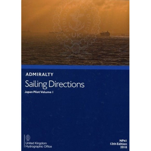





Digital sailing directions for Japan’s coastal waters, covering Honshu, Hokkaido, and the Kuril Islands. Includes hazards, weather, and port facilities for safe navigation.
Data sheet
Specific References
Navigate the complex coastal waters of Japan with confidence using this comprehensive digital sailing guide. Designed for merchant mariners operating all types of ocean-going vessels, this publication delivers critical navigation intelligence to ensure safe and efficient voyages. From hidden hazards to port entry procedures, this guide equips you with the knowledge needed to make informed decisions at sea.
This digital publication is engineered to complement standard nautical charts, providing an additional layer of safety and precision. Whether you're planning a coastal passage or approaching a busy port, the insights in this guide help you navigate with accuracy and avoid potential risks.
Approved by flag states representing over 80% of internationally trading vessels, this publication meets the highest standards of maritime safety. Its digital format ensures quick access to vital information, reducing the risk of outdated or incomplete data during critical operations.
For mariners who demand precision, reliability, and ease of use, this digital sailing guide is an indispensable tool. It combines the depth of traditional nautical publications with the convenience of modern technology, ensuring you have the most accurate and up-to-date information at your fingertips. Whether you're navigating Japan’s bustling shipping lanes or remote coastal areas, this guide is your trusted companion for safe and efficient voyages.
Navigate Japan’s Coastal Waters with Unmatched Precision
This digital sailing guide is your ultimate resource for safe and efficient navigation along Japan’s northern coastlines. Designed for merchant mariners, it provides a wealth of critical information, from navigational hazards to port entry procedures, ensuring you can make informed decisions at every stage of your voyage. Covering Honshu (excluding the southern coasts), Hokkaido, southern Sakhalin, and the Kuril Islands, this guide is an essential tool for anyone operating in these waters.
Real-Time Updates for Uninterrupted Safety
Stay ahead of the curve with weekly updates delivered via Notices to Mariners (NMs). This digital format ensures your data is always current, eliminating the risk of relying on outdated information. Updates are applied in seconds, allowing you to focus on what matters most—safe navigation. With a 12-month subscription, you’ll have continuous access to the latest intelligence without the hassle of manual replacements.
Trusted by the Global Maritime Community
Approved by flag states representing over 80% of internationally trading vessels, this publication adheres to the highest standards of maritime safety. Its encrypted PDF format guarantees secure access, while compatibility with ADMIRALTY e-Readers 1.3 and 1.4, as well as the AENP Integrated Viewer, ensures seamless integration into your existing workflow. With 344 pages of meticulously curated content, this guide is optimized for quick reference and professional use.
Comprehensive Coverage for Every Voyage
From meteorological data to local regulations, this guide provides everything you need to navigate Japan’s coastal waters with confidence. Detailed port facilities and entry guides ensure smooth operations, while insights into navigational aids and hazards help you avoid potential risks. Whether you’re planning a coastal passage or approaching a busy port, this publication is your trusted companion for safe and efficient voyages.
This digital sailing guide offers a robust set of features tailored for professional mariners. With a 12-month subscription model, you receive weekly updates via Notices to Mariners (NMs), ensuring your data remains current. The publication is compatible with Windows 7 and later versions and requires ADMIRALTY e-Readers 1.3 or 1.4, or the AENP Integrated Viewer for access. Covering 344 pages, it provides detailed information for Honshu (excluding southern coasts), Hokkaido, southern Sakhalin, and the Kuril Islands, with updates applied in just seconds.
With a legacy of excellence in maritime navigation, this publisher is a globally recognized authority in nautical publications. Their digital solutions are trusted by mariners worldwide, offering unparalleled accuracy, reliability, and ease of use. Designed to meet the needs of modern shipping, their publications are approved by flag states representing the majority of internationally trading vessels, ensuring compliance with the highest safety standards.
This volume covers coastal passages around Honshu (excluding the southern coasts), Hokkaido, the southern coast of Sakhalin, and the Kuril Islands.
No, this digital publication is only compatible with Windows 7 and later versions.
Updates are provided weekly through Notices to Mariners (NMs) and can be applied in a few seconds.
You need either ADMIRALTY e-Readers 1.3 or 1.4, or the AENP Integrated Viewer to access this publication after purchase.
This e-book contains 344 pages of detailed navigational information.
No, the e-book must be assigned to your account after purchase before it can be accessed.
You might also like





































































![Admiralty - eNP054 - Sailing directions: North Sea [West]](https://www.nautic-way.com/80626-home_default/admiralty-enp054-sailing-directions-north-sea-west-maritime-bookshop-nautic-way.jpg)
![Admiralty - eNP055 - Sailing directions: North Sea [East]](https://www.nautic-way.com/90870-home_default/admiralty-enp055-sailing-directions-north-sea-east-maritime-bookshop-nautic-way.jpg)





























