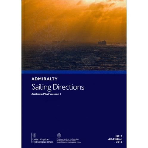





Digital sailing directions for Australia’s northern, western, and southern coasts, including Tasmania. Covers hazards, weather, port regulations, and pilotage for safe navigation.
Data sheet
Specific References
Navigate Australia’s northern, northwestern, western, and southern coasts with confidence using this comprehensive digital sailing guide. Designed for merchant mariners and commercial vessels, this publication delivers critical navigational insights to ensure safe and efficient voyages. Covering key regions from the western entrance of Endeavour Strait to Cape Carnot—including the western coast of Tasmania—this guide is an indispensable tool for professional seafarers.
This digital edition provides a wealth of practical information, including:
As a trusted companion to standard nautical charts, this publication enhances situational awareness by offering contextual insights that charts alone cannot provide. Whether navigating remote coastlines or busy commercial ports, mariners gain a deeper understanding of local conditions, reducing risks and improving operational efficiency.
Tailored for commercial shipping, this digital guide ensures quick access to vital information without the bulk of traditional printed materials. Its user-friendly format allows for easy updates and cross-referencing, making it a reliable resource for voyage planning and real-time decision-making. Ideal for captains, navigators, and maritime professionals, it combines accuracy with convenience for modern maritime operations.
Recognized as a global standard in maritime navigation, this publication is part of a series relied upon by shipping companies, naval fleets, and offshore operators. Its detailed coverage and up-to-date information make it a must-have for anyone navigating Australia’s diverse and challenging coastal waters.
Navigate Australia’s Coastal Waters with Unrivaled Accuracy
This digital sailing directions guide is engineered for professional mariners operating in Australia’s northern, northwestern, western, and southern coastal regions. Covering over 3,000 nautical miles—from the western entrance of Endeavour Strait to Cape Carnot, including Tasmania’s western coast—this publication provides the critical data needed to navigate safely and efficiently. With its 5th edition (2017) and digital format, it ensures mariners have access to the latest navigational intelligence without the limitations of printed materials.
Comprehensive Coverage for Complex Waters
Australia’s coastline presents unique challenges, from shifting sandbars to remote anchorages and busy commercial ports. This guide addresses these complexities with detailed sections on hazards, buoyage systems, and pilotage instructions. High-resolution color photographs and panoramic views offer visual confirmation of landmarks, while meteorological data helps mariners anticipate weather-related risks. Whether navigating the Great Barrier Reef’s outer edges or the industrial ports of Western Australia, this publication delivers the precision required for safe passage.
Designed for Modern Maritime Operations
Optimized for Windows 7 and later, this digital guide integrates seamlessly into electronic charting systems, allowing for real-time updates and cross-referencing. Its lightweight format (1.45 kg equivalent in digital data) eliminates the need for physical storage, making it ideal for vessels with limited space. The publication’s structured layout ensures quick access to port regulations, facility details, and entry procedures, streamlining voyage planning and execution.
A Trusted Resource for Professional Mariners
Used by shipping companies, naval fleets, and offshore operators worldwide, this guide adheres to the highest standards of maritime publishing. Its 6th edition (2017) reflects the latest hydrographic data, ensuring compliance with international navigation regulations. For mariners who demand reliability and accuracy, this publication is an indispensable tool for navigating Australia’s diverse and demanding coastal environments.
This digital sailing directions guide covers Australia’s northern, northwestern, western, and southern coasts, spanning latitudes from 9°S to 45°S and longitudes from 90°E to 142°E. Published in 2017 as the 5th edition (6th print run), it is available exclusively in a digital format compatible with Windows 7 and later. The publication includes high-resolution visuals, hazard warnings, and port-specific regulations, making it a vital resource for professional navigation.
With over two centuries of expertise in maritime navigation, this organization is a global leader in hydrographic data and nautical publications. Renowned for its precision and reliability, its products are trusted by commercial fleets, naval forces, and offshore industries worldwide. Each publication is meticulously updated to reflect the latest navigational standards, ensuring mariners have access to the most accurate and actionable information available.
This volume covers the northern, northwestern, western, and southern coasts of Australia, from the western entrance of Endeavour Strait to Cape Carnot, including the west coast of Tasmania.
No, the digital publication is only compatible with Windows 7 and later versions.
The publication includes color photographs and panoramic views to assist with navigation.
Yes, it provides port regulations, pilotage details, and entry guides for the covered regions.
The physical version weighs approximately 1.45 kg.
Yes, once downloaded, the digital publication can be accessed offline on compatible Windows devices.
This is the 5th edition, last updated in 2017.
You might also like





































































![Admiralty - eNP054 - Sailing directions: North Sea [West]](https://www.nautic-way.com/80626-home_default/admiralty-enp054-sailing-directions-north-sea-west-maritime-bookshop-nautic-way.jpg)
![Admiralty - eNP055 - Sailing directions: North Sea [East]](https://www.nautic-way.com/90870-home_default/admiralty-enp055-sailing-directions-north-sea-east-maritime-bookshop-nautic-way.jpg)





























