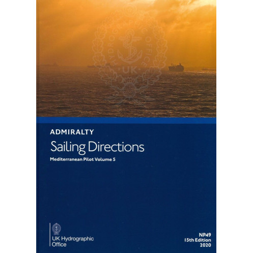





Digital sailing directions for Libya, Egypt, Israel, Lebanon, Syria, southern Greece, Turkey, and Cyprus. Includes hazards, port regulations, weather data, and pilotage guidance for safe navigation.
Data sheet
Specific References
Navigate the Mediterranean’s most complex waters with confidence using this comprehensive digital sailing guide. Designed for merchant mariners and professional navigators, this publication delivers critical insights for safe and efficient passage planning, covering high-traffic routes, remote coastlines, and everything in between. Whether you're charting a course along the Libyan coast, entering a bustling Egyptian port, or transiting the strategic waters of Cyprus, this guide ensures you have the most up-to-date information at your fingertips—no more flipping through outdated paper manuals or cross-referencing multiple sources.
Stay ahead of the curve with weekly electronic updates via Notices to Mariners (NMs), ensuring your navigation data is always current. In just seconds, integrate the latest changes on hazards, buoyage, port regulations, and meteorological conditions, eliminating the risk of relying on obsolete information. This dynamic update system is a game-changer for vessels operating in rapidly evolving maritime environments, where even minor discrepancies can have major consequences.
This volume zeroes in on one of the Mediterranean’s most critical and diverse navigation zones, including:
With detailed port entry guides, anchorage recommendations, and local regulations, this guide transforms complex passages into manageable, well-informed journeys.
Optimized for Windows 7 and later, this digital publication runs on the ADMIRALTY e-Reader software, a platform trusted by mariners worldwide for its reliability and user-friendly interface. The annual individual license ensures you’re always equipped with the latest edition, while the digital format allows for quick searches, bookmarking, and annotations—perfect for on-the-fly decision-making during passage planning or while underway.
Don’t leave your passage planning to chance. Equip your vessel with the most authoritative digital sailing directions for the Mediterranean and navigate with the precision and confidence that only comes from having the best tools at your disposal.
Navigate the Mediterranean’s Most Challenging Waters with Confidence
Sailing Directions: Mediterranean Pilot Volume 5 is your indispensable digital guide to mastering the complexities of the eastern Mediterranean, from the bustling ports of Egypt to the strategic waters of Cyprus. Designed for professional mariners, this 16th edition (2025) delivers real-time, actionable intelligence for safe and efficient passage planning, ensuring you’re always one step ahead of the curve. No more guesswork—just precise, up-to-date information tailored to the unique demands of commercial navigation in one of the world’s most dynamic maritime regions.
Unmatched Coverage for High-Stakes Navigation
This volume provides laser-focused coverage of a critical stretch of the Mediterranean, including the coasts of Libya, Egypt, Israel, Lebanon, Syria, the southern Greek islands (from Crete to Rhodes), Turkey, and Cyprus. Whether you’re navigating the shallow waters of the Nile Delta, the geopolitically sensitive eastern Mediterranean, or the congested shipping lanes near Cyprus, this guide offers the detailed insights you need to avoid hazards, optimize routes, and comply with local regulations. With coordinates spanning latitudes 30°N to 40°N and longitudes 11°E to 40°E, it’s your go-to resource for planning passages in areas where precision is non-negotiable.
Dynamic Updates for a Constantly Changing Maritime Environment
In the fast-paced world of commercial shipping, outdated information can be costly. That’s why this digital publication integrates weekly electronic updates via Notices to Mariners (NMs), ensuring your data is always current. In just seconds, you can incorporate the latest changes to buoyage, port regulations, meteorological conditions, and other critical factors—eliminating the risk of relying on obsolete paper manuals. This real-time update capability is a game-changer for vessels operating in regions where conditions evolve rapidly, such as the eastern Mediterranean.
Optimized for Professional Workflows
Built for efficiency, this digital guide runs on the ADMIRALTY e-Reader software, compatible with Windows 7 and later. The annual individual license ensures you always have access to the latest edition, while the intuitive interface allows for quick searches, bookmarking, and annotations—perfect for on-the-fly decision-making. Whether you’re planning a passage in the office or adjusting your route at sea, this tool integrates seamlessly into your navigation workflow, saving time and reducing the risk of human error.
Part of a Global Standard for Maritime Excellence
As one of 76 volumes in a worldwide series, this publication is the gold standard for professional mariners. It complements standard nautical charts, providing the contextual details that charts alone can’t offer—such as port entry procedures, local pilotage advice, and anchorage recommendations. With this guide in your digital navigation suite, you’re not just getting a book; you’re gaining access to decades of maritime expertise, meticulously curated to support safe, efficient, and compliant navigation.
This digital sailing guide delivers precise, up-to-date navigation intelligence for the eastern Mediterranean, covering the coasts of Libya, Egypt, Israel, Lebanon, Syria, the southern Greek islands (Crete to Rhodes), Turkey, and Cyprus. The 16th edition (2025) is optimized for Windows 7 and later via the ADMIRALTY e-Reader software, featuring weekly electronic updates via Notices to Mariners (NMs) to ensure real-time accuracy. With an annual individual license, this publication is designed for professional mariners who demand reliability, efficiency, and depth of information in their passage planning tools.
For over two centuries, this organization has set the global standard for maritime navigation, providing mariners with the most accurate, reliable, and comprehensive nautical information available. Their publications are trusted by commercial fleets, naval forces, and recreational sailors worldwide, offering unparalleled depth of expertise and a commitment to safety at sea. With a legacy of innovation, they continue to lead the way in digital navigation solutions, ensuring mariners have the tools they need to navigate with confidence in any waters.
This digital publication is compatible only with Windows 7 and later versions using the ADMIRALTY e-Reader software.
Updates are provided electronically on a weekly basis through Notices to Mariners (NMs), taking just a few seconds to apply.
Yes, it is designed for merchant navigators operating all types of ocean-going vessels.
It covers the coasts of Libya, Egypt, Israel, Lebanon, Syria, the southern coasts of the Greek islands from Crete to Rhodes, Turkey, and the island of Cyprus.
Yes, once downloaded via the ADMIRALTY e-Reader software, it can be used offline for passage planning tasks onboard.
It includes an individual annual license for use on a single device.
Yes, the ADMIRALTY e-Reader software is required to access and use this digital publication.
You might also like





































































![Admiralty - eNP054 - Sailing directions: North Sea [West]](https://www.nautic-way.com/80626-home_default/admiralty-enp054-sailing-directions-north-sea-west-maritime-bookshop-nautic-way.jpg)
![Admiralty - eNP055 - Sailing directions: North Sea [East]](https://www.nautic-way.com/90870-home_default/admiralty-enp055-sailing-directions-north-sea-east-maritime-bookshop-nautic-way.jpg)





























