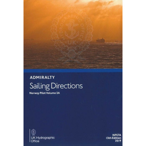





Essential digital sailing directions for Norway’s west coast (Jærens Rev to Stadlandet). Includes hazards, weather, port rules, and pilotage insights to optimize navigation for professional mariners.
Data sheet
Specific References
Navigate Norway’s rugged western coastline with confidence using this comprehensive digital nautical guide. Designed for merchant mariners and professional seafarers, this publication delivers critical insights for safe and efficient voyages from Jærens Rev to Stadlandet. Whether you’re charting a course through narrow fjords or approaching busy commercial ports, this guide ensures you have the most up-to-date and reliable information at your fingertips.
Don’t leave your voyage to chance. Equip your vessel with the most trusted digital sailing directions for Norway’s west coast. Whether you’re navigating the intricate fjords or approaching bustling ports, this guide provides the clarity and detail you need to ensure a safe and successful journey. Upgrade your navigational toolkit today and sail with the assurance that only the most reliable data can provide.
Precision Navigation for Norway’s West Coast – Your Digital Guide to Safe and Efficient Voyages
Navigating Norway’s western coastline demands more than just charts—it requires local expertise, real-time insights, and a deep understanding of the region’s unique challenges. This digital nautical guide delivers all that and more, offering merchant mariners a comprehensive resource for safe and efficient voyages from Jærens Rev to Stadlandet. Whether you’re maneuvering through narrow fjords, avoiding hidden hazards, or preparing for port entry, this guide ensures you have the most accurate and up-to-date information available.
Trusted by Mariners Worldwide for Over a Century
This 12th edition (2016) is part of a globally recognized series of 74 volumes, trusted by professional seafarers for its unparalleled accuracy and reliability. Designed to complement standard nautical charts, it provides critical details that charts alone cannot offer—such as local pilotage advice, port regulations, and real-world navigational hazards. With coverage spanning latitudes from 57.62°N to 62.20°N and longitudes from 1.48°E to 8.00°E, this guide is your go-to resource for navigating one of Norway’s most complex and trafficked coastal regions.
Digital Convenience for Modern Navigation
Say goodbye to bulky paper volumes. This digital guide is optimized for use on Windows PCs (7 and later) with the ADMIRALTY e-Reader software, offering quick searches, bookmarking, and seamless updates. The annual individual license ensures you always have access to the latest data, keeping your voyages compliant with the most current maritime regulations. Whether you’re on the bridge or planning your route ashore, this guide provides the flexibility and convenience modern mariners demand.
Built for Professional Mariners, Pilots, and Port Authorities
This guide isn’t just for captains—it’s an essential tool for pilots, port authorities, and maritime training institutions. With detailed port entry procedures, berthing instructions, and facility information, it ensures smooth and safe operations in both major and minor harbors. Offshore operators and commercial fleets will appreciate the guide’s focus on safety and efficiency, making it an indispensable part of any professional navigational toolkit.
This digital nautical guide provides essential navigational data for Norway’s west coast, covering latitudes from 57.62°N to 62.20°N and longitudes from 1.48°E to 8.00°E. The 12th edition (2016) is available in a digital format, compatible with Windows 7 and later via the ADMIRALTY e-Reader software. It operates under an annual individual license, ensuring continuous access to updated information. Designed for professional use, this guide includes detailed pilotage instructions, port regulations, and hazard warnings to support safe and efficient navigation.
For over two centuries, this organization has set the global standard for maritime navigation, providing accurate and reliable nautical publications trusted by mariners worldwide. Their comprehensive range of charts, guides, and digital tools ensures safe and efficient voyages across the world’s oceans, making them an indispensable resource for professional seafarers, port authorities, and maritime training institutions.
This volume covers the west coast of Norway, specifically from Jærens Rev to Stadlandet, including detailed coastal and navigational information for that region.
No, the digital publication requires the ADMIRALTY e-Reader software, which is only compatible with Windows 7 and later versions.
This is the 12th edition, published in 2016. Updates depend on new editions released by the publisher, which typically occur when significant navigational changes are identified.
It includes an individual annual license, allowing one user access to the digital publication for a year through the ADMIRALTY e-Reader software.
Yes, it requires a Windows-based system (Windows 7 or later) and the ADMIRALTY e-Reader software to access the digital content.
The publication provides detailed information on port regulations, pilotage details, available facilities, and entry guides for ports within the covered region.
Yes, once downloaded and installed via the ADMIRALTY e-Reader software, the publication can be accessed offline for navigation purposes.
You might also like






































































![Admiralty - eNP054 - Sailing directions: North Sea [West]](https://www.nautic-way.com/80626-home_default/admiralty-enp054-sailing-directions-north-sea-west-maritime-bookshop-nautic-way.jpg)
![Admiralty - eNP055 - Sailing directions: North Sea [East]](https://www.nautic-way.com/90870-home_default/admiralty-enp055-sailing-directions-north-sea-east-maritime-bookshop-nautic-way.jpg)




























