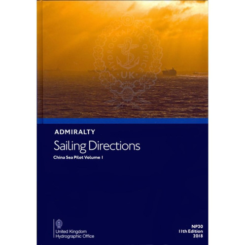





Digital guide for the western South China Sea, covering hazards, weather, port regulations, and pilotage instructions for safe voyages from Malaysia to China.
Data sheet
Specific References
Navigate the complex waters of the western South China Sea with confidence using this authoritative digital sailing directions publication. Designed for merchant mariners operating all types of ocean-going vessels, this comprehensive guide provides critical navigation information that complements standard nautical charts. Covering the region from eastern Peninsular Malaysia (Tanjung Lompat) to China (Zhelang Yan), this volume delivers unparalleled detail for safe and efficient passage planning.
This digital publication represents the evolution of traditional nautical publications, offering mariners an interactive navigation experience. The encrypted PDF format with interactive layers provides enhanced functionality while maintaining the reliability of official Admiralty publications. The digital format enables quick updates and easy access to the most current navigation information, ensuring compliance with SOLAS requirements for carriage of up-to-date nautical publications.
The South China Sea presents unique navigation challenges, from busy shipping lanes to complex coastal features. This publication provides mariners with the detailed information needed to navigate safely through these waters, including:
Navigate the Western South China Sea with Unmatched Precision
This digital sailing directions publication delivers the most comprehensive and up-to-date navigation information for one of the world's most critical maritime regions. Covering the western portion of the South China Sea from eastern Peninsular Malaysia to southern China, this essential reference provides professional mariners with the detailed intelligence needed for safe and efficient operations in these complex waters. The 2024 edition incorporates the latest hydrographic data, port developments, and regulatory changes to ensure compliance with international maritime standards.
Trusted Navigation Resource for Commercial Shipping
Developed specifically for merchant vessels of all types, this publication serves as an indispensable companion to Admiralty nautical charts. The digital format enables interactive features while maintaining the reliability that professional mariners have depended on for generations. With coverage spanning latitudes 1.57°N to 25°N and longitudes 99°E to 119°E, this volume provides complete navigation support for the entire western South China Sea region, including major ports, shipping lanes, and coastal approaches.
Advanced Digital Navigation Technology
The encrypted PDF format with interactive layers represents the cutting edge of digital nautical publications. Requiring only the ADMIRALTY e-Reader software (Windows 7 and later), this publication delivers enhanced functionality while maintaining strict security standards. The digital format ensures mariners always have access to the most current information, with updates available through the annual subscription model. The publication's 50-500 MB file size contains comprehensive navigation data, including color photographs and panoramic views that enhance situational awareness during critical navigation operations.
Comprehensive Navigation Intelligence
Beyond basic chart information, this publication provides the detailed operational intelligence that professional mariners require. Each section contains critical data on navigation hazards, aids to navigation, weather patterns, tidal streams, and port entry procedures. The publication includes specific guidance on traffic separation schemes, fishing zones, and marine protected areas, along with detailed port facility information and local maritime regulations. This comprehensive approach ensures vessels can navigate safely while complying with all applicable international and local maritime requirements.
This digital sailing directions publication features encrypted PDF format with interactive layers, requiring Windows 7 or later operating systems and the ADMIRALTY e-Reader software. The publication operates under an annual individual license subscription model, with file sizes ranging from 50-500 MB. Minimum system requirements include 4GB RAM and 2GB free storage space, with internet connectivity needed for initial download and updates. The 2024 edition covers the western South China Sea region from latitudes 1.57°N to 25°N and longitudes 99°E to 119°E, providing comprehensive navigation information for professional mariners.
For over two centuries, this hydrographic office has set the global standard for nautical publications and marine navigation data. As the official charting authority for one of the world's leading maritime nations, their publications are recognized and trusted by professional mariners worldwide. Their comprehensive range of nautical products combines cutting-edge technology with time-tested reliability, ensuring safe navigation across all ocean regions. The organization's commitment to accuracy and innovation has made their publications essential references for commercial shipping, naval operations, and maritime safety organizations globally.
This volume covers the western side of the South China Sea, from eastern Peninsular Malaysia (Tanjung Lompat) to China (Zhelang Yan).
Yes, it is compatible with macOS 10.15+ and iOS 14.0+, but the ADMIRALTY e-Reader software is only available for Windows.
You need at least 4GB RAM, 2GB free storage, and a Windows 10+ (or macOS 10.15+/iOS 14.0+/Android 8.0+) device with internet access for initial download and updates.
The publication follows an annual update cycle, with the latest edition released in 2024. Updates are delivered digitally and require an active annual license.
Yes, the PDF includes interactive layers, color photos, and panoramic views for enhanced navigation planning.
Yes, once downloaded, it can be accessed offline, though an internet connection is required for initial download and updates.
An individual annual subscription license is required, allowing access to the publication for one year.
You might also like





































































![Admiralty - eNP054 - Sailing directions: North Sea [West]](https://www.nautic-way.com/80626-home_default/admiralty-enp054-sailing-directions-north-sea-west-maritime-bookshop-nautic-way.jpg)
![Admiralty - eNP055 - Sailing directions: North Sea [East]](https://www.nautic-way.com/90870-home_default/admiralty-enp055-sailing-directions-north-sea-east-maritime-bookshop-nautic-way.jpg)





























