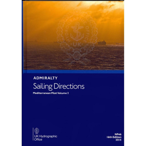





Digital sailing directions for the Mediterranean, covering Spain, France, Corsica, Sardinia, and Italy. Includes hazards, port regulations, weather, and harbor details for safer navigation.
Data sheet
Specific References
Navigate the Mediterranean with confidence using this comprehensive digital sailing guide. Designed for merchant mariners and commercial vessels, this publication delivers critical navigation data for one of the world’s busiest maritime regions. Covering the Spanish coast from Gibraltar to Cap Cerbère, the southern French coastline to the Franco-Italian border, the islands of Corsica and Sardinia, and Italy’s western shores down to latitude 39°N—including the Arcipelago Toscano—this guide is your trusted resource for safe and efficient passage planning.
This digital publication is engineered to complement standard nautical charts, providing an additional layer of intelligence for mariners. The ADMIRALTY e-Reader software ensures a user-friendly experience, with intuitive navigation tools and search functions that allow you to access critical information quickly. Whether you're plotting a course, assessing risks, or preparing for port entry, this guide delivers the data you need in a format optimized for professional use.
In the Mediterranean, where diverse coastlines, high traffic volumes, and varying local regulations converge, having a reliable source of navigational intelligence is non-negotiable. This digital sailing guide bridges the gap between traditional charts and real-world operational needs, offering actionable insights that enhance safety, efficiency, and compliance. Whether you're navigating the bustling ports of the French Riviera, the intricate channels of the Tuscan Archipelago, or the open waters between Corsica and Sardinia, this publication equips you with the knowledge to make informed decisions at every stage of your journey.
Navigate the Mediterranean with Unmatched Precision and Confidence
This digital sailing guide is your indispensable companion for safe and efficient navigation in the Mediterranean’s most critical waters. Designed for merchant mariners and commercial vessels, it provides a wealth of navigational intelligence for the Spanish coast from Gibraltar to Cap Cerbère, the southern French coastline, the islands of Corsica and Sardinia, and Italy’s western shores down to latitude 39°N. With the 15th edition of this trusted publication, you gain access to the most current and comprehensive data available, ensuring your operations remain compliant, efficient, and secure.
Comprehensive Coverage for Complex Waters
The Mediterranean is a dynamic and challenging maritime environment, where local regulations, weather patterns, and navigational hazards can change rapidly. This guide delivers detailed information on everything from aids to navigation and pilotage procedures to port regulations and meteorological conditions. It also includes full-color photographic views and port entry guides, offering visual references that enhance situational awareness and simplify decision-making. Whether you're navigating the bustling ports of the French Riviera or the intricate channels of the Tuscan Archipelago, this publication provides the insights you need to navigate with confidence.
Optimized for Professional Use
Engineered to complement standard nautical charts, this digital guide integrates seamlessly into your navigation workflow. The ADMIRALTY e-Reader software, compatible with Windows 7 and later, ensures a smooth and intuitive user experience, with powerful search functions and navigation tools that allow you to access critical information in seconds. The annual individual license guarantees that you always have the latest updates, reflecting the most recent maritime developments and regulatory changes. This ensures your operations remain compliant with international standards and local requirements, reducing risks and enhancing operational efficiency.
Trusted by Mariners Worldwide
For decades, this publication has been a cornerstone of maritime navigation, trusted by commercial fleets and professional mariners for its accuracy, depth of information, and reliability. The 2016 edition continues this tradition, offering a robust and user-friendly resource that meets the demands of modern navigation. Whether you're planning a voyage, assessing risks, or preparing for port entry, this guide equips you with the knowledge to make informed decisions, ensuring safe and efficient passage through one of the world’s most vital maritime regions.
This digital sailing guide provides essential navigational data for the Mediterranean, covering the Spanish coast from Gibraltar to Cap Cerbère, the southern French coastline, Corsica, Sardinia, and Italy’s western shores down to latitude 39°N. The 15th edition, published in 2016, is available in a digital format and requires the ADMIRALTY e-Reader software, compatible exclusively with Windows 7 and later. The annual individual license ensures access to the most up-to-date information, making it a reliable resource for professional mariners.
With a legacy spanning over two centuries, this publisher is a global leader in maritime navigation, providing accurate and reliable data to commercial fleets and professional mariners worldwide. Their publications are renowned for their precision, depth of information, and alignment with international maritime standards, making them an essential resource for safe and efficient navigation.
This volume covers the Spanish coast from Gibraltar to Cap Cerbère, the southern coast of France up to the French-Italian border, Corsica and Sardinia islands, and the western coast of Italy from the French-Italian border to latitude 39°N, including the Arcipelago Toscano.
The ADMIRALTY e-Reader software is required, which is compatible only with Windows 7 and later versions.
Yes, the sailing directions include color photographic views and port entry guides.
This product comes with an individual annual license.
No, the required ADMIRALTY e-Reader software is only compatible with Windows.
This is the 15th edition, published in 2016.
The sailing directions provide details on port regulations, facilities, pilotage, and navigational hazards.
You might also like





































































![Admiralty - eNP054 - Sailing directions: North Sea [West]](https://www.nautic-way.com/80626-home_default/admiralty-enp054-sailing-directions-north-sea-west-maritime-bookshop-nautic-way.jpg)
![Admiralty - eNP055 - Sailing directions: North Sea [East]](https://www.nautic-way.com/90870-home_default/admiralty-enp055-sailing-directions-north-sea-east-maritime-bookshop-nautic-way.jpg)





























