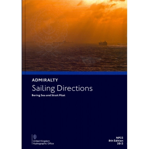





Navigate the Bering Sea and Strait with confidence using this digital guide, packed with vital details on hazards, weather, pilotage, and port facilities for Alaskan and Siberian coasts.
Data sheet
Specific References
Navigate the challenging waters of the Bering Sea and Strait with confidence using this comprehensive digital sailing directions publication. Designed for merchant mariners operating all types of ocean-going vessels, this essential resource complements standard nautical charts by providing critical navigation information in a convenient digital format. With global coverage spanning 74 volumes, this publication delivers unparalleled insights into one of the world's most complex maritime regions.
As the 8th edition published in 2013, this digital publication represents the most current and authoritative navigation reference for the Bering Sea region. The 1.6 kg digital file contains meticulously verified information from official hydrographic sources, ensuring mariners have access to the most reliable data for safe and efficient navigation. The Windows-compatible format provides instant access to critical information without the bulk of traditional paper publications, making it ideal for modern bridge operations.
Navigate the Bering Sea with confidence using this essential digital navigation resource
Designed for professional mariners operating in one of the world's most challenging maritime environments, these digital Sailing Directions provide comprehensive navigation guidance for the Bering Sea and Strait region. This 8th edition digital publication delivers critical information in a convenient, searchable format, eliminating the need for bulky paper volumes while maintaining the highest standards of maritime safety information.
Trusted navigation reference for complex Arctic waters
The Bering Sea presents unique navigation challenges, from extreme weather conditions to complex coastal geography. This digital publication addresses these challenges with detailed coverage of Alaska's western and northern coasts, the Aleutian Islands, and northeastern Siberia. The publication's precise geographic coordinates (spanning 50°N to 85°N latitude and 141°W to 178°E longitude) ensure mariners have accurate reference points for safe passage through these critical waterways.
Comprehensive maritime safety information in digital format
Beyond basic chart information, this digital publication provides the depth of knowledge required for safe navigation in Arctic waters. Mariners will find detailed descriptions of navigation hazards, comprehensive meteorological data, and step-by-step pilotage instructions. The publication also includes up-to-date port regulations, facility information, and harbor approach guidance, making it an indispensable tool for voyage planning and execution in the Bering Sea region.
Optimized for modern bridge operations
The 1.6 kg digital file format offers significant advantages over traditional paper publications. With instant search capabilities, digital bookmarking, and zoom functionality, navigators can quickly access the specific information they need during critical operations. The Windows 7+ compatible format ensures seamless integration with existing bridge systems, while the digital distribution model allows for more efficient updates and reduced environmental impact compared to paper publications.
This digital sailing directions publication provides comprehensive navigation guidance for the Bering Sea and Strait region in a convenient Windows-compatible format. The 8th edition (2013) covers critical maritime areas including Alaska's western and northern coasts, the Aleutian Islands, and northeastern Siberia, with precise geographic coordinates spanning 50°N to 85°N latitude and 141°W to 178°E longitude. The 1.6 kg digital file contains verified navigation information including hazards, meteorological data, pilotage instructions, port regulations, and harbor approach guidance, all accessible through an intuitive digital interface compatible with Windows 7 and later operating systems.
With a legacy spanning centuries of maritime navigation, this publisher represents the gold standard in hydrographic information and nautical publications. Their comprehensive range of navigation resources, developed by experienced maritime professionals, provides mariners worldwide with the accurate, reliable data needed for safe and efficient voyages. The organization's commitment to precision and innovation has made their publications essential tools for professional navigators across all maritime sectors.
This digital publication is compatible with Windows 7 and later versions.
It covers the western and northern coasts of Alaska from Cape Douglas to the Alaska-Canada border, the Aleutian Islands, and the northeastern coast of Siberia from the Mys Lopatka peninsula to near Mys Yukan, including adjacent islands.
It provides details on hazards, aids to navigation, meteorological data, pilotage information, port regulations, facilities, and entry guides.
Yes, it is designed for merchant navigators on all types of ocean-going vessels.
The digital publication has a weight of 1.60 kg for shipping purposes.
The global coverage of these sailing directions is provided in 74 volumes.
The latitudes range from 50°N to 85°N, and the longitudes range from 141°W to 178°E, covering the specified regions in detail.
You might also like





































































![Admiralty - eNP054 - Sailing directions: North Sea [West]](https://www.nautic-way.com/80626-home_default/admiralty-enp054-sailing-directions-north-sea-west-maritime-bookshop-nautic-way.jpg)
![Admiralty - eNP055 - Sailing directions: North Sea [East]](https://www.nautic-way.com/90870-home_default/admiralty-enp055-sailing-directions-north-sea-east-maritime-bookshop-nautic-way.jpg)





























