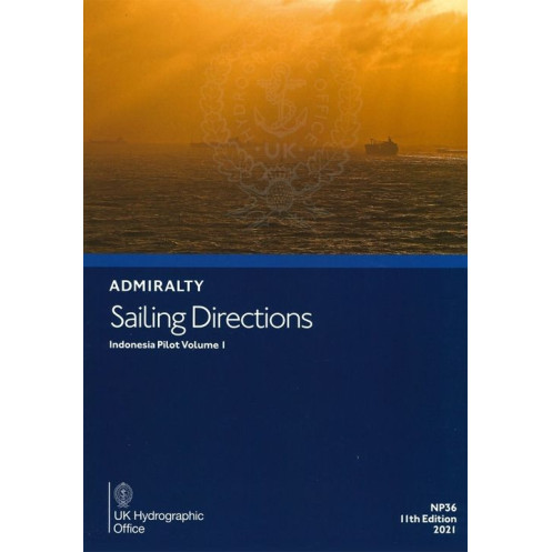





Ensure safe voyages in Indonesia with this digital guide. It details hazards, weather, and port facilities for Java, Sumatra, and Kalimantan. Essential for mariners. Requires Windows 7+.
Data sheet
Specific References
Navigate the complex waters of Indonesia with confidence using this comprehensive digital sailing guide. Designed for mariners, ship operators, and nautical professionals, this publication delivers critical insights for coastal navigation and port entry across a vast and strategically important region. Covering high-traffic areas, narrow straits, and key maritime routes, it ensures you have the most accurate and up-to-date information at your fingertips.
Whether you're navigating commercial vessels, yachts, or fishing boats, this digital sailing guide is an invaluable tool for safe and efficient passage through Indonesia’s intricate waterways. With its blend of visual aids, technical data, and practical advice, it empowers mariners to make informed decisions, avoid hazards, and optimize their routes. Trusted by professionals worldwide, this publication is your reliable companion for navigating one of the most dynamic maritime regions on Earth.
Navigate Indonesia’s Complex Waters with Confidence and Precision
This digital sailing guide is your ultimate resource for mastering the intricate maritime landscape of Indonesia. Covering critical areas such as the Sunda Strait, Bangka Strait, and the coasts of Java, Sumatra, and Kalimantan, it provides mariners with the essential data needed for safe and efficient navigation. Whether you're a commercial ship operator, a yacht captain, or a maritime professional, this publication ensures you have the most accurate and up-to-date information for coastal navigation and port entry.
Comprehensive Coverage for High-Stakes Maritime Operations
From the bustling shipping lanes of the west coast of Java to the challenging waters of the Karimata Strait, this guide offers unparalleled coverage of Indonesia’s most vital maritime zones. It includes detailed insights into the southern and eastern coasts of Sumatra, the northern coast of Java, and the strategic routes leading to Singapore and the South China Sea. With this publication, you gain access to a wealth of knowledge that spans over 74 volumes of global maritime data, tailored specifically for the Indonesian archipelago.
Visual and Technical Precision for Informed Decision-Making
Enhance your navigational accuracy with full-color photographs, panoramic views, and detailed charts that help you identify key landmarks and hazards. The guide also provides critical data on navigation aids, such as buoys and beacons, as well as meteorological information to prepare for regional weather patterns. With step-by-step pilotage instructions, you can confidently navigate port entries and exits, ensuring compliance with local regulations and maritime laws.
Designed for Modern Mariners with Digital Convenience
Optimized for use on PCs running Windows 7 and later versions, this digital publication offers a seamless and user-friendly experience. It is designed to complement Admiralty standard nautical charts, providing a complete and integrated solution for global navigation. Regular updates ensure that you always have the latest information at your fingertips, making this guide an indispensable tool for professional mariners operating in Indonesian waters.
This digital sailing guide, updated in 2021, provides comprehensive coverage of Indonesia’s key maritime zones, including the west and north coasts of Java, the southern and eastern coasts of Sumatra, and the strategic straits of Sunda, Bangka, Gelasa, and Karimata. Compatible with Windows 7 and later versions, it includes full-color photographs, panoramic views, and detailed data on navigation hazards, aids to navigation, meteorological conditions, and port facilities. The 11th edition is published in English and designed for professional use, ensuring accuracy and reliability for mariners navigating these critical waters.
With a legacy of over two centuries, this organization is a global leader in hydrographic and maritime data, providing trusted navigational solutions to mariners worldwide. Renowned for its precision, reliability, and commitment to safety, it sets the standard for nautical publications, ensuring that professionals have access to the most accurate and up-to-date information for safe and efficient navigation across the world’s oceans.
This volume covers the west coast of Java, the north coast of Java up to Tanjung Bendoh, the south and east coasts of Sumatra, Selat Sunda, Selat Bangka, Selat Gelasa, Selat Karimata, and the south and west coasts of Kalimantan from Tanjung Puting to the Lingga and Riau islands, including routes to Singapore and the South China Sea.
No, this digital sailing guide is only compatible with Windows 7 and later versions.
The guide includes information on various navigational hazards, such as shallow waters, reefs, wrecks, and other potential dangers to safe navigation.
Yes, the guide includes color photographs and panoramic views to assist with coastal navigation and port entry.
The guide details port facilities, including available services, docking information, fuel availability, and other essential amenities for vessels.
Yes, it provides relevant meteorological data to help plan safe and efficient voyages in the covered regions.
Yes, this sailing direction guide is designed to complement standard nautical charts for comprehensive navigation coverage.
You might also like





































































![Admiralty - eNP054 - Sailing directions: North Sea [West]](https://www.nautic-way.com/80626-home_default/admiralty-enp054-sailing-directions-north-sea-west-maritime-bookshop-nautic-way.jpg)
![Admiralty - eNP055 - Sailing directions: North Sea [East]](https://www.nautic-way.com/90870-home_default/admiralty-enp055-sailing-directions-north-sea-east-maritime-bookshop-nautic-way.jpg)





























