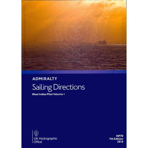





Digital sailing directions for the Western West Indies, covering Bermuda, Bahamas, Cuba, and more. Includes hazards, port rules, and weather data for safe navigation. Windows 7+ compatible.
Data sheet
Specific References
Navigate the Western Caribbean with confidence using this comprehensive digital sailing guide. Covering critical areas from the Bermuda Islands to Cuba, Jamaica, and the Cayman Islands, this publication delivers detailed, up-to-date maritime intelligence for commercial and recreational sailors alike. Whether you're charting a course through the Florida Straits, Bahamas, or Hispaniola, this guide ensures safe passage with accurate pilotage instructions, hazard warnings, and port regulations.
Part of the Admiralty Sailing Directions series, this digital volume is a cornerstone of global maritime navigation. Designed to complement Admiralty nautical charts, it provides 74 volumes of worldwide coverage, making it an indispensable resource for vessels of all sizes. With color photographs and detailed coastal views, it enhances situational awareness, helping crews identify landmarks and avoid dangers with precision.
This 2015 6th edition is engineered for modern navigation, offering seamless integration with digital charting systems. Compatible with Windows 7 and later, it ensures quick access to critical data, from weather patterns and tidal information to port facilities and pilotage services. Ideal for merchant ships, yachts, and expedition vessels, it streamlines voyage planning while maintaining the highest standards of accuracy and reliability.
Unlike traditional paper charts, this digital publication offers real-time updates and searchable content, making it easier to find critical information quickly. Whether you're navigating busy shipping lanes or remote island chains, it provides the reliability and depth of information needed to ensure a smooth and secure voyage. Trusted by mariners for generations, this guide is your essential companion for safe and efficient navigation in the Western Caribbean.
Master the Western Caribbean with the Ultimate Digital Sailing Guide
Unlock the secrets of the Western Caribbean with this digital nautical publication, meticulously crafted for mariners who demand precision and reliability. Covering a vast expanse from the Bermuda Islands to Cuba, Jamaica, and the Cayman Islands, this guide is your trusted companion for navigating some of the world’s most challenging and rewarding waters. Whether you're a commercial captain, a seasoned sailor, or an adventurous explorer, this publication provides the critical insights needed to chart a safe and efficient course.
Engineered for Modern Navigation
This 2015 6th edition digital guide is designed to meet the demands of today’s mariners. Compatible with Windows 7 and later, it offers seamless integration with digital navigation systems, ensuring you have instant access to vital information. From detailed pilotage instructions to hazard warnings and port regulations, every aspect of this publication is optimized for clarity and ease of use. With color photographs and coastal profiles, it enhances your ability to identify landmarks and avoid dangers, making it an indispensable tool for any voyage.
Comprehensive Coverage for Every Voyage
This guide doesn’t just cover the basics—it provides in-depth intelligence on the Western Caribbean’s most critical areas. Explore the Bahamas, Turks and Caicos, Hispaniola, and the Florida Straits with confidence, thanks to up-to-date meteorological data, tidal information, and port facilities. Whether you're navigating busy shipping lanes or remote island chains, this publication ensures you’re prepared for every challenge. It’s more than a guide; it’s your key to unlocking safer, smarter navigation in one of the world’s most dynamic maritime regions.
This digital nautical publication delivers comprehensive coverage of the Western Caribbean, including the Bermuda Islands, Bahamas, Turks and Caicos, Hispaniola, Cuba, Jamaica, and the Cayman Islands. Compatible with Windows 7 and later, it features the 2015 6th edition of the Admiralty Sailing Directions, offering detailed pilotage instructions, hazard warnings, meteorological data, and port regulations. Enhanced with color photographs and coastal profiles, it provides mariners with the precision and reliability needed for safe navigation.
With a legacy spanning centuries, this publisher is a global leader in maritime navigation, renowned for its precision, reliability, and innovation. Specializing in nautical publications and digital solutions, it equips mariners worldwide with the tools needed for safe and efficient voyages. Trusted by commercial fleets, naval forces, and recreational sailors, its products set the standard for accuracy and usability in the maritime industry.
This volume covers the Western West Indies, including the Bermuda, the Bahamas, Turks and Caicos Islands, Florida Straits and Cays, Hispaniola, Cuba, Jamaica, and the Cayman Islands.
No, this digital publication is only compatible with Windows 7 and later versions.
Yes, it includes color photos and detailed views to assist with navigation.
It is designed for merchant navigators operating all types of deep-sea vessels.
Yes, it provides details on port regulations, facilities, and entry guides.
The coverage spans latitudes from 15°N to 28.47°N and longitudes from 50°W to 84.52°W.
Yes, once downloaded, it can be accessed and used offline on compatible Windows systems.
You might also like






































































![Admiralty - eNP054 - Sailing directions: North Sea [West]](https://www.nautic-way.com/80626-home_default/admiralty-enp054-sailing-directions-north-sea-west-maritime-bookshop-nautic-way.jpg)
![Admiralty - eNP055 - Sailing directions: North Sea [East]](https://www.nautic-way.com/90870-home_default/admiralty-enp055-sailing-directions-north-sea-east-maritime-bookshop-nautic-way.jpg)




























