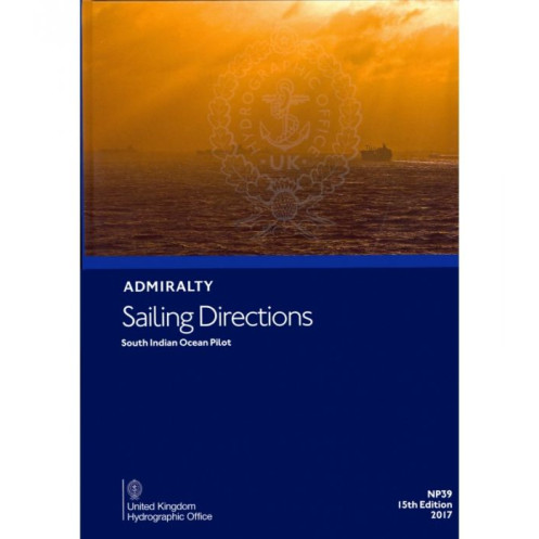





Ensure safe voyages across the South Indian Ocean with this digital sailing guide. It details hazards, weather, pilotage, port facilities, and regulations for merchant vessels.
Data sheet
Specific References
Navigate the vast and complex waters of the South Indian Ocean with confidence using this comprehensive digital sailing guide. Designed for merchant mariners and offshore vessels, this publication delivers critical navigation insights for one of the world’s most strategically important maritime regions. Covering key areas such as the Comoros, Madagascar, the Seychelles, Réunion, Mauritius, the Chagos Archipelago, and coastal zones up to 90°E longitude, it ensures safe and efficient passage planning in both familiar and remote waters.
Trusted by professional navigators worldwide, this digital sailing direction is part of a globally recognized series that complements standard nautical charts. With detailed coverage of navigational hazards, aids to navigation, local weather patterns, pilotage procedures, port regulations, and shore-based facilities, it provides the precise information needed to make informed decisions at sea. Whether approaching a busy commercial port or a secluded anchorage, mariners can rely on this guide to enhance situational awareness and operational safety.
This digital edition is engineered for seamless integration into modern navigation workflows. Compatible with Windows 7 and later operating systems, it offers quick access to vital data without the bulk of traditional paper publications. Ideal for use on bridge computers, it supports efficient route planning, real-time updates, and easy cross-referencing with electronic charting systems. The intuitive format ensures that critical information is always at your fingertips, reducing the risk of human error and improving voyage efficiency.
As part of a 76-volume global series, this publication upholds the highest standards of maritime documentation. It includes up-to-date information on port entry procedures, local maritime laws, and essential services such as fuel, water, and repairs. The guide also highlights environmental considerations, restricted areas, and recommended routes, making it an indispensable tool for compliance and operational planning. Whether navigating the bustling shipping lanes near Mauritius or the remote atolls of the Chagos Archipelago, this resource ensures that mariners are prepared for every challenge.
Master the South Indian Ocean with Unrivaled Navigation Intelligence
Sailing the South Indian Ocean demands precision, local knowledge, and reliable data—this digital sailing direction delivers all three. Designed for professional mariners operating merchant vessels, offshore ships, and commercial fleets, this guide provides an in-depth look at one of the world’s most critical maritime regions. Covering everything from the bustling ports of Madagascar and Mauritius to the remote atolls of the Chagos Archipelago, it ensures safe, compliant, and efficient voyages across vast and often challenging waters.
Engineered for Modern Navigation Workflows
This digital edition is built for today’s maritime professionals, offering seamless integration with electronic charting systems and bridge computers. Compatible with Windows 7 and later, it eliminates the need for cumbersome paper volumes while providing instant access to critical navigation data. Whether planning a route, assessing hazards, or preparing for port entry, mariners can rely on this guide to streamline operations and reduce the risk of errors. Its searchable format and intuitive layout make it an essential tool for time-sensitive decision-making at sea.
Trusted by Mariners Worldwide
As part of a 76-volume global series, this sailing direction upholds the highest standards of accuracy and reliability. It includes up-to-date information on navigational hazards, aids to navigation, local weather patterns, pilotage procedures, and port regulations—all curated by a leading authority in maritime navigation. With coverage extending to 90°E longitude, it ensures that mariners have the insights they need to navigate both high-traffic shipping lanes and remote, less-charted areas with confidence.
Beyond Basic Navigation: A Complete Operational Resource
More than just a guide to safe passage, this publication serves as a comprehensive operational resource. It details port facilities, including fuel, water, and repair services, as well as local maritime laws and environmental considerations. Whether navigating the deep waters of the Indian Ocean or approaching a coastal port, mariners will find the information they need to comply with regulations, optimize routes, and ensure the safety of crew and cargo. The 2017 edition reflects the latest updates, making it a current and indispensable asset for any voyage in the region.
This digital sailing direction provides comprehensive coverage of the South Indian Ocean, including key regions such as the Comoros, Madagascar, the Seychelles, Réunion, Mauritius, and the Chagos Archipelago. Compatible with Windows 7 and later, it offers a lightweight, searchable format for seamless integration into modern navigation systems. Part of a 76-volume global series, this 2017 edition ensures up-to-date and reliable information for professional mariners.
A globally recognized authority in maritime navigation, this organization sets the standard for accuracy, reliability, and innovation in nautical publications. With a legacy of supporting safe and efficient voyages, their digital and paper-based resources are trusted by commercial fleets, naval operations, and professional mariners worldwide. Their comprehensive series of sailing directions and charts provide unparalleled coverage of the world’s oceans, ensuring that navigators have the critical data they need for every journey.
This guide covers the South Indian Ocean, including the Comoros, Madagascar, Seychelles, Réunion, Mauritius, the Chagos Archipelago, and areas up to 90°E longitude.
No, the digital version is only compatible with Windows 7 and later versions.
These directions are designed for merchant navigators operating all types of ocean-going vessels.
It provides information on hazards, aids to navigation, weather, pilotage, port regulations, facilities, and entry guides.
The complete series consists of 76 volumes, offering worldwide coverage.
The digital version has a file size equivalent to a physical weight of 1.14 kg.
The coverage spans latitudes from -45 to -2 and longitudes from 39 to 90°E.
You might also like





































































![Admiralty - eNP054 - Sailing directions: North Sea [West]](https://www.nautic-way.com/80626-home_default/admiralty-enp054-sailing-directions-north-sea-west-maritime-bookshop-nautic-way.jpg)
![Admiralty - eNP055 - Sailing directions: North Sea [East]](https://www.nautic-way.com/90870-home_default/admiralty-enp055-sailing-directions-north-sea-east-maritime-bookshop-nautic-way.jpg)





























