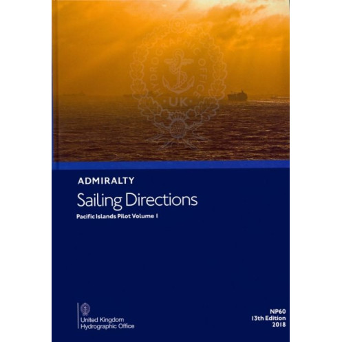





Digital sailing directions for the Pacific Islands, covering the Solomon Islands, Micronesia, and Guam. Includes navigation hazards, port regulations, and weather data for safe maritime voyages.
Data sheet
Specific References
Navigate the vast and challenging waters of the Pacific Islands with confidence. This digital sailing directions guide delivers unparalleled precision and depth, tailored for merchant navigators and seafarers operating in one of the world’s most complex maritime regions. Covering critical areas such as the Solomon Islands, the northeastern coast of Papua New Guinea, the Federated States of Micronesia, Palau, Guam, the Northern Mariana Islands, and parts of Japan, this guide is your indispensable tool for safe and efficient voyages.
Stay ahead of the curve with the latest navigational intelligence. This 12th edition, updated in 2012 and published in 2018, integrates vital data to support your decision-making at sea. From full-color photographs and panoramic views to detailed hazard warnings, this guide leaves no stone unturned. It includes critical information on:
Optimized for modern navigation, this digital edition is compatible with Windows 7 and later versions, ensuring seamless integration into your onboard systems. The digital format enhances accessibility, allowing you to quickly search, zoom, and cross-reference information without the bulk of traditional paper charts. Whether you're planning a route or navigating in real-time, this guide adapts to your needs, providing instant access to the data that matters most.
Part of a comprehensive series covering the world’s oceans in 74 volumes, this guide focuses on the unique challenges of the Pacific Islands. The included coordinates (latitude and longitude) ensure pinpoint accuracy, helping you navigate with confidence in even the most remote or hazardous waters. From bustling commercial hubs to isolated atolls, this guide equips you with the knowledge to tackle any maritime scenario.
Rely on a publication trusted by mariners for generations. This guide is a cornerstone of maritime navigation, designed to complement standard nautical charts and provide an additional layer of safety and efficiency. Whether you're a seasoned captain or a maritime professional, this digital sailing directions guide is an invaluable asset for every voyage in the Pacific Islands.
Master the Pacific Islands with Unmatched Navigational Precision
Embark on your maritime journeys with the confidence that only the most detailed and reliable navigational resources can provide. The *Sailing Directions: Pacific Islands Vol. 1* is a digital powerhouse of maritime intelligence, meticulously crafted to support merchant navigators and seafarers in one of the most intricate and expansive regions of the world. This guide is not just a tool—it’s your trusted companion for safe, efficient, and compliant navigation across the Pacific Islands.
Engineered for the Modern Mariner
This 12th edition, published in 2018, is a digital evolution of traditional sailing directions, designed to meet the demands of today’s maritime professionals. Compatible exclusively with Windows 7 and later versions, it offers a seamless, user-friendly experience that integrates effortlessly into your onboard systems. Say goodbye to cumbersome paper charts and hello to instant access, searchability, and cross-referencing capabilities that put critical information at your fingertips when you need it most.
Unrivaled Coverage of the Pacific’s Most Critical Waters
Spanning a vast and diverse region, this guide covers the Solomon Islands, the northeastern coast of Papua New Guinea, the Federated States of Micronesia, Palau, Guam, the Northern Mariana Islands, and parts of Japan. With precise latitude and longitude coordinates (ranging from 22.5°N to 14°S and 130°E to 164°E), it ensures you have the most accurate and localized data for every leg of your journey. Whether you’re navigating through bustling commercial ports or remote atolls, this guide provides the insights you need to avoid hazards and optimize your route.
More Than Just Directions—A Complete Navigational Ecosystem
This guide goes beyond basic sailing directions to offer a holistic view of the maritime environment. It includes full-color photographs and panoramic views to help you visually confirm landmarks and hazards, while detailed sections on buoyage, meteorological data, and pilotage procedures ensure you’re prepared for every scenario. Port regulations, facilities, and entry guides are also included, making it easier to plan stops, comply with local laws, and access essential services. It’s a one-stop resource for everything you need to navigate safely and efficiently.
Built for Professionals, Trusted by Experts
As part of a global series of 74 volumes, this guide is a testament to decades of maritime expertise and innovation. It’s designed to complement standard nautical charts, providing an additional layer of detail and context that enhances safety and operational efficiency. Whether you’re a captain, a maritime pilot, or a navigation officer, this digital sailing directions guide is an indispensable asset for every voyage in the Pacific Islands.
This digital sailing directions guide is engineered for precision and ease of use. Published in 2018, it represents the 12th edition of a trusted maritime resource, offering comprehensive coverage of the Pacific Islands. The guide is available exclusively in a digital format, compatible with Windows 7 and later versions, and is optimized for quick access to critical navigational data. With a focus on accuracy and usability, it includes detailed coordinates, full-color visuals, and up-to-date information on hazards, weather patterns, and port regulations.
With a legacy spanning centuries, this publisher is a global leader in maritime navigation and hydrographic services. Renowned for its precision, reliability, and innovation, it provides essential resources for mariners worldwide, ensuring safety and efficiency at sea. Its publications are trusted by professionals across the maritime industry, from commercial shipping to naval operations.
This volume covers the Pacific Islands, including the Solomon Islands, the northeast coast of Papua New Guinea and adjacent islands, the Federated States of Micronesia, the Republic of Palau, Guam, the Northern Mariana Islands, Oki-no-Tori Shima, and parts of Japan.
No, the digital edition is only compatible with Windows 7 and later versions.
The sailing directions include color photographs, panoramic views, and detailed charts to assist with navigation.
Yes, the digital version requires a device running Windows 7 or a later version to be accessed.
The sailing directions are periodically updated, with this edition being the 12th, published in 2018.
Yes, once downloaded, the digital edition can be accessed offline for navigation purposes.
The sailing directions include details on port regulations, pilotage information, port facilities, and entry guides for various ports in the covered regions.
You might also like






































































![Admiralty - eNP054 - Sailing directions: North Sea [West]](https://www.nautic-way.com/80626-home_default/admiralty-enp054-sailing-directions-north-sea-west-maritime-bookshop-nautic-way.jpg)
![Admiralty - eNP055 - Sailing directions: North Sea [East]](https://www.nautic-way.com/90870-home_default/admiralty-enp055-sailing-directions-north-sea-east-maritime-bookshop-nautic-way.jpg)




























