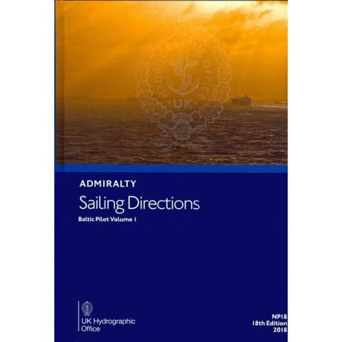





Digital guide for safe Baltic Sea navigation, covering Danish straits to Germany and Poland. Includes hazards, weather, pilotage, and port facilities for merchant vessels.
Data sheet
Specific References
Navigate the Baltic Sea with confidence using this comprehensive digital guide, designed for merchant mariners and all seafarers operating in one of the world’s busiest maritime regions. Covering the entrance to the Baltic via the Danish straits, southern Sweden, Germany, Poland, and the southern Baltic, this publication delivers critical insights for safe and efficient coastal navigation. Whether you're planning a voyage or already underway, this guide ensures you have the most up-to-date information at your fingertips.
This digital guide is designed to complement standard nautical charts, providing an additional layer of detail that enhances situational awareness. With global coverage spanning 74 volumes, it ensures mariners have access to consistent, reliable information wherever their voyages take them. Originally published in 1853 as the *Danish Pilot* and later renamed *Baltic Pilot* in 1895, this publication has evolved into a trusted resource for generations of navigators.
Whether you're navigating the bustling shipping lanes of the southern Baltic or preparing for a port call in Germany or Poland, this publication equips you with the knowledge to make informed decisions. Its combination of technical precision, practical guidance, and ease of use makes it an indispensable tool for safe and efficient maritime operations in the Baltic region.
Navigate the Baltic with Precision and Confidence
This digital nautical guide is your ultimate companion for safe and efficient navigation in the Baltic Sea, covering critical areas from the Danish straits to southern Sweden, Germany, Poland, and beyond. Designed for merchant mariners and all seafarers, it provides a wealth of information to enhance situational awareness and ensure compliance with local regulations. With its 17th edition (2015) updated for 2026, this guide reflects the latest navigational data, making it an indispensable resource for modern maritime operations.
Comprehensive Coverage for Coastal and Port Navigation
From detailed coastal views to high-resolution photographs, this guide offers visual and technical insights to help you identify landmarks, avoid hazards, and navigate with precision. It includes critical data on buoyage systems, meteorological conditions, and pilotage instructions, ensuring you’re prepared for every phase of your voyage. Whether you're transiting the Danish straits or approaching a port in Poland, this publication provides the clarity and detail needed to make informed decisions.
Regulatory Compliance and Port Readiness
Stay ahead of local regulations with up-to-date information on environmental restrictions, reporting requirements, and traffic separation schemes. The guide also features comprehensive port guides, including berthing procedures, customs protocols, and available services such as fuel, water, and repairs. With step-by-step entry instructions for major ports, you’ll have everything you need to ensure smooth and compliant port calls.
Designed for Modern Navigation Systems
Optimized for Windows 7 and later, this digital guide integrates seamlessly with your navigation software, providing a user-friendly experience with searchable content for quick access. Licensed for individual annual use, it offers flexibility for both commercial and recreational mariners. Regular updates ensure you always have the latest information on navigational hazards, port infrastructure, and regulatory changes, making it a reliable tool for safe and efficient voyages in the Baltic Sea.
This digital nautical guide is the 17th edition (2015), updated for 2026, and is available in English. Compatible with Windows 7 and later operating systems, it is licensed for individual annual use. The guide covers latitudes ranging from 53°N to 57.83°N and longitudes from 9.08°E to 13.56°E, providing detailed navigational data for the Baltic Sea’s southern and central regions.
With a legacy dating back to 1853, this publication is part of a globally recognized series trusted by mariners worldwide. Originally known as the *Danish Pilot* and later renamed, it has evolved into a cornerstone of maritime navigation, offering unparalleled accuracy and reliability. Today, it continues to set the standard for digital nautical guides, ensuring seafarers have access to the most precise and up-to-date information available.
This volume covers the entry to the Baltic Sea via the Danish straits, southern Sweden, Germany, Poland, and the southern Baltic Sea.
No, this digital publication is only compatible with Windows 7 and later versions.
The license for this publication is valid for one year and must be renewed annually.
It includes color photographs, detailed coastal views, and navigational hazard illustrations.
Yes, it includes details on port facilities, pilotage information, and entry guides for major ports.
Yes, it provides meteorological data relevant to safe navigation in the covered regions.
The coordinates cover latitudes from approximately 53°N to 57.83°N and longitudes from 9.08°E to 13.56°E within the Baltic Sea.
You might also like





































































![Admiralty - eNP054 - Sailing directions: North Sea [West]](https://www.nautic-way.com/80626-home_default/admiralty-enp054-sailing-directions-north-sea-west-maritime-bookshop-nautic-way.jpg)
![Admiralty - eNP055 - Sailing directions: North Sea [East]](https://www.nautic-way.com/90870-home_default/admiralty-enp055-sailing-directions-north-sea-east-maritime-bookshop-nautic-way.jpg)





























