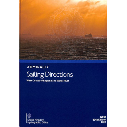





Digital sailing directions for England and Wales’ west coasts, packed with hazard alerts, port regulations, and weather data. Ensures safer, more efficient voyages for commercial mariners.
Data sheet
Specific References
Navigate the challenging waters of the West Coasts of England and Wales with confidence using this comprehensive digital sailing directions guide. Designed for merchant mariners and recreational sailors alike, this publication delivers critical navigation information for one of the most trafficked and dynamic maritime regions in the world. Covering the coastline from Cape Cornwall to the Mull of Galloway, including the southern coast of Scotland, this guide is an indispensable tool for anyone operating in these waters.
This digital sailing directions guide is part of a global series of 74 volumes, each meticulously crafted to provide unparalleled detail and accuracy. Whether you're navigating a commercial vessel or a private yacht, this publication offers a wealth of information to enhance safety and efficiency. It complements standard nautical charts, providing context, insights, and practical guidance that charts alone cannot offer. From detailed port entry procedures to local regulations, this guide ensures you have all the information needed for a smooth and secure journey.
Stay ahead of the curve with the latest edition of this essential navigation tool. This digital guide includes:
This digital edition is designed to enhance your navigation experience with features tailored for modern mariners. Enjoy the convenience of electronic updates, ensuring you always have the most current information available. The search functionality allows you to quickly find the details you need, saving time and improving efficiency. Compatible with Windows 7 and later versions, this guide is easy to install and use, making it a seamless addition to your navigation toolkit.
Rely on a publication that is trusted by professional mariners and recreational sailors around the globe. This guide is part of a long-standing tradition of excellence in maritime navigation, providing accurate, reliable, and up-to-date information. Whether you're navigating busy commercial shipping lanes or exploring remote coastal areas, this sailing directions guide is your trusted companion for safe and efficient voyages.
This digital sailing directions guide is sold under an individual annual license, ensuring you receive continuous updates and access to the latest information. Stay compliant with the most recent maritime regulations and enjoy peace of mind knowing your navigation tools are always up to date. The annual license model guarantees that you have access to the most accurate and relevant data, making it a cost-effective solution for mariners who demand the best.
Navigate the West Coasts of England and Wales with Unmatched Precision
Discover the ultimate digital navigation companion for the West Coasts of England and Wales, a region known for its complex tides, busy shipping lanes, and stunning yet challenging coastal features. This digital sailing directions guide is engineered to provide mariners with the most accurate, detailed, and up-to-date information available, ensuring safe and efficient voyages in one of the world's most dynamic maritime environments. Whether you're a professional mariner or a recreational sailor, this guide is your key to mastering the intricacies of these waters.
Designed for Modern Mariners
This digital edition is tailored for today's navigators, offering seamless integration with your existing navigation tools. Compatible with Windows 7 and later versions, it provides a user-friendly interface that allows for quick searches and easy access to critical information. The guide is sold under an individual annual license, ensuring you receive continuous updates and always have the latest data at your fingertips. Say goodbye to outdated paper charts and embrace the efficiency of digital navigation.
Comprehensive Coverage from Cape Cornwall to the Mull of Galloway
Covering a vast stretch of coastline, this guide provides detailed information for the West Coasts of England and Wales, as well as the southern coast of Scotland. From the rugged cliffs of Cornwall to the bustling ports of Wales, this publication offers unparalleled insights into the region's unique challenges and opportunities. With color photographs, panoramic views, and detailed descriptions, you'll have everything you need to navigate with confidence.
Enhance Safety with Detailed Hazard and Weather Information
Safety is paramount in maritime navigation, and this guide is designed to help you avoid potential dangers. It includes comprehensive information on underwater hazards, tidal streams, and other navigational risks, allowing you to plan your route with precision. Additionally, the guide provides meteorological data to help you anticipate weather conditions and make informed decisions. With this level of detail, you can navigate even the most challenging waters with ease.
Streamline Port Entries with Expert Guidance
Entering and exiting ports can be one of the most challenging aspects of navigation, especially in busy or unfamiliar waters. This guide offers step-by-step pilotage information, including detailed instructions for port entries and exits. It also includes local regulations, port facilities, and other essential details to ensure smooth and compliant operations. Whether you're docking in a major commercial port or a small marina, this guide provides the insights you need for a seamless experience.
This digital sailing directions guide is the 20th edition, published in 2017, and is designed for use on Windows 7 and later versions. It is available under an individual annual license, ensuring continuous access to updates and the latest information. The guide covers the West Coasts of England and Wales, as well as the southern coast of Scotland, from Cape Cornwall to the Mull of Galloway. It includes color photographs, panoramic views, hazard information, meteorological data, pilotage details, port regulations, and facilities. The digital format allows for easy searches and electronic updates, enhancing efficiency and convenience.
With a legacy spanning over two centuries, this publisher is a global leader in maritime navigation and hydrographic services. Renowned for its accuracy, reliability, and innovation, the publisher provides essential tools and data that mariners around the world depend on for safe and efficient voyages. From nautical charts to digital navigation guides, their products are trusted by professional and recreational sailors alike, setting the standard for excellence in the maritime industry.
The sailing directions cover the west coasts of England and Wales, as well as the southern coast of Scotland from Cape Cornwall to the Mull of Galloway.
The digital version is compatible with Windows 7 and later versions.
Updates are provided electronically as part of the annual individual license to ensure the latest navigational information is available.
The publication includes details on navigation hazards, aids to navigation, meteorological data, pilotage information, port regulations, port facilities, and harbor entry guides.
Yes, the digital version includes a search functionality to quickly locate specific information.
The physical package, which may include installation or licensing materials, weighs 1.35 kg.
You might also like





































































![Admiralty - eNP054 - Sailing directions: North Sea [West]](https://www.nautic-way.com/80626-home_default/admiralty-enp054-sailing-directions-north-sea-west-maritime-bookshop-nautic-way.jpg)
![Admiralty - eNP055 - Sailing directions: North Sea [East]](https://www.nautic-way.com/90870-home_default/admiralty-enp055-sailing-directions-north-sea-east-maritime-bookshop-nautic-way.jpg)





























