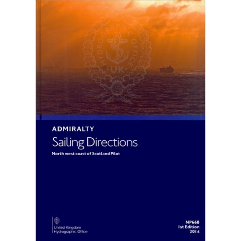





Digital sailing directions for Scotland’s North West Coast and Outer Hebrides. Covers hazards, weather, port facilities, and pilotage details for safe offshore navigation.
Data sheet
Specific References
Navigate the challenging yet breathtaking waters of Scotland’s northwest coast with confidence. This digital pilot guide delivers unparalleled insights into one of the world’s most intricate maritime regions, where shifting tides, remote islands, and unpredictable weather demand precision. Designed for commercial mariners and seasoned sailors alike, it transforms complex coastal data into actionable intelligence, ensuring safe passage through the Outer Hebrides and beyond.
This digital edition is a cornerstone of the Admiralty’s global navigation series, offering seamless integration with standard nautical charts. Its 74-volume collection provides worldwide coverage, but this volume zeroes in on the northwest coast of Scotland—a region where precision isn’t just valuable, it’s vital. Enhanced with high-resolution color photographs and coastal views, it bridges the gap between raw data and practical decision-making, allowing navigators to visualize key landmarks and hazards before they come into sight.
Unlike generic sailing manuals, this digital pilot is crafted by hydrographic experts with decades of experience in some of the world’s most demanding waters. It doesn’t just list coordinates—it interprets them, offering context that turns data into strategy. Whether you’re charting a course through the Minch, approaching Stornoway, or navigating the Sound of Harris, this guide provides the depth of knowledge needed to make informed, confident decisions. For mariners who refuse to compromise on safety or efficiency, it’s an indispensable tool for mastering Scotland’s northwest coast.
Master the Wild Waters of Scotland’s Northwest Coast with This Digital Pilot Guide
Designed for mariners who demand precision, this digital sailing directions guide unlocks the secrets of Scotland’s northwest coast—a region where tides, weather, and rugged terrain create some of the most challenging yet rewarding navigation in the world. Whether you’re piloting a commercial vessel, a fishing trawler, or a private yacht, this guide delivers the critical insights needed to navigate with confidence, from the remote Outer Hebrides to the bustling ports of the mainland.
Engineered for Professional-Grade Navigation
This isn’t just another coastal handbook. It’s a meticulously crafted tool built for mariners who operate in high-stakes environments. The guide covers every aspect of safe passage, including detailed hazard warnings for submerged rocks, strong tidal races, and unpredictable weather patterns. With step-by-step pilotage instructions for major ports like Stornoway, Ullapool, and Kinlochbervie, it ensures you can approach harbors with precision, even in low visibility or adverse conditions. The 2023 edition incorporates the latest hydrographic surveys, buoyage updates, and regulatory changes, so you’re always working with the most current data available.
Seamless Integration with Your Digital Navigation Suite
Optimized for Windows 7 and later, this digital guide is designed to work alongside your existing navigation tools. Its searchable format and hyperlinked sections allow for quick reference, whether you’re planning a voyage or making real-time decisions at sea. High-resolution color photographs and coastal views provide visual confirmation of landmarks, while localized meteorological data helps you anticipate weather shifts before they impact your route. Lightweight and portable, it eliminates the need for physical volumes without sacrificing the depth of information professional mariners rely on.
Part of a Global Standard in Maritime Navigation
This guide is one of 74 volumes in a worldwide series trusted by commercial fleets, naval operations, and private sailors alike. Each volume is crafted by hydrographic experts with unparalleled knowledge of their respective regions, ensuring that the data isn’t just accurate—it’s actionable. For the northwest coast of Scotland, where conditions can change in an instant, this guide doesn’t just tell you where to go; it tells you how to get there safely, efficiently, and in compliance with local regulations. Whether you’re navigating the Sound of Harris, the Minch, or the treacherous waters around Cape Wrath, this is the tool that turns uncertainty into mastery.
This digital pilot guide provides authoritative sailing directions for the northwest coast of Scotland, including the Outer Hebrides, with coverage spanning latitudes 55°50’N to 60°60’N and longitudes 20°W to 5°W. Compatible with Windows 7 and later, it features searchable text, hyperlinked sections, and high-resolution color imagery. The 2023 edition (3rd edition) includes the latest hydrographic data, buoyage updates, and port regulations, ensuring compliance with current maritime standards. Weighing just 2.34 lb, it replaces traditional paper volumes while delivering the same level of detail and reliability.
For over two centuries, this hydrographic authority has set the global standard for maritime navigation. Renowned for its precision and reliability, its publications are trusted by commercial fleets, naval operations, and private mariners worldwide. With a legacy of innovation, it continues to deliver cutting-edge digital and print solutions that ensure safe, efficient voyages across the world’s most challenging waters.
These sailing directions cover the northwest coast of Scotland, including the Outer Hebrides, with precise coordinates spanning latitudes 55.5°N to 60.60°N and longitudes 20°W to 5°W.
No, the digital version is only compatible with Windows 7 and later versions.
The guide provides details on coastal hazards, navigational aids, meteorological data, pilotage information, port regulations, port facilities, and entry guides for major harbors.
This series offers global coverage through 76 volumes.
Yes, the digital edition includes color photographs and high-quality coastal views.
The physical version weighs approximately 2.34 pounds.
The latest edition was published in 2023, marking the 3rd edition.
You might also like







































































![Admiralty - eNP054 - Sailing directions: North Sea [West]](https://www.nautic-way.com/80626-home_default/admiralty-enp054-sailing-directions-north-sea-west-maritime-bookshop-nautic-way.jpg)
![Admiralty - eNP055 - Sailing directions: North Sea [East]](https://www.nautic-way.com/90870-home_default/admiralty-enp055-sailing-directions-north-sea-east-maritime-bookshop-nautic-way.jpg)