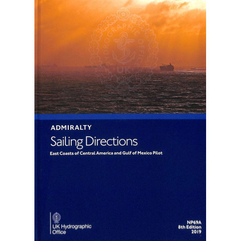





Navigate the East Coasts of Central America and the Gulf of Mexico with confidence using these detailed digital sailing directions, featuring hazards, regulations, and port information.
Data sheet
Specific References
Navigate the complex waters of the East Coasts of Central America and the Gulf of Mexico with confidence. This digital sailing directions publication is meticulously crafted to provide mariners with critical insights, ensuring safe and efficient voyages through one of the world’s most trafficked maritime regions. Whether you're a commercial vessel operator or a seasoned navigator, this guide is your trusted companion for mastering the challenges of these dynamic waters.
This publication delivers unparalleled coverage from Punta Terraba to Cape Sable, including the Yucatan Channel and the western Caribbean Sea. It bridges the gap between raw chart data and real-world navigation, offering a holistic view of the region’s unique maritime environment. With detailed information on hazards, aids to navigation, meteorological data, and pilotage procedures, it transforms complex data into actionable intelligence for mariners.
Optimized for digital use, this publication is tailored for navigators who rely on precision and accessibility. Compatible with Windows 7 and later, it ensures seamless integration into your onboard systems, providing instant access to vital information when you need it most. The annual individual license guarantees you always have the latest updates, keeping your voyages compliant and secure.
Part of a globally recognized series, this publication is trusted by mariners across the world for its accuracy, reliability, and depth of information. It complements standard nautical charts, offering a layer of contextual intelligence that enhances decision-making at sea. Whether you're navigating busy shipping lanes or remote coastal areas, this guide ensures you’re prepared for every scenario.
In a region where precision and local knowledge are paramount, this publication stands out as an indispensable tool. It combines decades of maritime expertise with modern digital convenience, offering a seamless blend of tradition and innovation. From port facilities to weather patterns, it provides everything you need to navigate with confidence and efficiency.
Equip your vessel with the knowledge to navigate safely and efficiently—wherever your journey takes you.
Navigate the East Coasts of Central America and Gulf of Mexico with Unmatched Precision
This digital sailing directions publication is your ultimate guide to mastering the intricate waters stretching from Punta Terraba to Cape Sable, including the Yucatan Channel and the western Caribbean Sea. Designed for mariners who demand accuracy and reliability, it transforms complex navigational data into clear, actionable insights, ensuring safe and efficient voyages through one of the world’s most critical maritime regions.
Tailored for Modern Maritime Operations
Optimized for digital use, this publication is compatible with Windows 7 and later, seamlessly integrating into your onboard navigation systems. The annual individual license ensures you always have access to the latest updates, keeping your voyages compliant and secure. Whether you're navigating commercial shipping lanes or exploring remote coastal areas, this guide provides the contextual intelligence needed to make informed decisions at sea.
Comprehensive Coverage for Every Navigational Challenge
From detailed descriptions of coastal features and port facilities to up-to-date information on hazards, aids to navigation, and local regulations, this publication covers every aspect of safe passage. Color photographs and panoramic views enhance situational awareness, while meteorological data and pilotage procedures provide a complete picture of the region’s maritime environment. Trusted by professionals worldwide, it complements standard nautical charts, offering a layer of depth that goes beyond raw data.
Built on a Legacy of Maritime Excellence
As part of a globally recognized series of 74 volumes, this publication upholds a tradition of accuracy and reliability. It reflects decades of maritime expertise, ensuring that mariners have access to the most current and comprehensive navigational information available. Whether you're a commercial operator or a seasoned navigator, this guide equips you with the knowledge to navigate confidently, no matter the conditions.
This digital sailing directions publication provides comprehensive coverage of the East Coasts of Central America and the Gulf of Mexico, from Punta Terraba to Cape Sable, including the Yucatan Channel and western Caribbean Sea. Designed for use on Windows 7 and later, it offers an annual individual license, ensuring access to the latest navigational updates. The publication includes critical data on hazards, aids to navigation, meteorological conditions, pilotage procedures, and port facilities, all presented in English for global accessibility.
With a legacy spanning over two centuries, this series of nautical publications is a cornerstone of maritime navigation, trusted by professionals worldwide. Renowned for its accuracy, reliability, and comprehensive coverage, it supports safe and efficient voyages across the globe. Each publication is meticulously updated to reflect the latest navigational data, ensuring mariners have access to the most current and trusted information available.
This digital publication requires a system running Windows 7 or higher to function properly.
No, this publication is only available in English.
It covers the east coasts of Central America and the Gulf of Mexico, from Punta Terraba to Cape Sable, including the Yucatan Channel and the western Caribbean Sea.
The license for this digital publication is valid for one year and must be renewed annually.
It includes details on port facilities, pilotage, regulations, and other essential navigation information for the covered regions.
Yes, it contains color photographs and panoramic views to assist with navigation and identification of key landmarks.
No, the license is individual and permits use on a single device only.
You might also like






































































![Admiralty - eNP054 - Sailing directions: North Sea [West]](https://www.nautic-way.com/80626-home_default/admiralty-enp054-sailing-directions-north-sea-west-maritime-bookshop-nautic-way.jpg)
![Admiralty - eNP055 - Sailing directions: North Sea [East]](https://www.nautic-way.com/90870-home_default/admiralty-enp055-sailing-directions-north-sea-east-maritime-bookshop-nautic-way.jpg)




























