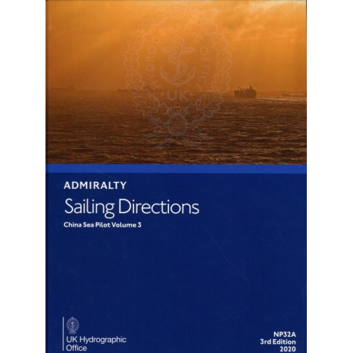





Essential digital sailing directions for the China Sea (Vol. 3), offering detailed navigation guidance, hazard alerts, and port information for safe maritime voyages.
Data sheet
Specific References
Navigate the complex waters of the China Sea with confidence using this comprehensive digital sailing directions guide. Designed for merchant mariners and professional navigators, this publication delivers critical insights for safe and efficient voyages across one of the world’s most strategically important maritime regions. Covering key areas with precision, it transforms raw data into actionable intelligence, ensuring you stay ahead of challenges at sea.
This digital guide is part of a globally recognized series of 74 volumes, offering unparalleled coverage of the China Sea. It includes:
Engineered for the demands of modern navigation, this digital publication is compatible with Windows 7 and later versions, ensuring seamless integration into your onboard systems. Its user-friendly format allows for quick reference, reducing the risk of human error and enhancing operational efficiency. Whether you're planning a route, assessing risks, or preparing for port entry, this guide provides the clarity and accuracy you need to make informed decisions.
Backed by decades of hydrographic expertise, this sailing directions guide is a trusted resource for mariners navigating the China Sea. Its 5th edition (2024) reflects the latest updates and advancements in maritime data, ensuring you have the most current information at your fingertips. From commercial vessels to private yachts, this publication is an indispensable tool for anyone operating in these waters.
This digital sailing directions guide is more than just a publication—it’s a vital component of your navigation toolkit. Its compatibility with modern systems ensures it fits effortlessly into your existing workflow, while its detailed content empowers you to navigate with confidence. Whether you're charting a course through busy shipping lanes or preparing for a complex port maneuver, this guide provides the insights you need to ensure a safe and successful voyage.
Master the China Sea with Unrivaled Precision and Confidence
Navigating the China Sea demands more than just skill—it requires the most accurate, up-to-date, and reliable information at your fingertips. This digital sailing directions guide delivers exactly that, offering mariners a comprehensive resource tailored to the unique challenges of this critical maritime region. Whether you're a seasoned captain or a professional navigator, this publication ensures you have the insights needed to make informed decisions, avoid hazards, and optimize your voyage.
Engineered for Professional Mariners
Designed specifically for merchant mariners operating on all types of ocean-going vessels, this guide is part of a globally recognized series that complements nautical charts with detailed, region-specific intelligence. It covers the China Sea with unmatched precision, providing essential data such as navigation hazards, buoyage systems, meteorological conditions, and pilotage instructions. The digital format ensures you can access this critical information quickly and efficiently, reducing the risk of errors and enhancing operational safety.
Visual Clarity and Practical Insights
This publication goes beyond raw data by incorporating high-resolution color photographs and quality visuals to aid in coastal recognition and landmark identification. These visuals, combined with detailed descriptions, allow you to verify your position and anticipate challenges before they arise. Additionally, the guide includes step-by-step instructions for navigating major ports and entry points, ensuring smooth and safe transitions in even the most complex maritime environments.
Stay Ahead with the Latest Updates
The 5th edition (2024) of this sailing directions guide reflects the most recent advancements in maritime data, ensuring you have access to the latest information on regulations, port facilities, and logistical support. Regular updates mean you can trust this publication to provide accurate and relevant insights, whether you're planning a route, assessing risks, or preparing for port entry. Its compatibility with Windows 7 and later versions ensures seamless integration into your onboard systems, making it a reliable and accessible tool for modern navigation.
Built for the Demands of the China Sea
The China Sea is a dynamic and often challenging maritime environment, where conditions can change rapidly. This guide is tailored to address these challenges, offering detailed coverage of critical areas with precise latitude and longitude data. From deep-sea routes to intricate port approaches, it provides the comprehensive information you need to navigate with confidence. Whether you're operating a commercial vessel or a private yacht, this publication is an indispensable resource for ensuring safe and efficient voyages.
This digital sailing directions guide offers a robust set of features designed to enhance navigation in the China Sea. Compatible with Windows 7 and later versions, it provides a seamless user experience with instant access to critical data. The publication includes high-resolution visuals, detailed pilotage instructions, and up-to-date regulatory information, all within a lightweight digital format weighing just 1.50 kg. Its 5th edition (2024) ensures you have the most current maritime data at your disposal, making it an essential tool for professional mariners.
With a legacy spanning over two centuries, this publisher is a global leader in hydrographic data and maritime navigation resources. Renowned for its accuracy, reliability, and innovation, it provides mariners worldwide with the tools they need to navigate safely and efficiently. Its publications are trusted by commercial fleets, naval forces, and private mariners alike, setting the standard for excellence in maritime information.
This volume covers the China Sea region between latitudes 18°N to 33°N and longitudes 115.5°E to 126°E, including key navigational zones and ports within this area.
No, this digital publication is only compatible with Windows 7 and later versions.
It includes information on submerged dangers, restricted areas, shallow waters, and other critical navigational hazards specific to the covered region.
Yes, the publication features color photographs and high-quality views to assist in identifying landmarks, ports, and other key navigational points.
This publication follows a multi-year update cycle, with the current edition (5th) covering 2020-2024.
Yes, once downloaded, the publication can be accessed offline on compatible Windows devices.
It provides details on port infrastructure, including berthing options, fuel and water availability, repair services, and local regulations for ports within the covered area.
You might also like





































































![Admiralty - eNP054 - Sailing directions: North Sea [West]](https://www.nautic-way.com/80626-home_default/admiralty-enp054-sailing-directions-north-sea-west-maritime-bookshop-nautic-way.jpg)
![Admiralty - eNP055 - Sailing directions: North Sea [East]](https://www.nautic-way.com/90870-home_default/admiralty-enp055-sailing-directions-north-sea-east-maritime-bookshop-nautic-way.jpg)





























