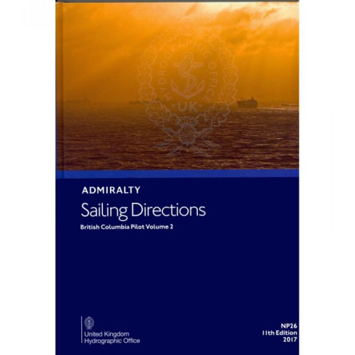





Upgrade your maritime safety with this digital sailing guide for British Columbia. Detailed coverage of hazards, markings, and port regulations from Cape Caution to Portland Inlet for merchant ships.
Data sheet
Specific References
Navigate the intricate waters of British Columbia with confidence using this comprehensive digital sailing directions guide. Designed for merchant mariners and professional navigators, this publication delivers critical insights for safe and efficient voyages along one of North America’s most challenging coastlines. From hidden hazards to port regulations, this guide ensures you’re equipped with the latest, most accurate information for seamless navigation.
Covering the rugged coastline from Cape Caution to Portland Inlet, including the Queen Charlotte Islands and extending into Alaskan waters up to Sitklan Island and Cape Fox, this volume is your go-to resource for navigating these remote and often treacherous waters. Whether you’re charting a course through narrow passages or planning a stop at a lesser-known port, this guide provides the detailed intelligence you need to avoid risks and optimize your route.
This digital edition is packed with high-precision navigational data, including:
This guide is designed to complement Admiralty nautical charts, offering a layer of contextual information that enhances your chart-reading experience. With full-color photographs and high-quality coastal views, you can visually confirm landmarks, harbors, and navigational markers, bridging the gap between paper charts and real-world conditions. Whether you’re plotting a course in unfamiliar waters or verifying your position, this publication ensures you have the most reliable data at your fingertips.
Tailored for merchant vessels and commercial shipping, this digital guide is an indispensable tool for captains, navigators, and maritime professionals who demand accuracy and reliability. The 11th edition (2017) reflects the most up-to-date information available at the time of publication, ensuring you’re working with the latest intelligence for safe and efficient navigation.
Accessible on Windows 7 and later, this digital format offers unparalleled convenience for onboard use. Say goodbye to bulky paper volumes—this guide is designed for quick searches, easy updates, and seamless integration into your digital navigation workflow. With 74 volumes covering global waters, this series ensures you have consistent, high-quality sailing directions no matter where your voyages take you.
Whether you’re navigating the remote fjords of British Columbia, the exposed waters of the Queen Charlotte Islands, or the Alaskan coastline, this sailing directions guide provides the critical insights you need to navigate safely and efficiently. From avoiding hazards to optimizing port calls, this publication is your trusted companion for professional maritime operations in one of the world’s most demanding regions.
Navigate British Columbia’s Coastal Waters with Unmatched Precision
This digital sailing directions guide is your ultimate resource for mastering the complex and often hazardous waters of British Columbia, from Cape Caution to Portland Inlet, including the Queen Charlotte Islands and parts of the Alaskan coastline. Designed for professional mariners, this publication delivers critical navigational intelligence, ensuring safe passage and efficient voyage planning for merchant vessels of all sizes.
Comprehensive Coverage for Remote and Challenging Waters
Covering over 600 nautical miles of coastline, this guide provides in-depth information for navigating some of North America’s most remote and treacherous maritime zones. Whether you’re charting a course through narrow passages, avoiding underwater hazards, or planning a stop at a lesser-known port, this volume equips you with the detailed data needed to make informed decisions. The guide includes precise coordinates, with latitudes ranging from 51.17°N to 57°N and longitudes from 120°W to 140°W, ensuring you can pinpoint your location with accuracy.
Essential Data for Safe and Efficient Navigation
This digital edition is packed with high-value navigational insights, including real-time hazard alerts, buoyage systems, and meteorological data tailored to the region. It also features pilotage instructions for entering ports and harbors, along with depth soundings and approach strategies to help you navigate safely. With port regulations, local maritime laws, and facility guides, you’ll have everything you need to comply with requirements and streamline your operations.
Seamless Integration with Nautical Charts
Designed to complement Admiralty nautical charts, this guide enhances your chart-reading experience with full-color photographs and high-quality coastal views. These visual aids allow you to confirm landmarks, harbors, and navigational markers, bridging the gap between paper charts and real-world conditions. Whether you’re verifying your position or planning a route, this publication ensures you have the most reliable and up-to-date information at your disposal.
Optimized for Professional Maritime Use
Tailored for merchant vessels and commercial shipping, this guide is an indispensable tool for captains, navigators, and maritime professionals who demand precision and reliability. The 11th edition (2017) reflects the most current data available at the time of publication, ensuring you’re equipped with the latest intelligence for safe and efficient navigation. With a global series of 74 volumes, this guide is part of a trusted collection that covers waters worldwide, making it a consistent resource for your maritime operations.
Digital Convenience for Modern Navigation
Accessible on Windows 7 and later, this digital format offers unmatched convenience for onboard use. Designed for quick searches and easy integration into your digital navigation workflow, this guide eliminates the need for bulky paper volumes. Whether you’re conducting a rapid search for port information or verifying navigational hazards, this digital edition ensures you have the data you need at your fingertips, anytime, anywhere.
This digital sailing directions guide provides essential navigational data for the British Columbia coastline, covering the region from Cape Caution to Portland Inlet, including the Queen Charlotte Islands and parts of the Alaskan coast up to Sitklan Island and Cape Fox. The 11th edition (2017) is compatible with Windows 7 and later, offering a digital format optimized for professional maritime use. With a file size of 1.05 kg, this guide is part of a global series of 74 volumes, ensuring consistent and reliable coverage for mariners worldwide.
With a legacy spanning over two centuries, this publisher is a globally recognized authority in maritime navigation, providing trusted nautical publications and digital solutions for professional mariners. Known for their precision, reliability, and adherence to international standards, their products are essential tools for safe and efficient navigation across the world’s oceans.
This volume covers the coast of British Columbia from Cape Caution to Portland Inlet, including the Queen Charlotte Islands and parts of Alaska from Sitklan Island to Cape Fox.
No, this digital publication is only compatible with Windows 7 and later versions.
It is designed for merchant navigators operating all types of ocean-going vessels.
Yes, it includes color photos and high-quality coastal views to assist with navigation.
There are 76 volumes in the series, providing worldwide coverage.
It includes information on coastal hazards, aids to navigation, meteorological data, pilotage details, port regulations, facilities, and entry guides.
You might also like





































































![Admiralty - eNP054 - Sailing directions: North Sea [West]](https://www.nautic-way.com/80626-home_default/admiralty-enp054-sailing-directions-north-sea-west-maritime-bookshop-nautic-way.jpg)
![Admiralty - eNP055 - Sailing directions: North Sea [East]](https://www.nautic-way.com/90870-home_default/admiralty-enp055-sailing-directions-north-sea-east-maritime-bookshop-nautic-way.jpg)





























