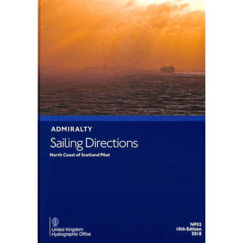





Navigate Scotland’s northern coast safely with this digital guide. It covers hazards, weather, tides, and ports from Cape Wrath to Rattray Head, ensuring confident and efficient voyages.
Data sheet
Specific References
Navigate the rugged and breathtaking North Coast of Scotland with confidence using this comprehensive digital sailing guide. Designed for merchant mariners and seafarers of all vessel types, this publication delivers critical navigational insights for one of the most challenging yet rewarding maritime regions in the world. From the dramatic cliffs of Cape Wrath to the serene shores of Rattray Head, including the iconic Orkney and Shetland Islands, this guide ensures you have the knowledge to sail safely and efficiently.
This digital sailing direction is part of a globally trusted series of 74 volumes, meticulously crafted to complement standard nautical charts. Whether you're navigating commercial routes or exploring remote coastal areas, this guide provides unparalleled detail to enhance your situational awareness and decision-making on the water.
Stay ahead of potential hazards with in-depth information on:
This guide goes beyond basic navigation to provide practical information for every stop along your journey:
Enhance your understanding of the coastline with high-quality visual aids:
This digital edition is designed for seamless integration into your onboard navigation system. Compatible with Windows 7 and later versions, it offers the convenience of instant access to critical information without the bulk of traditional paper charts. Whether you're planning a voyage or navigating in real-time, this guide ensures you have the most accurate and up-to-date data at your fingertips.
Rely on a publication that has been trusted by generations of seafarers. With a legacy of accuracy and reliability, this guide is an indispensable tool for anyone navigating the North Coast of Scotland. Equip yourself with the knowledge to tackle the challenges of this stunning yet demanding maritime region and sail with confidence.
Unlock the Secrets of Scotland’s North Coast with This Digital Sailing Companion
Embark on a journey along the North Coast of Scotland with the confidence that only comes from having the most detailed and reliable navigational guide at your disposal. This digital sailing direction is your ultimate resource for mastering the complexities of one of the world’s most captivating yet challenging maritime regions. Covering the stretch from Cape Wrath to Rattray Head, including the Orkney and Shetland Islands, this guide is an indispensable tool for mariners navigating these storied waters.
Precision Navigation for Every Voyage
Designed to complement standard nautical charts, this digital guide offers a wealth of information tailored to the needs of merchant mariners and seafarers. With coverage spanning latitudes from 56.17°N to 63°N and longitudes from -15°W to 1.73°E, it provides a comprehensive overview of the region’s unique navigational challenges. Whether you're plotting a course through narrow straits, avoiding submerged hazards, or planning a safe harbor approach, this guide delivers the precise data you need to navigate with confidence.
Visual Clarity for Safer Sailing
Enhance your situational awareness with high-resolution color photographs and detailed views of key landmarks, harbors, and coastal features. These visual aids are invaluable for identifying navigational points from a distance, ensuring you can make informed decisions even in low-visibility conditions. The guide’s intuitive layout and clear illustrations make it easy to interpret critical information at a glance, reducing the risk of errors and improving overall safety.
Stay Informed with Up-to-Date Data
This 2015 (9th edition) digital publication is packed with the latest information on meteorological conditions, tidal patterns, and local regulations. It includes essential details on port facilities, pilotage procedures, and environmental guidelines, ensuring you remain compliant with maritime laws while making the most of available resources. Whether you're docking at a major port or anchoring in a remote bay, this guide provides the insights you need to plan and execute your voyage efficiently.
Seamless Integration with Your Onboard Systems
Optimized for use on PCs running Windows 7 and later versions, this digital guide offers the convenience of instant access to critical navigational data. Say goodbye to the hassle of paper charts and embrace the efficiency of a fully digital solution. With this guide, you can quickly search for information, zoom in on specific areas, and update your knowledge base as needed, all without the clutter of traditional printed materials.
This digital sailing direction provides mariners with a robust set of tools for navigating the North Coast of Scotland. Published in 2015 as the 9th edition, it covers a vast area from Cape Wrath to Rattray Head, including the Orkney and Shetland Islands, with detailed coordinates spanning latitudes 56.17°N to 63°N and longitudes -15°W to 1.73°E. The guide is available in a digital format, compatible with Windows 7 and later versions, and includes high-resolution color photographs, detailed views, and comprehensive data on navigational hazards, markings, meteorological conditions, and port facilities.
With a legacy spanning over two centuries, this publisher is a globally recognized authority in maritime navigation. Renowned for producing high-quality nautical charts and publications, their products are trusted by mariners, naval forces, and commercial fleets worldwide. Their commitment to accuracy, innovation, and safety has made them a cornerstone of the maritime industry, ensuring that seafarers have access to the most reliable and up-to-date navigational information available.
This guide covers the north coast of Scotland from Cape Wrath to Rattray Head, including the Orkney and Shetland Islands.
No, it is only compatible with Windows 7 and later versions.
It includes color photographs and high-quality coastal views to assist with navigation.
Yes, it provides information on port facilities, regulations, and pilotage details for key harbors.
The guide includes details on potential navigational hazards, buoyage systems, and weather-related risks.
Yes, once downloaded, the guide can be accessed offline for navigation purposes.
The coordinates cover latitudes from 56.17°N to 63°N and longitudes from 1.73°W to 15°W, encompassing the north coast of Scotland.
You might also like





































































![Admiralty - eNP054 - Sailing directions: North Sea [West]](https://www.nautic-way.com/80626-home_default/admiralty-enp054-sailing-directions-north-sea-west-maritime-bookshop-nautic-way.jpg)
![Admiralty - eNP055 - Sailing directions: North Sea [East]](https://www.nautic-way.com/90870-home_default/admiralty-enp055-sailing-directions-north-sea-east-maritime-bookshop-nautic-way.jpg)





























