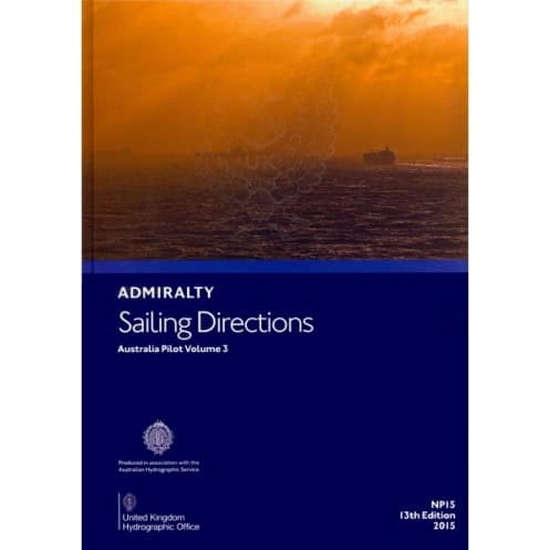





Navigate Australia’s eastern waters with this digital guide. Covers North Head to Cape York, the Great Barrier Reef, and Torres Strait, with key navigation details, hazards, and port regulations.
Data sheet
Specific References
Navigate the eastern coast of Australia, the Great Barrier Reef, and the Torres Strait with confidence using this comprehensive digital nautical guide. Designed for merchant mariners and professional navigators, this publication delivers critical insights for safe and efficient voyage planning in one of the world’s most complex maritime regions. From North Head to Cape York, including the southern coasts of New Guinea, this guide ensures you have the most accurate and up-to-date information at your fingertips.
Part of a global series of 74 volumes, this digital nautical guide is a trusted resource for professional navigators. Whether you're charting a course through the intricate waters of the Great Barrier Reef or preparing for port entry in Cairns or Port Moresby, this publication provides the reliability and precision you need for safe and successful voyages.
Say goodbye to outdated paper charts and embrace the efficiency of digital navigation. With instant updates, detailed visuals, and comprehensive data, this guide is an indispensable tool for modern mariners. Ensure your crew and vessel are prepared for every challenge with the most advanced nautical information available.
Navigate Australia’s Eastern Coast with Precision and Confidence
Discover the ultimate digital solution for safe and efficient navigation along Australia’s eastern seaboard with Sailing Directions: Australia Vol. 3. This 13th edition (2015) digital nautical guide is meticulously crafted for merchant mariners, offering unparalleled coverage from North Head to Cape York, including the Great Barrier Reef, Torres Strait, and the southern coasts of New Guinea. Designed to complement standard nautical charts, this publication provides the critical insights needed to navigate one of the world’s most challenging maritime environments with ease.
Real-Time Updates for Unmatched Accuracy
Stay ahead of the curve with weekly electronic updates for Notices to Mariners (NMs), ensuring your navigational data is always current. This digital format allows for seamless integration of updates in just seconds, eliminating the need for manual corrections and reducing the risk of outdated information. Whether you're planning a passage through the intricate reefs of the Great Barrier Reef or preparing for port entry, this guide ensures you have the most reliable and up-to-date information at your fingertips.
Comprehensive Visual and Technical Guidance
Enhance your situational awareness with full-color photographs, panoramic views, and detailed illustrations that bring coastal features and landmarks to life. This guide goes beyond traditional charts by providing in-depth descriptions of navigational hazards, weather patterns, pilotage instructions, and port regulations. With precise latitude and longitude coordinates (spanning from -6° to -33.82° latitude and 141° to 170° longitude), you can plan your route with confidence, knowing every detail has been accounted for.
Optimized for Professional Mariners
Tailored for merchant vessels of all sizes, this digital publication is an essential tool for passage planning and operational efficiency. It includes critical information on port facilities, customs procedures, and environmental protections, ensuring compliance with local and international maritime laws. The user-friendly interface allows for quick searches and easy navigation, making it a valuable resource for both seasoned navigators and those new to the region.
Seamless Compatibility and Accessibility
Compatible with Windows 7 and later versions, this digital guide is designed for modern maritime operations. Its intuitive format ensures quick access to information, reducing downtime and enhancing productivity. Whether you're on the bridge or planning your next voyage from shore, this publication provides the flexibility and reliability needed to navigate Australia’s eastern waters safely and efficiently.
This digital nautical guide delivers essential navigational data for Australia’s eastern coast, covering latitudes from -6° to -33.82° and longitudes from 141° to 170°. The 13th edition (2015) is available in a digital format, compatible exclusively with Windows 7 and later versions. It includes weekly electronic updates for Notices to Mariners (NMs), ensuring your information remains current. Designed for professional mariners, this publication features full-color photographs, panoramic views, and detailed descriptions of hazards, weather conditions, and port regulations, making it an indispensable tool for safe and efficient passage planning.
With over two centuries of expertise in maritime navigation, this publisher is a global leader in providing accurate and reliable nautical information. Renowned for its comprehensive range of charts, publications, and digital solutions, the brand is trusted by professional mariners, naval forces, and commercial fleets worldwide. Their commitment to precision, innovation, and safety has made them a cornerstone of the maritime industry, ensuring navigators have the tools they need to traverse the world’s oceans with confidence.
This volume covers the east coast of Australia from North Head to Cape York, including the Great Barrier Reef, islands and reefs, the Torres Strait, and the southern coasts of New Guinea.
No, this digital publication is only compatible with Windows 7 and later versions.
Updates are provided electronically on a weekly basis through Notices to Mariners (NMs), taking just a few seconds to apply.
The publication includes color photographs, panoramic views, and detailed charts to assist with navigation and hazard identification.
Yes, it is specifically designed to assist with passage planning tasks for merchant navigators on all types of ocean-going vessels.
Yes, it includes the Sailing Directions (Pilots) and the Nautical Almanac as part of the digital package.
The covered area spans latitudes from approximately 6°S to 33.82°S and longitudes from 140.67°E to 170°E.
You might also like





































































![Admiralty - eNP054 - Sailing directions: North Sea [West]](https://www.nautic-way.com/80626-home_default/admiralty-enp054-sailing-directions-north-sea-west-maritime-bookshop-nautic-way.jpg)
![Admiralty - eNP055 - Sailing directions: North Sea [East]](https://www.nautic-way.com/90870-home_default/admiralty-enp055-sailing-directions-north-sea-east-maritime-bookshop-nautic-way.jpg)





























