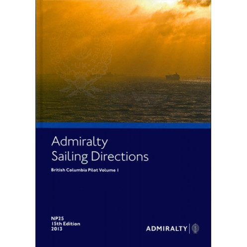





Reliable digital sailing directions for British Columbia (Vol. 1). Includes hazards, pilotage, and weather data to ensure safe voyages from Point Roberts to Cape Caution and beyond.
Data sheet
Specific References
Navigate the intricate waters of British Columbia with confidence using this comprehensive digital sailing directions guide. Covering the coastline from Point Roberts to Cape Caution, Vancouver Island, Puget Sound, and the adjacent U.S. shores from Cape Flattery to Point Roberts, this publication is an indispensable resource for merchant mariners and commercial vessels. Designed to enhance safety and efficiency, it delivers critical navigation insights tailored for deep-sea voyages.
This digital guide is part of a global series of 74 to 76 volumes, ensuring consistent and reliable coverage for mariners worldwide. It complements standard nautical charts, providing a layered approach to navigation that enhances situational awareness and decision-making. Whether you're navigating busy shipping lanes or remote coastal areas, this publication bridges the gap between chart data and real-world conditions.
This digital edition is more than just a static document—it’s a dynamic tool designed for the demands of modern navigation. The annual license model ensures you always have access to the latest data, while the ability to save, print, and annotate supports efficient passage planning. Whether you're preparing for a voyage or navigating in real-time, this guide provides the accuracy and reliability needed to operate safely in British Columbia’s diverse maritime environment.
From commercial shipping to professional maritime operations, this sailing directions guide offers unparalleled depth and precision. Its digital format eliminates the hassle of manual updates, ensuring you’re always equipped with the most current information. With its focus on safety, compliance, and efficiency, it’s an essential addition to any mariner’s digital library.
Navigate British Columbia’s Coastal Waters with Precision and Confidence
Unlock the secrets of one of North America’s most complex maritime regions with this digital sailing directions guide, meticulously crafted for professional mariners. Covering the critical stretch from Point Roberts to Cape Caution, including Vancouver Island, Puget Sound, and the adjacent U.S. coastline, this publication is your ultimate companion for safe and efficient navigation. Designed to meet the needs of merchant vessels and deep-sea operators, it provides a wealth of information that goes beyond standard charts, offering real-world insights to enhance your voyage planning and execution.
Comprehensive Data for Every Stage of Your Journey
This guide is packed with essential details to support every phase of your voyage. From identifying hidden hazards and understanding local pilotage requirements to accessing up-to-date information on port facilities and berthing options, it ensures you’re prepared for any challenge. Dive into data on tidal currents, weather patterns, and climatic conditions to optimize your route and minimize risks. With high-resolution color photos and detailed visual aids, you’ll gain a deeper understanding of key landmarks, making it easier to navigate even the most unfamiliar waters.
Seamless Updates and Advanced Digital Features
Say goodbye to outdated paper guides—this digital edition is designed for the modern mariner. Updated weekly via Notices to Mariners (NM), it ensures you always have the latest information at your fingertips. The encrypted PDF format guarantees data security while maintaining full compliance with maritime standards. Compatible with ADMIRALTY e-Readers and the AENP Integrated Viewer, it offers instant search functionality, allowing you to quickly locate critical information. Whether you’re planning a passage or navigating in real-time, this guide’s dynamic features make it an indispensable tool for professional use.
Built for Professional Mariners, Backed by Global Standards
As part of a global series of 74 to 76 volumes, this sailing directions guide adheres to the highest standards of accuracy and reliability. It complements standard nautical charts, providing an additional layer of detail that enhances situational awareness. The annual license model ensures continuous access to updated data, while the ability to save, print, and annotate supports efficient voyage planning. Whether you’re operating in busy shipping lanes or remote coastal areas, this guide delivers the precision and dependability you need to navigate with confidence.
This digital sailing directions guide delivers unparalleled precision for navigating British Columbia’s coastal waters. Published in 2017, it covers latitudes from 47°N to 51.25°N and longitudes from 120°W to 140°W, ensuring comprehensive coverage of the region. The encrypted PDF format is compatible with Windows 7 and later, offering seamless integration with ADMIRALTY e-Readers 1.3 and 1.4 or the AENP Integrated Viewer. Updated weekly via Notices to Mariners, it includes high-quality color photos and visual aids to enhance navigation accuracy. The annual license model ensures you always have access to the latest data, making it a reliable tool for professional mariners.
With a legacy spanning over two centuries, this publisher is a global leader in maritime navigation, providing trusted and authoritative resources for professional mariners. Renowned for their precision, reliability, and adherence to international standards, their publications are essential tools for safe and efficient navigation. From digital sailing directions to nautical charts, their products are designed to meet the evolving needs of the maritime industry, ensuring mariners have access to the most accurate and up-to-date information available.
This volume covers the coasts of British Columbia from Point Roberts to Cape Caution, Vancouver Island, Puget Sound, and the adjacent U.S. coasts from Cape Flattery to Point Roberts.
No, the digital version is only compatible with Windows 7 and later versions.
Updates are applied electronically via weekly Notices to Mariners (NM) and can be integrated in seconds using the ADMIRALTY e-Readers or AENP Integrated Viewer.
Yes, the digital version includes an instant function to view, save, or print sections, supporting passage planning with electronic updates.
You need ADMIRALTY e-Readers 1.3 or 1.4, or the AENP Integrated Viewer, which must be assigned after purchase. The file cannot be downloaded directly.
The license is valid for 12 months and is sold as a subscription service, including updates.
Yes, the digital version includes high-quality color photos and views, identical to the printed equivalent.
You might also like





































































![Admiralty - eNP054 - Sailing directions: North Sea [West]](https://www.nautic-way.com/80626-home_default/admiralty-enp054-sailing-directions-north-sea-west-maritime-bookshop-nautic-way.jpg)
![Admiralty - eNP055 - Sailing directions: North Sea [East]](https://www.nautic-way.com/90870-home_default/admiralty-enp055-sailing-directions-north-sea-east-maritime-bookshop-nautic-way.jpg)





























