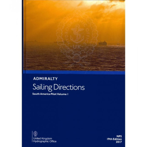





Navigate Northeast and East South America with confidence using this digital guide. Covers key routes, port entries, weather insights, and navigation hazards for merchant vessels.
Data sheet
Specific References
Navigate the northeastern and eastern coasts of South America with confidence using this comprehensive digital nautical guide. Designed for merchant mariners and professional navigators, this publication delivers critical insights for safe and efficient voyages from Cabo Orange to Cabo Tres Puntas. Whether you're charting a course through bustling shipping lanes or remote coastal areas, this guide ensures you have the most up-to-date information at your fingertips.
This digital guide is part of a global series of 74 volumes, offering unparalleled coverage of international waters. It complements standard nautical charts by providing detailed, practical information that enhances situational awareness and decision-making. From high-resolution color photographs to precise navigational views, every detail is crafted to support safe passage and efficient port operations.
This digital format ensures seamless integration with your onboard navigation systems, allowing for quick searches, bookmarking, and cross-referencing with other nautical publications. Compatible with Windows 7 and later, it provides a user-friendly interface that enhances accessibility and usability during voyages. Regular updates and revisions guarantee that you always have the latest information, reducing risks and improving operational efficiency.
Rely on a publication that has been refined through decades of maritime expertise. With editions dating back to 2017 and the latest updates in 2021, this guide reflects the most accurate and reliable data available. Whether you're navigating commercial routes, planning a transoceanic voyage, or conducting port operations, this digital nautical guide is an indispensable tool for modern mariners.
Navigate South America’s Coastal Waters with Unmatched Precision
This digital nautical guide is engineered for professional mariners who demand accuracy, reliability, and comprehensive coverage for voyages along South America’s northeastern and eastern coasts. From the dense shipping lanes of major ports to the remote stretches of Cabo Orange and Cabo Tres Puntas, this publication provides the critical data needed to ensure safe, efficient, and compliant navigation. Designed to complement standard nautical charts, it transforms complex coastal information into actionable insights, making it an indispensable resource for merchant vessels, commercial fleets, and maritime operators.
Tailored for Modern Maritime Operations
Unlike traditional paper guides, this digital version offers dynamic, searchable content that integrates seamlessly with onboard navigation systems. Compatible with Windows 7 and later, it allows mariners to quickly access vital information, from hazard alerts to port regulations, without the clutter of physical manuals. High-resolution color photographs and detailed navigational views provide visual confirmation of landmarks, buoys, and coastal features, enhancing situational awareness and reducing the risk of misidentification. Whether you're plotting a course through congested waterways or preparing for port entry, this guide delivers the clarity and precision required for modern maritime operations.
Comprehensive Data for Every Phase of Your Voyage
This publication goes beyond basic navigation by offering a wealth of practical information tailored to the unique challenges of South American waters. Detailed pilotage instructions outline recommended tracks, depth soundings, and safe passage routes, while localized weather and tidal data help mariners anticipate and adapt to changing conditions. Port-specific regulations, customs procedures, and facility overviews ensure smooth operations upon arrival, minimizing delays and optimizing turnaround times. With coverage spanning latitudes from 11.75°N to 47.1°S and longitudes from 20°W to 70°W, this guide provides a holistic view of the region, empowering mariners to make informed decisions at every stage of their journey.
Built on a Legacy of Maritime Expertise
With editions dating back to 2017 and the latest updates in 2021, this nautical guide reflects decades of maritime experience and continuous refinement. It is part of a global series of 74 volumes, each meticulously curated to provide consistent, high-quality information for international waters. By leveraging this publication, mariners gain access to a trusted resource that has been vetted by industry professionals and updated to reflect the latest navigational standards. Whether you're navigating commercial routes, conducting port operations, or planning long-haul voyages, this digital guide ensures you have the most accurate and reliable data at your disposal.
This digital nautical guide provides comprehensive coverage of South America’s northeastern and eastern coasts, spanning from Cabo Orange to Cabo Tres Puntas. Designed for professional mariners, it includes detailed navigational data, hazard alerts, buoyage information, weather insights, and port regulations. Compatible with Windows 7 and later, this digital format ensures seamless integration with onboard systems, offering searchable content, high-resolution images, and regular updates for enhanced accuracy and usability.
With a legacy spanning over two centuries, this organization is a global leader in maritime navigation and hydrographic services. Renowned for its precision, reliability, and commitment to safety, it provides mariners with the most accurate and up-to-date nautical information available. Its publications, trusted by commercial fleets and naval operations worldwide, set the standard for navigational excellence and innovation in the maritime industry.
This volume covers the northeast and east coasts of South America, from Cabo Orange to Cabo Tres Puntas.
No, this digital publication is only compatible with Windows 7 and later versions.
It includes color photographs and high-quality views to assist navigators.
Yes, the publication provides information on port regulations, facilities, and pilotage details for major ports.
The coverage spans latitudes from approximately 11.75°N to 47.1°S and longitudes from 20°W to 70°W.
New editions are typically released every few years; the latest editions are from 2017 and 2021.
Yes, once downloaded, the digital format allows for offline use on compatible Windows systems.
You might also like





































































![Admiralty - eNP054 - Sailing directions: North Sea [West]](https://www.nautic-way.com/80626-home_default/admiralty-enp054-sailing-directions-north-sea-west-maritime-bookshop-nautic-way.jpg)
![Admiralty - eNP055 - Sailing directions: North Sea [East]](https://www.nautic-way.com/90870-home_default/admiralty-enp055-sailing-directions-north-sea-east-maritime-bookshop-nautic-way.jpg)





























