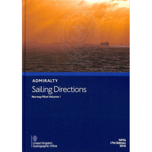





Navigate Norway’s southern waters with confidence using this digital guide. Includes hazards, weather, port entries, and pilotage details for merchant vessels and offshore ships.
Data sheet
Specific References
Navigate Norway’s southern waters with confidence using this comprehensive digital nautical publication. Designed for merchant mariners operating vessels of all sizes, this guide delivers critical navigation instructions for the coastline spanning from Egersund/Jærens Rev to the Norwegian-Swedish border. Whether planning a voyage or executing precise maneuvers, this publication ensures safe and efficient passage with up-to-date, reliable data.
This digital publication is enriched with high-quality color photographs and navigational views, providing mariners with a realistic perspective of coastal landmarks, port entrances, and critical waypoints. These visual aids complement the textual data, allowing for quicker identification of key features and improved situational awareness during voyages.
Tailored for passage planning tasks, this digital publication enhances efficiency and precision on the bridge. Its user-friendly interface and structured data layout allow navigators to quickly access the information they need, streamlining decision-making processes and improving overall operational safety. Compatible with Windows 7 and later versions, it integrates seamlessly into existing digital navigation systems.
Part of a worldwide series of 74 volumes, this publication complements standard nautical charts, offering a complete solution for mariners navigating international waters. Whether operating in coastal or offshore environments, this guide ensures compliance with the highest standards of maritime safety and navigation.
Navigate Norway’s Southern Coast with Precision and Confidence
This digital nautical publication is your indispensable companion for safe and efficient navigation along Norway’s southern coastline, from Egersund/Jærens Rev to the Norwegian-Swedish border. Designed for merchant mariners, it provides a wealth of critical information tailored to vessels of all sizes, ensuring compliance with maritime regulations and enhancing operational safety. With its 16th edition (2015), this guide combines decades of expertise with modern digital convenience, making it a trusted resource for professional navigators.
Comprehensive Navigation Data for Informed Decision-Making
This publication goes beyond basic charts by offering in-depth details on navigation hazards, such as shallow waters and submerged obstacles, alongside precise information on navigational aids like buoys and lighthouses. Mariners will find essential meteorological data, including wind patterns and tidal currents, as well as pilotage instructions for safe port entry and exit. The guide also covers local regulations, port facilities, and logistical support, ensuring seamless operations in Norwegian waters.
Visual Aids for Enhanced Situational Awareness
Enriched with high-quality color photographs and navigational views, this digital publication provides a realistic perspective of coastal landmarks and port entrances. These visual tools enable quicker identification of key features, improving decision-making during voyages. Whether navigating busy harbors or remote coastal areas, mariners can rely on these aids to enhance their situational awareness and reduce risks.
Stay Up-to-Date with Weekly Digital Updates
One of the standout features of this digital publication is its seamless update process. Mariners receive weekly Electronic Notices to Mariners (NMs), ensuring that all corrections and amendments are applied in seconds. This eliminates the need for manual updates, reducing the risk of errors and saving valuable time on the bridge. The publication’s compatibility with Windows 7 and later versions ensures smooth integration into modern navigation workflows.
Part of a Global Navigation Solution
As part of a worldwide series of 74 volumes, this publication complements standard nautical charts, offering a complete solution for mariners navigating international waters. Whether planning a voyage or executing precise maneuvers, this guide ensures compliance with the highest standards of maritime safety and efficiency. Trusted by professional navigators, it is an essential tool for anyone operating in Norway’s southern waters.
This digital nautical publication provides essential navigation instructions for Norway’s southern coastline, covering latitudes from 56.09°N to 62.00°N and longitudes from 2.10°E to 13.42°E. Updated weekly via downloadable Electronic Notices to Mariners (NMs), it ensures mariners always have the latest corrections and amendments. Compatible with Windows 7 and later versions, this 16th edition (2015) is designed for efficient passage planning and operational safety on the bridge.
With a legacy spanning over two centuries, this organization is a global leader in maritime navigation solutions, providing trusted nautical publications and charts to mariners worldwide. Renowned for its accuracy, reliability, and adherence to international standards, its products are essential tools for professional navigators, ensuring safety and efficiency in both coastal and offshore operations.
This volume covers the southern coast of Norway, from Egersund/Jærens Rev to the Norwegian/Swedish border.
Updates are available weekly through downloadable Electronic Notices to Mariners (NMs).
It is compatible with Windows 7 and later versions.
It is designed for merchant navigators on all categories of seagoing vessels.
Yes, it contains color photographs and high-quality views to assist with navigation.
Updates can be downloaded and applied in just a few seconds.
Yes, it includes information on port facilities and guides for entering major ports.
You might also like






































































![Admiralty - eNP054 - Sailing directions: North Sea [West]](https://www.nautic-way.com/80626-home_default/admiralty-enp054-sailing-directions-north-sea-west-maritime-bookshop-nautic-way.jpg)
![Admiralty - eNP055 - Sailing directions: North Sea [East]](https://www.nautic-way.com/90870-home_default/admiralty-enp055-sailing-directions-north-sea-east-maritime-bookshop-nautic-way.jpg)




























