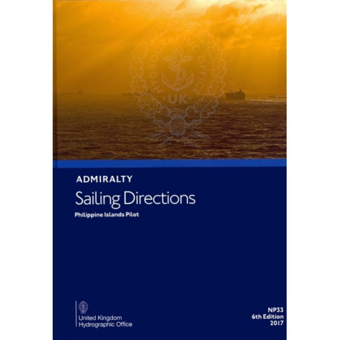





This 2017 digital sailing guide for the Philippine Islands provides critical navigation data—hazards, weather, tides, and port facilities—optimized for Windows 7+ to ensure safe voyages.
Data sheet
Specific References
Navigate the complex waters of the Philippine Islands with confidence using this comprehensive digital sailing guide. Designed for merchant mariners and all categories of ocean-going vessels, this publication delivers critical insights to ensure safe and efficient voyages. Whether you're charting a course along the northern and northeastern coasts of Borneo or exploring the intricate archipelagos of the Philippines, this guide complements standard nautical charts with unparalleled detail.
This digital edition is engineered for modern navigators, offering seamless compatibility with Windows 7 and later operating systems. The intuitive format ensures quick access to information, allowing you to focus on what matters most—safe and efficient navigation. With global coverage spanning 74 to 76 volumes, this series is a trusted resource for mariners worldwide.
Whether you're a seasoned mariner or navigating these waters for the first time, this digital sailing guide provides the tools you need to navigate safely and efficiently. Equip your vessel with the most reliable and up-to-date information available, and set sail with peace of mind.
Master the Philippine Waters with the Ultimate Digital Navigation Guide
Unlock the secrets of the Philippine Islands' intricate coastlines and archipelagos with this indispensable digital sailing guide. Tailored for merchant mariners and ocean-going vessels, this publication bridges the gap between standard nautical charts and real-world navigation challenges. With its 2017 digital edition, you gain access to a wealth of information designed to enhance safety, efficiency, and compliance during every voyage.
Comprehensive Coverage for Every Navigator
From the northern coasts of Borneo to the diverse islands of the Philippines, this guide offers unparalleled coverage of one of the world's most complex maritime regions. It provides detailed insights into navigation hazards, ensuring you can identify and avoid potential dangers before they become threats. With precise coordinates and descriptions, you'll navigate with confidence, even in the most challenging conditions.
Critical Data at Your Fingertips
Stay ahead of the elements with up-to-date meteorological data, including seasonal currents, climatic conditions, and weather patterns. This guide also delivers essential pilotage information for ports and harbors, helping you plan your approach with precision. Understand local regulations, port facilities, and compliance requirements to ensure smooth and hassle-free operations.
Visual Aids for Enhanced Situational Awareness
Enhance your navigation experience with high-quality color photographs and visual aids that provide a clear view of key landmarks, hazards, and coastal features. These visual tools are invaluable for verifying your position and making informed decisions while at sea. Whether you're navigating busy shipping lanes or remote island passages, these aids ensure you never lose your bearings.
Designed for Modern Mariners
This digital edition is optimized for use on PCs running Windows 7 and later, offering a seamless and user-friendly experience. The intuitive format allows for quick access to information, ensuring you can focus on navigation without unnecessary distractions. With a global series covering 74 to 76 volumes, this guide is part of a trusted resource used by mariners worldwide.
This digital sailing guide for the Philippine Islands is the 7th edition, published in 2017, and weighs 1.85 kg. It is compatible with Windows 7 and later operating systems and covers the region defined by latitudes ranging from 4° to 18.5° and longitudes from 116.58° to 130°. Available as a downloadable digital format, it provides mariners with essential navigation data in English.
With a legacy of excellence in maritime navigation, this publisher is a globally recognized authority in providing accurate and reliable nautical information. Their publications are trusted by mariners, shipping companies, and naval organizations worldwide, ensuring safe and efficient voyages across the globe. Each guide is meticulously researched and updated to reflect the latest navigational data and maritime regulations.
This digital publication is compatible with Windows 7 and later versions.
Yes, it provides details on seasonal currents, along with weather conditions and other critical navigation data.
Yes, it includes color photographs and high-quality coastal views to assist with navigation.
The digital file weighs approximately 1.85 kg.
It covers latitudes from 4°N to 18.53°N and longitudes from 116.58°E to 130°E, focusing on the Philippine Islands region.
Yes, it is designed for merchant navigators operating all categories of ocean-going vessels.
Global coverage is provided by 74 to 76 volumes in this series.
You might also like





































































![Admiralty - eNP054 - Sailing directions: North Sea [West]](https://www.nautic-way.com/80626-home_default/admiralty-enp054-sailing-directions-north-sea-west-maritime-bookshop-nautic-way.jpg)
![Admiralty - eNP055 - Sailing directions: North Sea [East]](https://www.nautic-way.com/90870-home_default/admiralty-enp055-sailing-directions-north-sea-east-maritime-bookshop-nautic-way.jpg)





























