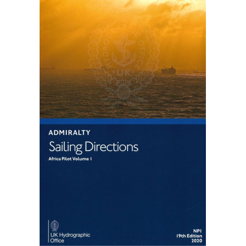





Digital guide for West Africa’s coast (Cabinda to Mogadishu), detailing navigation hazards, port facilities, and weather insights. Essential for merchant vessels, compatible with Windows 7+.
Data sheet
Specific References
Navigate the challenging waters of Africa’s western coastline with confidence. This digital Sailing Directions: Africa Vol. 1 guide delivers critical, up-to-date maritime intelligence for commercial vessels and seasoned mariners. Covering the vast stretch from Cabinda to Mogadishu, this volume is your trusted resource for safe, efficient, and compliant voyages in one of the world’s most dynamic maritime regions.
More than just a guide—this is a complete navigational toolkit packed with actionable insights. Every page is crafted to support decision-making at sea, offering:
Say goodbye to bulky paper manuals. This fully digital edition is engineered for modern navigation, offering:
Whether you're navigating the busy shipping lanes of the Gulf of Guinea or approaching the ports of East Africa, this guide is designed to reduce risk, improve efficiency, and ensure compliance. It’s not just about getting from point A to B—it’s about doing so safely, legally, and profitably.
In a region where local knowledge can mean the difference between smooth sailing and costly delays, Sailing Directions: Africa Vol. 1 delivers the insights you need—when you need them. It’s the digital upgrade your navigation toolkit deserves.
Navigate Africa’s West Coast with Confidence – The Digital Guide Trusted by Professional Mariners
When every mile counts, precision matters. Sailing Directions: Africa Vol. 1 is the digital nautical guide designed for commercial vessels navigating the complex waters from Cabinda to Mogadishu. This 2020 edition delivers real-time, actionable intelligence to help captains, navigators, and shipping companies avoid hazards, optimize routes, and comply with local maritime regulations—all from a single, searchable digital platform.
More Than a Guide – A Complete Navigational Ecosystem
This isn’t just another sailing manual. It’s a fully integrated digital resource that combines hazard mapping, weather patterns, port entry procedures, and regulatory updates into one seamless experience. With full-color imagery, high-resolution coastal views, and detailed buoyage systems, mariners gain a 360-degree understanding of their environment—before they even set sail. The guide is optimized for Windows 7 and later, ensuring compatibility with standard maritime PCs without the need for additional software.
Designed for the Demands of Modern Shipping
In a region where seasonal currents, shifting weather, and strict port regulations can disrupt even the best-laid plans, this guide provides the predictive insights needed to stay ahead. It covers critical details like tidal flows, pilotage requirements, and customs procedures, ensuring that vessels not only arrive safely but also avoid costly delays and compliance issues. Whether navigating the busy shipping lanes of the Gulf of Guinea or approaching the ports of East Africa, this guide is built to reduce risk, improve efficiency, and protect your bottom line.
Part of a Global Standard – Trusted by Mariners Worldwide
As one of 74 volumes in the Admiralty Sailing Directions series, this guide is part of a worldwide standard used by commercial fleets, naval operations, and maritime authorities. It’s designed to complement Admiralty nautical charts, providing an additional layer of intelligence that enhances situational awareness. With this digital edition, mariners gain instant access to the most current data, ensuring they’re always working with the latest information—no outdated paper manuals, no guesswork.
The Smart Choice for Safe, Efficient, and Compliant Voyages
In maritime navigation, knowledge is safety. Sailing Directions: Africa Vol. 1 delivers that knowledge in a format built for the modern mariner—fast, accurate, and always accessible. Whether you're a captain, a shipping company, or a maritime professional, this guide is the digital upgrade your navigation toolkit needs to tackle Africa’s western coastline with confidence.
This digital nautical guide provides comprehensive coverage of Africa’s western coastline, from Cabinda to Mogadishu, with up-to-date information on navigation hazards, port facilities, and maritime regulations. Compatible with Windows 7 and later, it features full-color imagery, high-resolution coastal views, and instant search functionality for quick access to critical data. Published in 2020, this English-language edition is part of a 74-volume global series, ensuring consistency and reliability for professional mariners.
For over two centuries, this organization has set the global standard for maritime navigation, providing accurate, reliable, and up-to-date nautical information to commercial fleets, naval operations, and maritime authorities worldwide. Their publications, including charts, sailing directions, and digital guides, are trusted by mariners across the globe for their precision, comprehensiveness, and commitment to safety at sea.
This volume covers the west coast of Africa, from Cabinda to Mogadishu, including key navigational details for the region.
No, this digital publication is only compatible with Windows 7 and later versions.
It includes information on underwater dangers, reefs, shallow waters, and other critical hazards for safe navigation.
Yes, it provides detailed port entry guides, including regulations, pilotage details, and berthing facilities.
Yes, it covers seasonal weather conditions, tidal patterns, and ocean currents relevant to the covered regions.
Updates are released periodically; this edition is based on data from approximately 2020.
Yes, once downloaded, it can be accessed offline, making it suitable for use at sea.
You might also like





































































![Admiralty - eNP054 - Sailing directions: North Sea [West]](https://www.nautic-way.com/80626-home_default/admiralty-enp054-sailing-directions-north-sea-west-maritime-bookshop-nautic-way.jpg)
![Admiralty - eNP055 - Sailing directions: North Sea [East]](https://www.nautic-way.com/90870-home_default/admiralty-enp055-sailing-directions-north-sea-east-maritime-bookshop-nautic-way.jpg)





























