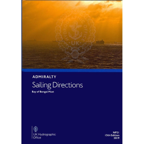





Digital sailing directions for the Bay of Bengal, detailing coastal hazards, weather, pilotage, and port regulations. Designed for merchant vessels navigating from India to Myanmar.
Data sheet
Specific References
Navigate the Bay of Bengal with confidence using the Sailing Directions: Bay of Bengal – eNP021, a comprehensive digital nautical publication designed for merchant mariners and commercial vessels. This essential resource delivers critical coastal navigation data, ensuring safe and efficient voyages along one of the world’s busiest maritime routes. Covering the eastern coast of India, Bangladesh, and the northern Bay of Bengal up to Myanmar, this publication is your trusted companion for precise pilotage and hazard avoidance.
This digital sailing direction provides detailed insights into key navigation zones, including:
As a digital nautical publication (e-NP), the Sailing Directions: Bay of Bengal – eNP021 is designed for seamless integration into modern navigation workflows. Compatible with Windows 7 and later, it requires the ADMIRALTY e-Reader software for access, ensuring a secure and user-friendly experience. The digital format allows for quick updates, easy searchability, and efficient cross-referencing with other nautical charts and publications, making it an indispensable tool for today’s mariners.
Published by a globally recognized authority in maritime navigation, this 14th edition reflects the latest hydrographic data and best practices in safe navigation. Ideal for commercial shipping, fishing vessels, and offshore operations, it combines accuracy with practicality, helping crews mitigate risks and optimize voyage planning. With an individual annual license, you gain access to a reliable resource that evolves with the dynamic maritime environment.
This publication stands out for its:
Navigate the Bay of Bengal with Unmatched Precision
The Sailing Directions: Bay of Bengal – eNP021 is a digital nautical publication engineered to elevate maritime safety and efficiency for commercial vessels operating in one of the world’s most critical waterways. Designed for merchant mariners, this 14th edition delivers a wealth of verified data, ensuring seamless navigation along the eastern coast of India, Bangladesh, and the northern Bay of Bengal up to Myanmar. With coverage spanning from Point Calimere to the Myanmar coastline, this resource is indispensable for vessels traversing these high-traffic and often challenging waters.
Tailored for Modern Maritime Operations
This digital publication is optimized for today’s navigation needs, offering instant access to critical information without the limitations of traditional paper charts. Compatible with Windows 7 and later, it requires the ADMIRALTY e-Reader software, providing a secure and intuitive platform for mariners. The digital format enables quick updates, ensuring that crews always have the most current data on coastal hazards, navigational aids, and port facilities. Whether you're planning a voyage or navigating in real-time, this tool streamlines decision-making and enhances operational efficiency.
Comprehensive Data for Safe and Compliant Voyages
The Sailing Directions: Bay of Bengal – eNP021 goes beyond basic navigation, offering a holistic view of the region’s maritime landscape. It includes detailed information on: Coastal hazards: Identifies reefs, shoals, and other dangers to avoid Navigational aids: Covers buoys, beacons, and lights for precise positioning Meteorological insights: Provides seasonal weather patterns and tidal data Pilotage procedures: Guides vessels through complex port approaches Regulatory compliance: Outlines local maritime laws and reporting requirements Port facilities: Details berths, fuel availability, and provisions for efficient logistics This level of detail ensures that mariners can navigate with confidence, reducing risks and optimizing voyage planning.
Built for Professional Mariners
Published in 2025, this edition reflects the latest hydrographic surveys and maritime best practices, making it a trusted resource for commercial shipping, fishing fleets, and offshore operations. The individual annual license ensures that users receive regular updates, keeping the publication aligned with evolving maritime conditions. Whether you're navigating the congested waters near Chennai, the intricate channels of the Sundarbans, or the approaches to Chittagong, this publication is your reliable partner for safe and efficient voyages.
The Sailing Directions: Bay of Bengal – eNP021 is a digital nautical publication offering comprehensive navigation data for the Bay of Bengal region. This 14th edition, published in 2025, is compatible with Windows 7 and later and requires the ADMIRALTY e-Reader software for access. Available as a digital download, it operates under an individual annual license, ensuring users receive the latest updates and verified data for safe navigation.
For over two centuries, this publisher has set the standard for maritime navigation, providing hydrographic data and nautical publications trusted by mariners worldwide. Renowned for accuracy, reliability, and innovation, their digital and paper-based solutions are essential tools for commercial shipping, naval operations, and offshore industries, ensuring safe and efficient voyages across the globe.
The directions cover the east coast of India north of Point Calimere, the coast of Bangladesh, and the northern Bay of Bengal up to the coast of Myanmar.
No, it is only compatible with Windows 7 and later versions, as it requires the ADMIRALTY e-Reader software.
The license is valid for one year and must be renewed annually for continued access.
It includes information on coastal navigation hazards, buoyage systems, pilotage details, and port entry guidelines.
Yes, it requires a Windows 7 or later operating system and sufficient storage for the digital download.
Yes, it provides details on port facilities, local regulations, and meteorological data relevant to the covered regions.
Yes, once downloaded, it can be accessed offline through the ADMIRALTY e-Reader software.
You might also like





































































![Admiralty - eNP054 - Sailing directions: North Sea [West]](https://www.nautic-way.com/80626-home_default/admiralty-enp054-sailing-directions-north-sea-west-maritime-bookshop-nautic-way.jpg)
![Admiralty - eNP055 - Sailing directions: North Sea [East]](https://www.nautic-way.com/90870-home_default/admiralty-enp055-sailing-directions-north-sea-east-maritime-bookshop-nautic-way.jpg)





























