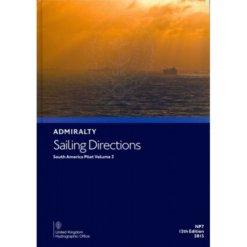





Navigate South America’s western coast with confidence using this digital guide. Covers hazards, markings, ports, and climate data for seamless voyage planning from Cabo Ráper to Punta Mariato.
Data sheet
Specific References
Navigate the complex coastal waters of western South America with confidence using this comprehensive digital nautical publication. Designed for merchant mariners and commercial vessels, this essential guide covers critical maritime regions from Cabo Ráper to Punta Mariato, including the expansive area up to 100°W, the Archipiélago de Colón, and other isolated islands. Whether you're planning a passage or executing precise maneuvers, this publication delivers the detailed insights needed to ensure safety and efficiency at sea.
This digital publication is designed to complement the Admiralty’s standard nautical charts, offering a global coverage system spanning 74 volumes. Together, they provide a complete navigational solution, ensuring mariners have access to the most accurate and up-to-date information available. High-quality color photographs and detailed coastal views further enhance situational awareness, allowing for precise visual identification of landmarks and hazards.
Rely on a publication trusted by professional navigators for its accuracy, reliability, and depth of information. Whether you're navigating busy commercial routes or remote coastal areas, this digital guide provides the critical data needed to make informed decisions, enhance operational efficiency, and ensure the safety of your crew and vessel.
Unlock Precision Navigation with the Digital Sailing Directions for South America
Elevate your maritime operations with this indispensable digital guide, meticulously crafted for commercial vessels navigating the western coasts of South America. Covering a vast expanse from Cabo Ráper to Punta Mariato, including the Archipiélago de Colón and other isolated islands, this publication delivers unparalleled insights into one of the world’s most challenging maritime regions. Designed to complement Admiralty’s global suite of 74 nautical charts, it ensures mariners have access to the most accurate and up-to-date information for safe and efficient voyages.
Comprehensive Data for Informed Decision-Making
This digital publication is packed with critical details to support every phase of your journey. From identifying navigation hazards like reefs and shoals to understanding local pilotage procedures and port regulations, it provides a holistic view of the maritime environment. Seasonal currents, ice conditions, and climatic data are meticulously documented, allowing mariners to anticipate and adapt to dynamic conditions. High-resolution color photographs and coastal views further enhance situational awareness, making it easier to identify landmarks and avoid potential dangers.
Seamless Updates for Uninterrupted Compliance
Stay ahead of the curve with weekly updates delivered through Electronic Notices to Mariners (NMs). These updates are designed to be downloaded and applied in seconds, ensuring your navigational data is always current without disrupting operations. Compatible with Windows 7 and later versions, this digital format integrates effortlessly into your onboard systems, providing a reliable and efficient solution for modern maritime navigation.
Built for Professional Mariners
Trusted by commercial navigators worldwide, this publication is a cornerstone of safe and efficient maritime operations. Whether you're planning a passage or executing complex maneuvers in unfamiliar waters, it equips you with the knowledge and confidence to navigate with precision. Enhance your operational efficiency, ensure compliance with international standards, and safeguard your crew and vessel with this essential digital tool.
This digital nautical publication provides essential guidance for navigating the western coasts of South America, covering latitudes from 47.1°S to 9.25°N and longitudes from 100°W to 65°W. Updated weekly through downloadable Electronic Notices to Mariners (NMs), it ensures mariners have access to the latest navigational data, with updates applied in just seconds. Compatible with Windows 7 and later versions, this 12th edition (2015) is designed for professional use, offering detailed insights into hazards, pilotage, port regulations, and environmental conditions to support safe and efficient maritime operations.
With a legacy spanning over two centuries, this brand is synonymous with precision and reliability in maritime navigation. Renowned for its comprehensive suite of nautical publications and charts, it serves as the gold standard for commercial and professional mariners worldwide. Its products are trusted for their accuracy, up-to-date information, and seamless integration into modern navigation systems, ensuring safety and efficiency at sea.
This volume covers the western coastal waters of South America from Cabo Ráper to Punta Mariato, including the maritime area up to 100°W, the Archipiélago de Colón, and other isolated islands.
No, this edition is only available in English.
They are designed for merchant navigators operating all types of ocean-going vessels.
The digital sailing directions are updated weekly with downloadable Electronic Notices to Mariners (NMs) that can be applied in seconds.
The digital version is compatible with Windows 7 and later versions only.
The sailing directions include color photographs and high-quality coastal views to assist with navigation.
Yes, it is specifically designed to improve efficiency and accuracy in passage planning for ocean voyages.
You might also like





































































![Admiralty - eNP054 - Sailing directions: North Sea [West]](https://www.nautic-way.com/80626-home_default/admiralty-enp054-sailing-directions-north-sea-west-maritime-bookshop-nautic-way.jpg)
![Admiralty - eNP055 - Sailing directions: North Sea [East]](https://www.nautic-way.com/90870-home_default/admiralty-enp055-sailing-directions-north-sea-east-maritime-bookshop-nautic-way.jpg)





























