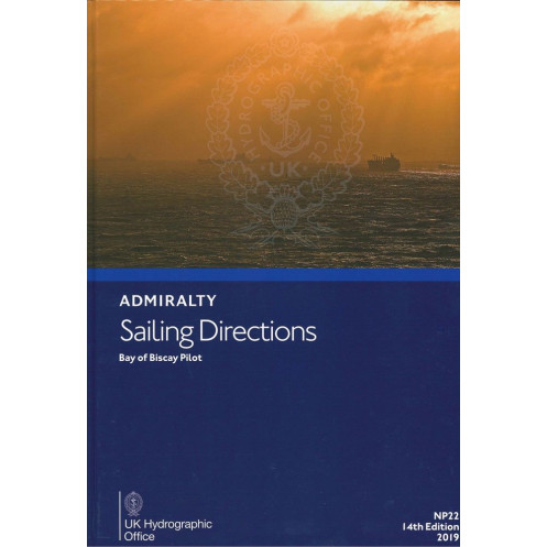





Digital Sailing Directions for the Bay of Biscay, offering critical data on hazards, tides, weather, and ports. Designed for offshore vessels to ensure safer, more efficient passage planning.
Data sheet
Specific References
Navigate the challenging waters of the Bay of Biscay with confidence using the Sailing Directions: Bay of Biscay – eNP022. This digital nautical publication delivers critical, up-to-date information for merchant mariners operating in one of Europe’s most demanding maritime regions. Covering the Bay of Biscay and its approaches—from Pointe de Penmarch in France to Cabo Ortegal in Spain—this guide is an indispensable tool for safe and efficient passage planning.
Designed for deep-sea vessels of all types, this sailing direction provides detailed insights into navigation hazards, aids to navigation, pilotage procedures, and local regulations. It also includes vital data on port facilities, seasonal currents, and weather conditions, ensuring mariners are fully prepared for every aspect of their journey. Whether you're navigating coastal routes or open waters, this publication enhances situational awareness with high-quality color photographs, detailed views, and precise diagrams.
As a perfect complement to standard Admiralty nautical charts, the Sailing Directions: Bay of Biscay – eNP022 ensures a layered approach to navigation. The digital format allows for quick updates, with weekly Notices to Mariners (NMs) applied in seconds, keeping your data current and reliable. No more outdated paper volumes—this digital solution delivers real-time accuracy for modern mariners.
This digital edition is engineered for efficiency, offering instant access to critical navigation data on PCs running Windows 7 or later. Its user-friendly interface and searchable content make it easy to find the information you need, when you need it. Ideal for voyage planning, risk assessment, and on-board decision-making, it’s a must-have for professional navigators and maritime operators.
Backed by decades of maritime expertise, this sailing direction is part of a globally recognized series trusted by commercial fleets, naval operations, and recreational sailors alike. With its precise coverage of the Bay of Biscay—including the western coasts of France, Spain, and Portugal—it ensures compliance with international maritime standards while enhancing operational safety.
Navigate the Bay of Biscay with precision and confidence
The Sailing Directions: Bay of Biscay – eNP022 is a digital nautical publication engineered to provide mariners with the most accurate and up-to-date information for navigating one of Europe’s most complex maritime regions. Covering the Bay of Biscay and its approaches—from Pointe de Penmarch in France to Cabo Ortegal in Spain—this guide is an essential resource for merchant vessels, ensuring safe passage through challenging waters. With its 15th edition (2024), it reflects the latest hydrographic data and maritime regulations, making it a trusted tool for professional navigators.
Critical data for safe and efficient navigation
This sailing direction delivers comprehensive insights into navigation hazards, including shallow waters, submerged rocks, and other dangers that could compromise vessel safety. It also provides detailed information on aids to navigation, such as buoys, beacons, and lighthouses, along with pilotage procedures for entering and exiting ports. Local regulations, port facilities, and seasonal variations in currents and weather conditions are all meticulously documented, ensuring mariners are fully prepared for every aspect of their voyage.
Enhanced situational awareness with visual aids
To further support safe navigation, this digital publication includes high-quality color photographs, detailed coastal views, and precise diagrams. These visual aids help mariners recognize key landmarks, assess navigational risks, and plan their routes with greater accuracy. Whether you're navigating near the rugged coastlines of Brittany or the busy shipping lanes of the Bay of Biscay, these tools provide an extra layer of confidence.
Real-time updates for modern mariners
One of the standout features of this digital edition is its ability to receive weekly updates via Notices to Mariners (NMs). These updates, which can be downloaded and applied in seconds, ensure that your navigation data remains current, reducing the risk of relying on outdated information. This feature is particularly valuable in dynamic maritime environments where conditions can change rapidly.
Designed for digital efficiency
The Sailing Directions: Bay of Biscay – eNP022 is optimized for use on PCs running Windows 7 or later, offering a user-friendly interface that allows for quick searches and easy access to critical data. Its digital format eliminates the need for bulky paper volumes, making it a practical and space-saving solution for modern vessels. Whether you're planning a voyage or making real-time decisions at sea, this publication ensures you have the information you need at your fingertips.
The Sailing Directions: Bay of Biscay – eNP022 is a digital nautical publication covering latitudes from 43°N to 48.33°N and longitudes from 20°W to 0°E. This 15th edition (2024) is authored by a leading hydrographic office and is available in English. The digital format ensures compatibility with Windows 7 and later, with weekly updates via Notices to Mariners (NMs) for real-time accuracy. It includes high-resolution visual aids, detailed coastal views, and comprehensive data on navigation hazards, port facilities, and weather conditions.
With a legacy spanning over two centuries, this hydrographic office is a global leader in maritime navigation data. Renowned for its precision and reliability, it provides essential tools for commercial shipping, naval operations, and recreational boating. Its publications, including sailing directions and nautical charts, are trusted by mariners worldwide for their accuracy and adherence to international maritime standards.
The guide covers the Bay of Biscay and its approaches, including the adjacent coasts of France from Pointe de Penmarch to Spain’s Cabo Ortegal, as well as parts of the western coasts of France, Spain, and Portugal.
No, this digital guide is only compatible with Windows 7 and later versions.
Updates are applied weekly through the Notices to Mariners (NMs) and typically take just a few seconds to download and apply.
The guide includes color photographs, detailed views, and high-quality diagrams to enhance situational awareness during passage planning.
The guide covers latitudes from 43°N to 48.33°N and longitudes from 20°W to 0°E.
Yes, it is designed for merchant navigators operating all types of ocean-going vessels, providing essential navigation information.
You might also like





































































![Admiralty - eNP054 - Sailing directions: North Sea [West]](https://www.nautic-way.com/80626-home_default/admiralty-enp054-sailing-directions-north-sea-west-maritime-bookshop-nautic-way.jpg)
![Admiralty - eNP055 - Sailing directions: North Sea [East]](https://www.nautic-way.com/90870-home_default/admiralty-enp055-sailing-directions-north-sea-east-maritime-bookshop-nautic-way.jpg)





























