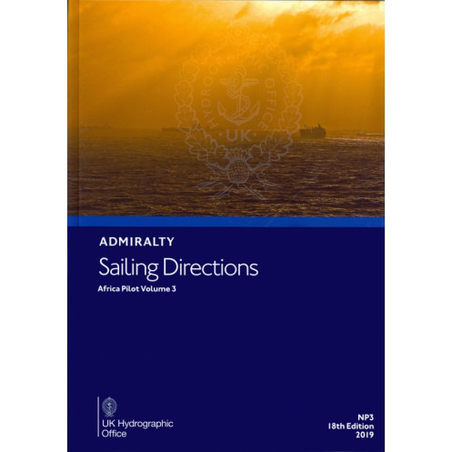





Essential digital sailing directions for Africa’s southern and eastern coasts, from Cape Agulhas to Ras Binnah. Includes hazards, weather, port regulations, and approach guides for safe navigation.
Data sheet
Specific References
Navigate the southern and eastern coasts of Africa with confidence using this official digital Sailing Directions: Africa Vol. 3. Designed for merchant mariners and all types of ocean-going vessels, this comprehensive nautical publication delivers critical coastal navigation information from Cape Agulhas to Ras Binnah. It serves as the perfect companion to standard nautical charts, offering unparalleled insights into safe passage planning and execution.
This digital edition brings maritime navigation into the modern age with cutting-edge functionality. The encrypted PDF format ensures secure access while maintaining the highest standards of accuracy. Weekly or bi-weekly updates keep your navigation data current, with corrections delivered through Notices to Mariners (NM). The intuitive interface allows for quick searches, instant printing, and seamless updates applied in seconds—eliminating the need for manual corrections.
Whether you're navigating commercial shipping lanes or planning complex port approaches, this digital sailing direction provides the precise, reliable information needed for safe operations. The publication covers critical coordinates spanning latitudes from 8°N to 45°S and longitudes from 20°E to 61.33°E, ensuring comprehensive coverage of this vital maritime region. With its combination of official data, practical guidance, and digital convenience, this is an indispensable tool for professional navigation in African waters.
Navigate Africa’s Southern and Eastern Coasts with Unmatched Precision
This official Sailing Directions: Africa Vol. 3 digital publication delivers authoritative coastal navigation guidance for mariners operating between Cape Agulhas and Ras Binnah. As part of the globally recognized 74-volume series, it provides the critical information needed to safely navigate one of the world’s most strategically important maritime regions. Designed specifically for merchant vessels and professional mariners, this digital edition combines the trusted accuracy of traditional sailing directions with the convenience and efficiency of modern digital navigation tools.
Comprehensive Maritime Intelligence at Your Fingertips
Beyond basic chart information, this publication offers a wealth of practical navigation data including detailed descriptions of navigational hazards, local weather patterns, and aids to navigation. High-resolution color photographs and panoramic views provide visual confirmation of key landmarks, while comprehensive port information covers everything from approach procedures to local regulations and available facilities. The 2019 edition incorporates the latest hydrographic data and maritime best practices, ensuring you have the most current information for safe passage planning and execution.
Advanced Digital Navigation for the Modern Mariner
The encrypted PDF format with digital rights management (DRM) ensures secure access while maintaining the publication’s integrity. Weekly or bi-weekly updates through Notices to Mariners (NM) keep your navigation data current without manual corrections. The intuitive interface supports quick searches, instant printing, and seamless updates applied in seconds. Compatible with Windows 7 and later, as well as ECDIS systems, this digital edition works seamlessly with your existing navigation setup. Access is provided through ADMIRALTY e-Readers 1.3/1.4 or the AENP Integrated Viewer, with subscription options available for one or three years.
Precision Coverage for Critical Maritime Routes
This volume provides detailed coverage of African waters spanning latitudes from 8°N to 45°S and longitudes from 20°E to 61.33°E. The publication’s comprehensive approach includes everything from major shipping lanes to complex port approaches, making it an indispensable resource for professional navigation in this region. Whether you're planning a voyage along the southern coast or navigating the intricate waters of the east, this digital sailing direction delivers the precise, reliable information needed for safe and efficient maritime operations.
This digital Sailing Directions: Africa Vol. 3 publication combines official maritime authority with advanced digital functionality. The 2019 edition delivers encrypted PDF content with DRM protection, ensuring secure access while maintaining data integrity. Designed for Windows 7 and later systems, it offers compatibility with ECDIS navigation setups and provides weekly or bi-weekly updates through Notices to Mariners. The publication covers critical coordinates from 8°N to 45°S latitude and 20°E to 61.33°E longitude, with access through ADMIRALTY e-Readers or the AENP Integrated Viewer.
For over two centuries, this hydrographic office has set the global standard for maritime navigation publications. As the world’s leading provider of official nautical information, their comprehensive range of sailing directions, charts, and digital navigation tools serves professional mariners across all oceans. Their publications are recognized by maritime authorities worldwide for their accuracy, reliability, and adherence to international navigation standards, making them the trusted choice for commercial shipping, naval operations, and professional maritime navigation.
This volume covers the southern and eastern coasts of Africa, from Cape Agulhas to Ras Binnah, including key navigational details for coastal and port approaches.
No, this digital publication is only compatible with Windows 7 and later versions, and cannot be accessed on Mac or Linux systems.
Updates are provided weekly or bi-weekly via downloads, incorporating the latest Notices to Mariners (NM) corrections.
Yes, the publication allows instant printing and screenshot functions, though the content remains encrypted and protected by DRM.
It requires a PC running Windows 7 or later, with either ADMIRALTY e-Readers 1.3/1.4 or the AENP Integrated Viewer for access.
Updates are applied in seconds, ensuring the latest navigational information is quickly integrated into the publication.
Yes, it includes color photographs, panoramic views, and detailed charts to assist with navigation and port approaches.
You might also like





































































![Admiralty - eNP054 - Sailing directions: North Sea [West]](https://www.nautic-way.com/80626-home_default/admiralty-enp054-sailing-directions-north-sea-west-maritime-bookshop-nautic-way.jpg)
![Admiralty - eNP055 - Sailing directions: North Sea [East]](https://www.nautic-way.com/90870-home_default/admiralty-enp055-sailing-directions-north-sea-east-maritime-bookshop-nautic-way.jpg)





























