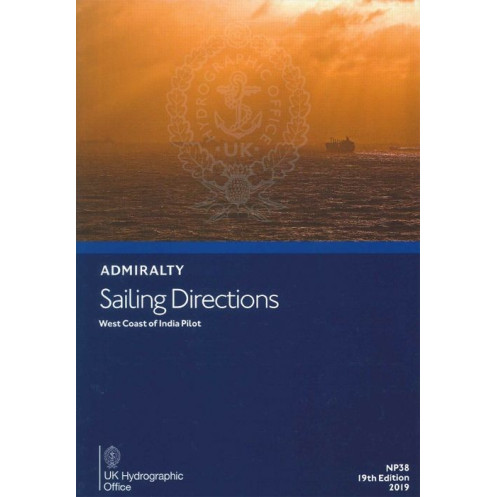





Digital guide for the West Coast of India, Maldives, and Sri Lanka. Covers hazards, buoyage, port rules, and weather data to ensure safe navigation for merchant vessels.
Data sheet
Specific References
Navigate the waters of the West Coast of India, the Maldives, Lakshadweep, Sri Lanka, and Pakistan with confidence. This digital Sailing Directions publication delivers critical, up-to-date information tailored for merchant mariners operating on all types of ocean-going vessels. Whether you're charting a course through the Bay of Palk or approaching the bustling ports of Mumbai, this guide ensures you have the knowledge to sail safely and efficiently.
Designed as a vital companion to standard nautical charts, this publication provides a wealth of essential details, including:
Part of a globally recognized series of 74 volumes, this Sailing Directions publication ensures consistent, reliable, and authoritative information for mariners worldwide. Updated regularly, it reflects the latest changes in maritime conditions, regulations, and infrastructure, making it an indispensable tool for safe and efficient navigation.
This digital edition is designed for convenience and accessibility, allowing you to:
Whether you're a seasoned captain, a maritime professional, or a shipping company ensuring the safety of your fleet, this Sailing Directions publication is your trusted resource for navigating one of the world's most dynamic maritime regions. Equip your vessel with the knowledge needed to avoid risks, optimize routes, and ensure smooth operations in the waters of the West Coast of India and beyond.
Master the Waters of the West Coast of India with Precision and Confidence
Navigating the complex and bustling maritime routes of the West Coast of India, the Maldives, Lakshadweep, Sri Lanka, and Pakistan demands more than just skill—it requires the most accurate and reliable information at your fingertips. The Sailing Directions: West Coast of India – eNP038 is a digital navigation guide designed to provide mariners with the critical data needed to ensure safe, efficient, and compliant voyages. Whether you're steering through the challenging waters of the Bay of Palk or approaching the high-traffic ports of Mumbai and Karachi, this publication is your indispensable companion for avoiding hazards, optimizing routes, and adhering to local regulations.
Engineered for Professional Mariners
This 18th edition, published in 2016, is part of a globally trusted series of 74 volumes that cover the world's oceans. It is meticulously crafted to support merchant mariners operating on all types of ocean-going vessels, from container ships to tankers and bulk carriers. The digital format ensures that you have instant access to the latest navigational intelligence, including detailed descriptions of navigational hazards, buoyage systems, pilotage requirements, and port entry procedures. With coverage spanning latitudes from 32°N to 2°S and longitudes from 61°E to 90°E, this guide provides a comprehensive overview of the region's maritime landscape.
Critical Data for Safe and Efficient Navigation
Beyond basic navigation, this publication delivers in-depth insights into the region's dynamic maritime environment. You'll find essential information on seasonal weather patterns, including the impact of monsoons, as well as tidal streams and ocean currents that can significantly affect your voyage. The guide also includes detailed port profiles, outlining facilities such as berths, anchorages, fuel and water supplies, and repair services. For major ports, step-by-step entry guides simplify the approach, ensuring you can navigate with confidence even in unfamiliar waters. This level of detail is invaluable for planning routes, avoiding delays, and ensuring the safety of your crew and cargo.
Designed for the Digital Age
The digital format of this Sailing Directions publication is optimized for modern mariners. Compatible with Windows 7 and later, it allows you to access critical information quickly and efficiently, without the need for physical storage or manual updates. The intuitive interface supports search functions and hyperlinks, enabling you to find specific details in seconds. Regular updates ensure that you always have the most current data, reflecting changes in maritime conditions, regulations, and infrastructure. This digital advantage not only enhances convenience but also ensures that your navigational tools are always aligned with the latest standards.
Your Trusted Partner for Global Navigation
As part of a globally recognized series, this publication upholds the highest standards of accuracy and reliability. It is trusted by mariners, shipping companies, and maritime authorities worldwide to provide the knowledge needed to navigate safely and efficiently. Whether you're a captain with decades of experience or a maritime professional responsible for fleet operations, the Sailing Directions: West Coast of India – eNP038 equips you with the tools to make informed decisions, mitigate risks, and ensure smooth sailing in one of the world's most critical maritime regions.
The Sailing Directions: West Coast of India – eNP038 is a digital navigation guide designed for professional mariners, offering comprehensive coverage of the West Coast of India, the Maldives, Lakshadweep, Sri Lanka, and Pakistan. This 18th edition, published in 2016, is available in a digital format compatible with Windows 7 and later. It provides critical navigational data, including hazards, buoyage, pilotage, port regulations, meteorological conditions, and port facilities, with coverage spanning latitudes from 32°N to 2°S and longitudes from 61°E to 90°E. Part of a globally recognized series of 74 volumes, this publication ensures mariners have access to the most accurate and up-to-date information for safe and efficient navigation.
For over two centuries, this organization has been a cornerstone of global maritime navigation, providing authoritative nautical publications and charts trusted by mariners worldwide. Renowned for their precision, reliability, and adherence to international standards, their products are essential tools for safe and efficient voyages across the world's oceans. With a commitment to innovation and accuracy, they continue to set the benchmark for maritime navigation resources.
The digital version is compatible with Windows 7 and later operating systems.
Yes, coverage includes the Maldives, Lakshadweep, Sri Lanka with Palk Bay, and the coast of Pakistan.
It includes information on underwater hazards, restricted zones, and areas with challenging pilotage conditions.
New editions are typically released every few years, with the latest being the 18th edition from 2016.
Yes, it provides detailed port entry guides, including approach procedures and berthing instructions.
The coverage spans latitudes from approximately 32°N to 2°S and longitudes from 61°E to 90°E.
While primarily designed for merchant navigators, it contains essential information that can benefit all types of vessels, including recreational boats.
You might also like





































































![Admiralty - eNP054 - Sailing directions: North Sea [West]](https://www.nautic-way.com/80626-home_default/admiralty-enp054-sailing-directions-north-sea-west-maritime-bookshop-nautic-way.jpg)
![Admiralty - eNP055 - Sailing directions: North Sea [East]](https://www.nautic-way.com/90870-home_default/admiralty-enp055-sailing-directions-north-sea-east-maritime-bookshop-nautic-way.jpg)





























