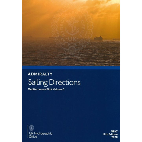





Digital sailing directions for the Ionian Sea and Adriatic, covering Greece’s western coast, Patras and Corinth gulfs. Includes hazards, ports, and weather for safer navigation.
Data sheet
Specific References
Navigate the Mediterranean’s most challenging waters with confidence. This digital nautical guide delivers expertly curated sailing directions for the Ionian Sea, including the Gulf of Patras and the Gulf of Corinth, as well as the Adriatic Sea. Designed for merchant mariners and professional navigators, it provides critical insights to ensure safe passage through one of the world’s busiest maritime regions.
From hidden shoals to seasonal currents, this guide leaves no detail unchecked. It includes:
This digital guide is the perfect companion to standard nautical charts, offering layered insights that enhance situational awareness. Whether planning a route through the narrow straits of the Adriatic or approaching the bustling ports of western Greece, mariners gain a strategic advantage with real-time, actionable data.
Accessible via the ADMIRALTY e-Reader software, this digital edition ensures seamless updates and effortless navigation. Compatible with Windows 7 and later, it provides a user-friendly interface for quick reference at sea or in port. The annual individual license guarantees access to the latest revisions, keeping crews informed and compliant with evolving maritime standards.
Backed by decades of hydrographic expertise, this guide is an indispensable tool for vessels of all sizes. Its meticulous attention to detail and practical focus make it a cornerstone of maritime safety, ensuring that every voyage through the Mediterranean’s dynamic waters is executed with precision and confidence.
Master the Mediterranean’s Most Complex Waters with Expert Digital Guidance
Sailing through the Ionian and Adriatic Seas demands more than standard charts—it requires precise, up-to-date intelligence. This digital nautical guide delivers just that, offering mariners an unparalleled resource for navigating the western coast of Greece, the Gulf of Patras, the Gulf of Corinth, and the Adriatic’s intricate waterways. Designed for professional use, it bridges the gap between traditional cartography and real-world maritime challenges, ensuring safer, more efficient voyages.
Engineered for Professional Mariners
This 18th edition (2024) is tailored for merchant vessels and commercial fleets, providing critical data that goes beyond basic navigation. From identifying submerged hazards to understanding local pilotage regulations, the guide equips crews with the knowledge needed to avoid risks and optimize port calls. Seasonal variations in weather, currents, and ice conditions are meticulously documented, allowing for proactive route planning in even the most unpredictable conditions.
Visual Clarity Meets Digital Efficiency
Enhancing traditional text-based directions, this digital edition incorporates high-resolution color photographs, panoramic coastal views, and detailed diagrams. These visual aids provide immediate context, helping navigators match real-world landmarks with charted data. The ADMIRALTY e-Reader platform ensures seamless access, with a download size of 529 MB and compatibility limited to Windows 7 and later—delivering a streamlined, distraction-free experience for crews on the move.
Built for Compliance and Convenience
With an annual individual license, users receive automatic updates, ensuring compliance with the latest maritime regulations and chart corrections. The guide’s structured format allows for quick searches, while its integration with standard nautical charts provides a holistic view of each voyage. Whether navigating the narrow channels of the Adriatic or the bustling ports of Greece, this tool is an essential asset for maintaining operational efficiency and safety.
This digital nautical guide covers the Ionian Sea (including the Gulf of Patras and Gulf of Corinth) and the Adriatic Sea, offering 2024’s most current navigational data. Compatible exclusively with Windows 7 and later via the ADMIRALTY e-Reader software, it requires a 529 MB download and operates under an annual individual license. The guide includes high-resolution visuals, seasonal environmental data, and port facility details, all optimized for professional maritime use.
With over two centuries of hydrographic leadership, this publisher sets the global standard for maritime navigation resources. Their digital and print publications are trusted by commercial fleets, naval forces, and recreational mariners worldwide, offering unmatched accuracy, reliability, and innovation in nautical guidance.
This volume covers the Ionian Sea along the western coast of Greece, including the Gulf of Patras and the Gulf of Corinth, as well as the Adriatic Sea.
No, the digital version requires the ADMIRALTY e-Reader software, which is only compatible with Windows 7 and later versions.
Updates are available for this edition, but the frequency depends on navigational changes and new editions. The latest edition is from 2024.
The digital download size is approximately 529 MB.
Yes, it includes color photographs, panoramic views, and high-quality diagrams to assist with navigation.
The license is valid for one year from the date of activation and is for individual use only.
Yes, once downloaded and activated through the ADMIRALTY e-Reader software, it can be accessed offline.
You might also like





































































![Admiralty - eNP054 - Sailing directions: North Sea [West]](https://www.nautic-way.com/80626-home_default/admiralty-enp054-sailing-directions-north-sea-west-maritime-bookshop-nautic-way.jpg)
![Admiralty - eNP055 - Sailing directions: North Sea [East]](https://www.nautic-way.com/90870-home_default/admiralty-enp055-sailing-directions-north-sea-east-maritime-bookshop-nautic-way.jpg)





























