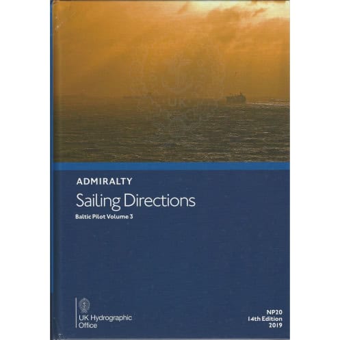





Digital guide for Baltic navigation, covering the Gulf of Finland, Gulf of Bothnia, and Åland Islands. Includes hazards, port facilities, and regulations for merchant vessels. Windows-compatible.
Data sheet
Specific References
Navigate the Baltic’s most critical waterways with confidence. This digital edition of Sailing Directions: Baltic Volume 3 delivers unparalleled precision for mariners operating in the Gulf of Finland, Gulf of Bothnia, and Åland Islands. Designed for commercial vessels and seafarers requiring reliable, up-to-date information, this guide ensures safe passage through one of Europe’s busiest maritime regions. Whether you’re charting a course through narrow straits or approaching key ports, this publication provides the clarity and detail needed to navigate with accuracy.
Part of the globally trusted Sailing Directions series, this volume complements Admiralty charts with a 74-volume library covering every major shipping route. The 2019 digital edition integrates seamlessly with electronic charting systems, offering a dynamic tool for modern navigation. Its compatibility with Windows 7 and later ensures accessibility for vessels equipped with standard maritime software, making it an indispensable resource for captains, navigators, and fleet managers.
From ice-prone waters in the Gulf of Bothnia to the congested shipping lanes of the Gulf of Finland, this guide addresses the unique challenges of Baltic navigation. Its structured layout and clear language make it accessible to international crews, while its technical depth satisfies the demands of professional mariners. Whether you’re navigating through archipelagos or preparing for port calls, this digital resource delivers the confidence and control needed to operate safely and efficiently.
Master the Baltic’s Complex Waterways with Digital Precision
For mariners navigating the Baltic Sea’s high-traffic corridors, Sailing Directions: Baltic Volume 3 is more than a guide—it’s a mission-critical tool. This 2019 digital edition covers the Gulf of Finland, Gulf of Bothnia, and Åland Islands, offering real-time data to tackle the region’s unique challenges, from shifting ice conditions to dense commercial traffic. Designed for vessels of all sizes, it bridges the gap between traditional charting and modern digital navigation, ensuring every voyage is executed with confidence and compliance.
Engineered for Professional Navigation
This publication isn’t just about maps; it’s about actionable intelligence. With latitude and longitude coordinates spanning from 63°N to 69.12°N and 11°E to 35°E, it provides pinpoint accuracy for critical areas. High-resolution photographs and harbor views eliminate guesswork, while detailed port entry guides—including berthing facilities, local regulations, and pilotage requirements—streamline operations. Whether you’re a captain, navigator, or fleet manager, this guide transforms complex data into clear, executable insights.
Seamless Integration with Modern Maritime Workflows
Compatible with Windows 7 and later, this digital edition is built for today’s maritime technology. It integrates effortlessly with electronic charting systems, allowing for quick searches, annotations, and cross-referencing with other navigational tools. Part of the globally recognized Sailing Directions series—a 74-volume library trusted by shipping companies worldwide—it ensures consistency and reliability across every voyage. From ice navigation in the Gulf of Bothnia to port approaches in Helsinki, this guide is your digital co-pilot for safer, smarter sailing.
This digital nautical guide delivers comprehensive coverage of the Baltic Sea’s Gulf of Finland, Gulf of Bothnia, and Åland Islands, with precise latitude (63°N to 69.12°N) and longitude (11°E to 35°E) coordinates. Published in 2019, it includes high-resolution color photographs, port entry details, and hazard warnings, all optimized for Windows 7 and later systems. Part of the global Sailing Directions series, it ensures compliance with SOLAS standards and integrates seamlessly with electronic charting tools.
With over two centuries of maritime expertise, this publisher sets the global standard for nautical publications. Renowned for accuracy and reliability, their guides are trusted by commercial fleets, naval forces, and recreational mariners worldwide. Each publication reflects the latest hydrographic data, ensuring compliance with international maritime regulations and delivering the precision needed for safe navigation in every corner of the globe.
This volume covers the Gulf of Finland, the Gulf of Bothnia, and the Åland Islands, providing detailed navigational guidance for these regions.
No, the digital version is only compatible with Windows 7 and later operating systems.
The guide includes color photographs and high-quality coastal views to assist with navigation and port identification.
Yes, it provides comprehensive information on port facilities, pilotage details, and step-by-step guides for entering ports in the covered regions.
The specified coordinates outline the coverage area, spanning from approximately 59°N to 69°N latitude and 11°E to 35°E longitude, encompassing the Baltic Sea's northern regions.
Yes, it is designed for merchant navigators operating all types of ocean-going vessels, offering critical safety and regulatory information.
You might also like





































































![Admiralty - eNP054 - Sailing directions: North Sea [West]](https://www.nautic-way.com/80626-home_default/admiralty-enp054-sailing-directions-north-sea-west-maritime-bookshop-nautic-way.jpg)
![Admiralty - eNP055 - Sailing directions: North Sea [East]](https://www.nautic-way.com/90870-home_default/admiralty-enp055-sailing-directions-north-sea-east-maritime-bookshop-nautic-way.jpg)





























