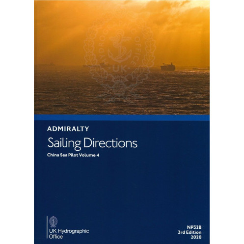





This digital sailing guide for the China Sea (Vol. 4) delivers critical navigation data, port entry details, and hazard warnings. Essential for safe and efficient commercial voyages.
Data sheet
Specific References
Navigate the complex waters of the China Sea with confidence using this comprehensive digital sailing directions guide. Designed for merchant mariners and professional navigators, this publication delivers critical coastal and port entry information for safe and efficient voyages. Whether you're approaching busy commercial hubs or remote anchorages, this guide ensures you have the latest data at your fingertips.
Part of a worldwide series spanning 74 to 76 volumes, this digital edition covers the China Sea with unmatched detail. It complements standard nautical charts by providing context-rich information that charts alone cannot convey. From high-resolution color photographs to detailed harbor views, this guide transforms raw navigational data into actionable intelligence for mariners.
This Windows-compatible digital publication (529 MB download) offers seamless integration with your onboard navigation systems. The annual individual license ensures you receive timely updates and maintain compliance with maritime regulations. Designed for professional use, the interface provides quick access to critical information while underway, reducing the risk of human error in high-traffic areas.
Rely on the same navigation intelligence used by commercial fleets worldwide. This publication combines decades of hydrographic expertise with modern digital delivery, offering a perfect balance of tradition and innovation. The final sale policy reflects the time-sensitive nature of navigational data, ensuring you receive the most current information available.
Navigate the China Sea with Unmatched Precision
This digital sailing directions guide delivers the critical intelligence merchant mariners need for safe and efficient operations in one of the world's busiest maritime regions. Covering the China Sea with meticulous detail, this Volume 4 publication transforms complex navigational challenges into clear, actionable guidance for professional navigers.
Comprehensive Coastal and Port Intelligence
Beyond standard nautical charts, this digital guide provides the contextual information that makes the difference between routine and exceptional navigation. High-resolution color photographs, detailed harbor views, and precise descriptions of navigational hazards give you the complete picture of your operating environment. The publication covers everything from major commercial ports to remote anchorages, ensuring you're prepared for any destination in the region.
Professional-Grade Digital Navigation Tool
Designed for modern maritime operations, this 529 MB digital publication runs exclusively on Windows 7 and later systems. The annual individual license model ensures you always have access to the most current navigational data, with updates reflecting the latest hydrographic surveys and maritime regulations. The intuitive interface provides quick access to critical information, reducing the risk of human error during complex maneuvers or in high-traffic areas.
Trusted Maritime Intelligence for Commercial Operations
Part of a global series spanning 74-76 volumes, this guide represents the gold standard in professional maritime navigation. It includes detailed meteorological data, pilotage procedures, local regulations, and port facility information - everything a professional mariner needs for safe and compliant operations. The final sale policy ensures you receive the most up-to-date information available, reflecting the time-sensitive nature of navigational data.
This digital sailing directions guide provides comprehensive coverage of the China Sea region between latitudes 31.69°N to 41.5°N and longitudes 115.5°E to 127.5°E. The 2020 edition delivers 529 MB of critical navigational data in English, optimized for Windows 7 and later systems. The annual individual license ensures continuous access to updated maritime intelligence, with a final sale policy reflecting the time-sensitive nature of navigational publications.
For over two centuries, this hydrographic authority has set the global standard for maritime navigation publications. Their comprehensive portfolio of nautical charts and sailing directions serves as the trusted reference for commercial fleets, naval operations, and professional mariners worldwide. The organization's commitment to precision and innovation has made their publications an essential component of safe and efficient maritime operations across all major shipping routes.
This volume covers coastal navigation and port entry information for the China Sea, specifically between latitudes 31.69°N to 41.5°N and longitudes 115.5°E to 127.5°E.
No, this digital publication is only compatible with Windows 7 and later versions.
The total download size for this publication is 529 MB.
Yes, it includes color photographs, high-quality views, and detailed charts to assist with navigation.
This publication requires an individual annual license, which is non-transferable and non-refundable.
Yes, it provides meteorological data relevant to safe navigation in the covered regions.
Yes, once downloaded, the publication can be accessed offline on compatible Windows devices.
You might also like





































































![Admiralty - eNP054 - Sailing directions: North Sea [West]](https://www.nautic-way.com/80626-home_default/admiralty-enp054-sailing-directions-north-sea-west-maritime-bookshop-nautic-way.jpg)
![Admiralty - eNP055 - Sailing directions: North Sea [East]](https://www.nautic-way.com/90870-home_default/admiralty-enp055-sailing-directions-north-sea-east-maritime-bookshop-nautic-way.jpg)





























