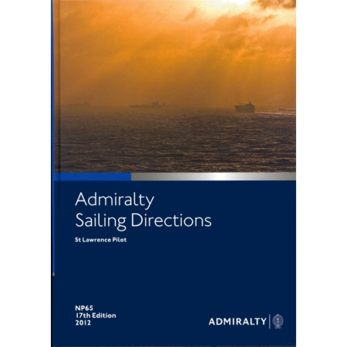





Essential digital sailing directions for the St. Lawrence River and Gulf, covering hazards, weather, ports, and pilotage. Designed for safe and efficient commercial navigation.
Data sheet
Specific References
Navigate the St. Lawrence River, Gulf of St. Lawrence, Cabot Strait, and Canso Strait with confidence using this comprehensive digital sailing directions guide. Designed for merchant navigators operating all types of ocean-going vessels, this publication delivers critical insights to ensure safe and efficient voyages. It complements standard nautical charts, offering a complete solution for mariners in one of North America’s most vital waterways.
Part of a worldwide series of 74 volumes, this digital guide provides consistent, reliable information tailored to the unique challenges of the St. Lawrence region. Whether you're navigating commercial routes, planning port entries, or assessing weather conditions, this publication equips you with the knowledge needed to make informed decisions at sea.
This digital edition is designed for seamless integration into your navigation workflow. Compatible with Windows 7 and later versions, it provides instant access to critical information without the need for physical storage. Whether you're on the bridge or planning a voyage ashore, this publication ensures you have the latest data at your fingertips.
Rely on a publication trusted by professional navigators for its accuracy, depth, and practicality. With editions updated regularly (18th edition 2016 or 19th edition 2020), you can be confident that the information reflects the latest conditions and best practices for navigating the St. Lawrence.
Navigate the St. Lawrence with Precision and Confidence
Discover the ultimate digital navigation companion for the St. Lawrence River and Gulf, designed to enhance safety and efficiency for merchant vessels. This digital sailing directions guide, part of a globally recognized series, provides mariners with unparalleled insights into one of North America’s most critical waterways. Whether you're traversing the Cabot Strait or approaching the bustling ports of the St. Lawrence, this publication ensures you have the most accurate and up-to-date information at your disposal.
Comprehensive Coverage for Every Voyage
This digital guide covers the entire St. Lawrence region, from the Gulf of St. Lawrence to the Canso Strait, offering detailed information on navigation hazards, buoyage systems, and meteorological conditions. With high-resolution color photographs and panoramic views, it helps mariners identify key landmarks and avoid potential dangers. The publication also includes essential pilotage details, ensuring smooth and safe passage through even the most complex areas.
Designed for Modern Navigation Needs
Optimized for digital use, this publication is compatible with Windows 7 and later versions, providing instant access to critical data without the need for physical storage. It complements standard nautical charts, offering a seamless integration into your navigation workflow. Whether you're planning a voyage or navigating in real-time, this guide ensures you have the latest information to make informed decisions.
Trusted by Professionals Worldwide
With editions updated regularly (18th edition 2016 or 19th edition 2020), this publication reflects the latest conditions and best practices for navigating the St. Lawrence. Trusted by mariners for its accuracy and reliability, it is an indispensable tool for ensuring safe and efficient voyages in one of the world’s most vital maritime regions.
This digital sailing directions guide provides essential navigation information for the St. Lawrence River, Gulf of St. Lawrence, Cabot Strait, and Canso Strait. Compatible with Windows 7 and later versions, it includes high-resolution color photographs, panoramic views, and detailed data on hazards, buoyage, weather, pilotage, regulations, and port facilities. Available in the 18th edition (2016) or 19th edition (2020), this digital publication is designed for seamless integration into modern navigation workflows.
For over two centuries, this organization has been a global leader in maritime navigation, providing accurate and reliable nautical publications trusted by mariners worldwide. Their comprehensive range of digital and print resources ensures safe and efficient voyages across the world’s oceans, making them a cornerstone of modern maritime navigation.
The sailing directions cover the St. Lawrence River and Gulf, including the Cabot Strait and the Strait of Canso.
Yes, they are designed for merchant navigators on all types of ocean-going vessels.
The publication includes color photographs and panoramic views to assist navigation.
This digital publication is compatible with Windows 7 and later versions.
It includes details on port facilities, pilotage information, entry guides for major ports, and relevant regulations.
New editions are typically released every few years; recent editions include the 18th edition (2016) and the 19th edition (2020).
Yes, once downloaded, the digital publication can be accessed and used offline.
You might also like






































































![Admiralty - eNP054 - Sailing directions: North Sea [West]](https://www.nautic-way.com/80626-home_default/admiralty-enp054-sailing-directions-north-sea-west-maritime-bookshop-nautic-way.jpg)
![Admiralty - eNP055 - Sailing directions: North Sea [East]](https://www.nautic-way.com/90870-home_default/admiralty-enp055-sailing-directions-north-sea-east-maritime-bookshop-nautic-way.jpg)




























