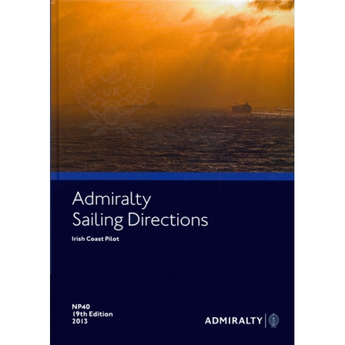





Navigate Ireland’s coastal and offshore waters confidently with this digital sailing guide. Covers hazards, weather, port entries, and regulations for safe and efficient voyages.
Data sheet
Specific References
Navigate the challenging waters of the Irish Coast with confidence using this comprehensive digital sailing directions publication. Designed for merchant mariners and all types of ocean-going vessels, this essential resource provides critical information to ensure safe and efficient voyages along one of the world’s most dynamic maritime regions. From the Atlantic approaches to the Irish Sea, this guide covers coastal and offshore waters with unparalleled precision, making it an indispensable tool for professional and recreational sailors alike.
This digital publication delivers detailed insights into the Irish Coast, including:
Part of a global series of 74 to 76 volumes, this publication is tailored to meet the needs of professional navigators operating in commercial shipping, fishing, and offshore industries. It complements standard nautical charts by providing contextual information that enhances situational awareness and decision-making. Whether you're navigating busy shipping lanes or remote coastal areas, this guide ensures you have the knowledge to make informed choices.
Optimized for Windows 7 and later versions, this digital publication offers a user-friendly interface that allows for easy navigation and quick access to critical information. Regular updates via Notices to Mariners ensure your data remains current, reducing the risk of encountering outdated or inaccurate information. The digital format also eliminates the need for physical storage, making it a practical and eco-friendly choice for modern vessels.
This publication stands out for its:
Whether you're a seasoned mariner or a captain planning your first voyage along the Irish Coast, this digital sailing directions publication is your go-to resource for safe and efficient navigation. Equip your vessel with the knowledge and tools needed to tackle the challenges of these waters, and set sail with the confidence that comes from having the best information at your fingertips.
Navigate the Irish Coast with Unmatched Precision and Confidence
Sailing the Irish Coast demands more than just skill—it requires the most accurate, up-to-date, and comprehensive navigational guidance available. This digital sailing directions publication delivers exactly that, offering mariners an indispensable resource for traversing one of the world’s most intricate and demanding maritime regions. Covering everything from the Atlantic approaches to the Irish Sea, this guide is meticulously crafted to support safe, efficient, and compliant navigation for all types of ocean-going vessels, from commercial ships to private yachts.
Trusted Data for Every Voyage
This 20th edition (2016) publication is part of a globally recognized series of 74 to 76 volumes, each designed to provide mariners with the critical information needed to navigate safely. Updated through Notices to Mariners, it ensures that you always have access to the latest data on navigation hazards, aids to navigation, meteorological conditions, and port facilities. With coverage spanning latitudes from 50.13°N to 55.5°N and longitudes from -20°W to -5°W, this guide leaves no corner of the Irish Coast unexplored.
Optimized for Modern Navigation
Gone are the days of cumbersome paper volumes—this digital publication is designed for the modern mariner. Compatible with Windows 7 and later versions, it offers a seamless, user-friendly experience that allows for quick searches, easy updates, and effortless access to critical information. The digital format also means no more worrying about physical wear and tear, making it a durable and reliable choice for vessels of all sizes. Weighing in at just 1.55 kg in its digital form, it’s a lightweight yet powerful tool that belongs in every navigator’s toolkit.
Built for Professional and Recreational Mariners Alike
Whether you're a professional mariner responsible for the safety of a commercial vessel or a recreational sailor exploring the Irish Coast for the first time, this publication is tailored to meet your needs. It provides detailed pilotage information, including recommended routes, safe channels, and best practices for entering ports, as well as regulatory details to ensure compliance with local and international maritime laws. With this guide, you can navigate with the confidence that comes from having the most trusted and comprehensive information at your disposal.
This digital sailing directions publication is the 20th edition (2016), updated for 2023, and is designed for use on PCs running Windows 7 or later. It covers the Irish Coast, including latitudes from 50.13°N to 55.5°N and longitudes from -20°W to -5°W. The publication is available in English and is provided under an annual individual license. Weighing 1.55 kg in its digital form, it offers a comprehensive and up-to-date resource for safe navigation in this region.
With a legacy spanning over two centuries, this series of nautical publications is trusted by mariners worldwide for its unparalleled accuracy, reliability, and comprehensive coverage. Renowned for setting the standard in maritime navigation, these publications are an essential resource for professional and recreational sailors alike, ensuring safe and informed voyages across the globe.
The sailing directions cover coastal and offshore waters around Ireland, including routes from the Atlantic Ocean approaches to the Irish Sea.
No, the digital sailing directions are only compatible with Windows 7 and later versions.
Updates are provided via Notices to Mariners, ensuring the latest navigational information is available.
They are designed for merchant navigators on all types of deep-sea vessels.
The publication includes pilotage details, port entry guides, harbor facilities, and local regulations for major ports.
Yes, it is part of a global series of 74 to 76 volumes covering sailing directions worldwide.
The physical packaging weighs 1.55 kg.
You might also like





































































![Admiralty - eNP054 - Sailing directions: North Sea [West]](https://www.nautic-way.com/80626-home_default/admiralty-enp054-sailing-directions-north-sea-west-maritime-bookshop-nautic-way.jpg)
![Admiralty - eNP055 - Sailing directions: North Sea [East]](https://www.nautic-way.com/90870-home_default/admiralty-enp055-sailing-directions-north-sea-east-maritime-bookshop-nautic-way.jpg)





























