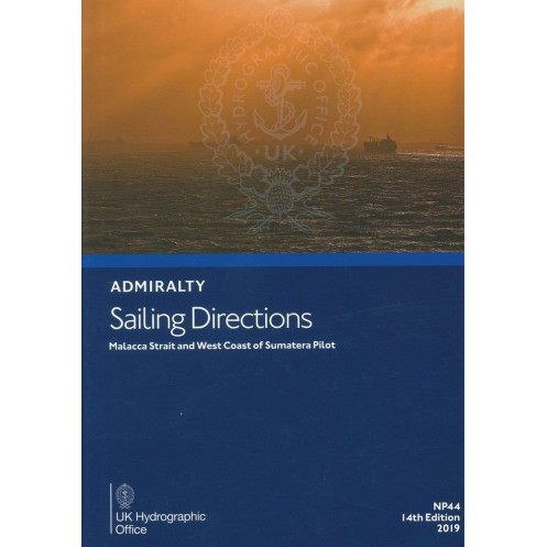





Digital sailing directions for the Strait of Malacca, Singapore Strait, and Sumatra’s west coast. Covers hazards, weather, ports, and pilotage for safe and efficient navigation.
Data sheet
Specific References
Navigate the complex waters of the Strait of Malacca, the Singapore Strait, and the West Coast of Sumatera with confidence. This digital nautical guide delivers authoritative, up-to-date information tailored for merchant mariners operating on all types of ocean-going vessels. Designed to complement standard nautical charts, it provides a complete overview of one of the world’s busiest and most strategically important maritime regions, ensuring safe and efficient passage planning.
Part of a 74-volume series covering the world’s oceans, this digital sailing direction is an indispensable tool for mariners navigating Southeast Asia’s most challenging and vital waterways. Whether transiting high-traffic straits, approaching key ports, or planning long-haul voyages, this guide provides the critical insights needed to ensure safety, compliance, and operational efficiency.
Navigate Southeast Asia’s Most Critical Waterways with Precision and Confidence
This digital nautical guide is an essential resource for mariners operating in the Strait of Malacca, Singapore Strait, and the West Coast of Sumatera—one of the world’s busiest and most strategically important maritime regions. Designed for merchant vessels of all types, it provides a comprehensive, up-to-date reference to ensure safe passage, regulatory compliance, and efficient port operations. With coverage spanning from the northern approaches of the Strait of Malacca to the Cocos Islands, this guide delivers the critical insights needed to navigate complex waterways with confidence.
Trusted Navigation Support for High-Stakes Maritime Operations
Developed by a globally recognized authority in maritime navigation, this digital publication is part of a 74-volume series that sets the standard for safe and efficient seafaring. It complements standard nautical charts by offering detailed, actionable information tailored to the unique challenges of Southeast Asian waters. Mariners gain access to high-resolution color photographs, professional-quality visual aids, and precise pilotage directions, all designed to enhance situational awareness and decision-making in real time.
Comprehensive Coverage of Navigational Hazards, Regulations, and Port Facilities
This guide goes beyond basic charting to provide a holistic view of the region’s maritime environment. It includes in-depth analysis of navigational dangers such as submerged rocks, strong currents, and restricted zones, along with up-to-date meteorological and oceanographic data to support route planning. Mariners will also find detailed port entry guides for major hubs like Singapore, Port Klang, and Belawan, complete with information on pilotage services, customs procedures, and emergency contacts. Local maritime regulations, including traffic separation schemes and reporting requirements, are clearly outlined to ensure full compliance with international and regional standards.
Optimized for Digital Navigation Systems and Professional Use
Designed for seamless integration with electronic chart display and information systems (ECDIS), this digital guide is optimized for quick reference and efficient onboard use. Its user-friendly format allows mariners to access critical information instantly, reducing the risk of human error and enhancing operational efficiency. Regular updates ensure that the content remains aligned with the latest maritime safety standards, making it a reliable tool for commercial fleets, naval operators, and maritime authorities worldwide. Compatible exclusively with Windows 7 and later versions, this digital edition offers the convenience of instant access without the need for physical storage, making it an ideal choice for modern vessels.
This digital nautical guide provides essential navigation data for the Strait of Malacca, Singapore Strait, and the West Coast of Sumatera, including the Cocos Islands. Published in 2017, it is available as a digital download compatible exclusively with Windows 7 and later operating systems. The guide is written in English and includes high-resolution visual aids, pilotage directions, and regulatory information to support safe and compliant maritime operations in one of the world’s most critical shipping regions.
For over two centuries, this organization has been the gold standard in maritime navigation, providing accurate, reliable, and up-to-date nautical information to mariners worldwide. Its publications are trusted by commercial fleets, naval forces, and maritime authorities, ensuring safe and efficient passage across the globe’s most challenging waterways. With a legacy of precision and innovation, it remains a cornerstone of modern maritime operations.
The sailing directions cover the Strait of Malacca and its northern approaches, the Strait of Singapore and its approaches, the west coast of Sumatera (Sumatra), and the Cocos Islands.
No, the sailing directions are only available in English.
These sailing directions are designed for merchant navigators on all types of ocean-going vessels.
The sailing directions include color photographs and high-quality views to assist with navigation.
The digital version is compatible with Windows 7 and later versions only.
The sailing directions include information on port facilities, pilotage guidelines, entry guides for major ports, and relevant regulations.
The latest edition of these sailing directions was published in 2017.
You might also like





































































![Admiralty - eNP054 - Sailing directions: North Sea [West]](https://www.nautic-way.com/80626-home_default/admiralty-enp054-sailing-directions-north-sea-west-maritime-bookshop-nautic-way.jpg)
![Admiralty - eNP055 - Sailing directions: North Sea [East]](https://www.nautic-way.com/90870-home_default/admiralty-enp055-sailing-directions-north-sea-east-maritime-bookshop-nautic-way.jpg)





























