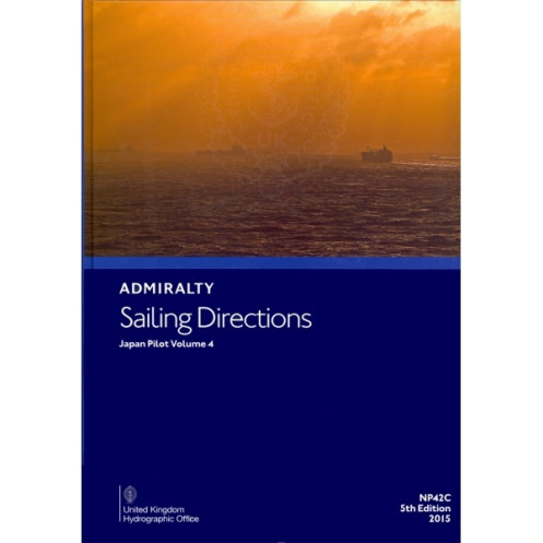





Navigate Japan’s coastal waters with confidence using this digital guide covering Nansei Shoto, Kyushu, and Tsushima. Includes port details, hazards, and weather insights for seamless voyages.
Data sheet
Specific References
Navigate the complex waters of Japan with confidence using this comprehensive digital sailing directions guide. Designed for merchant mariners operating ocean-going vessels, this publication delivers critical navigation insights for the Nansei Shoto region, including the eastern, western, and northwestern coasts of Kyushu, as well as Tsushima. It serves as an indispensable companion to standard nautical charts, offering a wealth of practical information to enhance voyage planning and execution.
This digital edition integrates seamlessly with your onboard navigation systems, providing instant access to vital information. Weekly updates via Notices to Mariners (NMs) ensure your data remains current, with downloads completed in seconds. The intuitive interface allows for quick searches and easy reference during voyage planning and execution, making it an essential tool for modern mariners.
Part of a 74-volume series offering worldwide coverage, this publication upholds the highest standards of maritime safety. Whether navigating busy shipping lanes or remote coastal areas, you’ll benefit from authoritative guidance that has supported mariners for generations. The 2023 edition reflects the latest hydrographic data and navigational best practices, ensuring you have the most reliable information at your fingertips.
Elevate Your Voyage Planning with Precision Navigation Data
This digital sailing directions guide delivers unparalleled accuracy for mariners navigating Japan’s intricate coastal waters. Covering the Nansei Shoto archipelago, Kyushu’s coastlines, and Tsushima, it provides a critical layer of navigational intelligence beyond standard charts. Designed for merchant vessels, it combines high-resolution visuals with actionable data to support safe and efficient passage planning.
Trusted Hydrographic Intelligence for Professional Mariners
Developed by leading hydrographic experts, this publication offers more than just basic directions—it includes detailed hazard assessments, buoyage systems, and port entry protocols. The 7th edition (2023) incorporates the latest hydrographic surveys and regulatory updates, ensuring compliance with international maritime standards. Weekly digital updates via Notices to Mariners (NMs) keep your data current, eliminating the need for manual corrections.
Seamless Integration with Onboard Systems
Optimized for Windows 7 and later, this digital guide is engineered for rapid access and easy integration into your vessel’s navigation workflow. Color photographs, coastal profiles, and real-time weather insights enable quick decision-making, while port facility details streamline logistics planning. Whether transiting busy straits or approaching remote anchorages, this tool enhances situational awareness and operational efficiency.
Global Coverage with Local Precision
As part of a 74-volume series, this guide reflects a commitment to comprehensive maritime safety. The Japan Vol. 4 edition specifically addresses the unique challenges of the region, from tidal currents to local traffic schemes. With coverage spanning latitudes 18.5°N to 34.83°N and longitudes 122.5°E to 133°E, it ensures no critical detail is overlooked—whether you’re navigating the Seto Inland Sea or the East China Sea.
This digital sailing directions guide provides mariners with a robust tool for navigating Japan’s coastal waters. The 7th edition (2023) is available in a digital format, compatible exclusively with Windows 7 and later operating systems. Updated weekly via Notices to Mariners (NMs), it ensures access to the latest hydrographic data, with downloads completed in seconds. Covering key regions such as Nansei Shoto, Kyushu, and Tsushima, it includes high-resolution visuals, hazard assessments, and port entry guidelines for enhanced voyage planning.
For over two centuries, this hydrographic authority has set the global standard for maritime navigation. Renowned for its precision and reliability, it provides mariners with authoritative charts, publications, and digital tools that ensure safe and efficient voyages. Its products are trusted by commercial fleets, naval forces, and recreational sailors worldwide, backed by continuous innovation and adherence to international maritime regulations.
This volume covers Nansei Shoto, the east, west, and northwest coasts of Kyushu, and Tsushima.
No, this digital publication is compatible only with Windows 7 and later versions.
Updates are provided weekly through Notices to Mariners (NMs) via download and take just a few seconds to apply.
It includes high-quality color photographs, coastal views, and detailed charts to assist with navigation.
Yes, it is designed for onboard passage planning and provides essential navigational information for merchant mariners.
It requires a Windows-based system running Windows 7 or a later version. No additional hardware specifications are provided.
Yes, it provides details on port facilities, entry guides, and local regulations for key ports in the covered regions.
You might also like





































































![Admiralty - eNP054 - Sailing directions: North Sea [West]](https://www.nautic-way.com/80626-home_default/admiralty-enp054-sailing-directions-north-sea-west-maritime-bookshop-nautic-way.jpg)
![Admiralty - eNP055 - Sailing directions: North Sea [East]](https://www.nautic-way.com/90870-home_default/admiralty-enp055-sailing-directions-north-sea-east-maritime-bookshop-nautic-way.jpg)





























