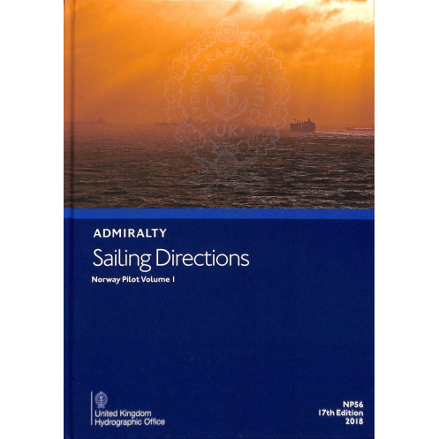




Essential for safe navigation along Norway’s southern coast, this guide covers ports, hazards, and weather from Egersund to the Swedish border. Updated for SOLAS compliance and recreational use.
Data sheet
Specific References
Sailing Directions: Norway Vol. 1 is a critical navigational tool designed for mariners operating along the southern coast of Norway and the western coast of Sweden. This official publication delivers comprehensive, up-to-date guidance for safe and efficient coastal navigation, port entries, and maritime operations in one of Europe’s busiest and most complex maritime regions. Covering the area from Egersund to the Norwegian-Swedish border, as well as the Swedish coast down to Marstrandsfjorden, this volume is indispensable for commercial vessels, cargo ships, and professional mariners navigating these waters.
This volume provides detailed information on navigation routes, port facilities, and critical maritime hazards, ensuring mariners can plan and execute voyages with precision. It includes essential data on navigational aids, buoyage systems, port approaches, and Traffic Separation Schemes (TSS), all aligned with international maritime standards. The publication also features climatic conditions, tidal information, and visual references such as illustrations, photographs, and charts, making it a complete resource for real-time decision-making at sea.
Sailing Directions: Norway Vol. 1 meets the stringent requirements of the Safety of Life at Sea (SOLAS) convention, making it a mandatory resource for commercial vessels. Its authoritative content is trusted by maritime professionals worldwide, providing the accuracy and reliability needed for safe and compliant navigation. Regular updates via Notices to Mariners ensure that mariners always have access to the latest information, reducing risks and enhancing operational efficiency.
This paperback edition is built to withstand the demanding conditions of maritime environments. With a sturdy binding and high-quality print, it remains a dependable reference on the bridge or in the chartroom. Weighing just 0.98 kg, it is lightweight yet robust, making it easy to handle and store while ensuring longevity even with frequent use.
As part of a globally recognized series of nautical publications, Sailing Directions: Norway Vol. 1 is relied upon by shipping companies, naval fleets, and maritime authorities. Its detailed coverage and adherence to international standards make it an invaluable asset for professionals navigating the challenging waters of Norway and Sweden. Whether for route planning, port calls, or emergency preparedness, this publication delivers the critical information needed to navigate with confidence.
Navigate Norway’s Coastal Waters with Unmatched Precision
Sailing Directions: Norway Vol. 1 is the definitive guide for mariners navigating the southern coast of Norway and the western coast of Sweden. This 18th edition, published in October 2022, provides the most current and comprehensive data for safe and efficient maritime operations in this high-traffic region. Designed for commercial vessels, cargo ships, and professional mariners, it ensures compliance with SOLAS regulations while delivering the critical insights needed for seamless navigation.
Detailed Coverage for Complex Maritime Environments
This volume covers the southern Norwegian coast from Lindesnes eastward, extending to the Swedish coast down to Marstrandsfjorden. It includes essential details on navigation routes, port facilities, and maritime hazards, along with up-to-date information on buoyage systems, Traffic Separation Schemes (TSS), and port approaches. With visual aids such as illustrations, photographs, and charts, mariners can quickly assess conditions and make informed decisions, reducing risks and enhancing operational efficiency.
Built for Professional Use and Longevity
Weighing just 0.98 kg, this paperback edition is designed for durability and practicality. Its sturdy binding and high-quality print ensure it withstands the rigors of maritime environments, making it a reliable companion on the bridge or in the chartroom. Regular updates via Notices to Mariners keep the content current, ensuring mariners always have access to the latest navigational data.
Trusted by Maritime Professionals Worldwide
Sailing Directions: Norway Vol. 1 is part of a globally recognized series of nautical publications, trusted by shipping companies, naval fleets, and maritime authorities. Its adherence to international standards and comprehensive coverage make it an indispensable resource for professionals navigating the challenging waters of Norway and Sweden. Whether for route planning, port calls, or emergency preparedness, this publication provides the critical information needed to navigate with confidence and precision.
Sailing Directions: Norway Vol. 1 is an 18th edition paperback publication, released in October 2022. Weighing 0.98 kg, it covers the southern coast of Norway from Lindesnes eastward and the western coast of Sweden down to Marstrandsfjorden. This English-language guide includes detailed navigational data, port facilities, maritime hazards, and visual aids such as illustrations and charts, ensuring compliance with SOLAS regulations for commercial vessels.
With over two centuries of expertise, this publisher is a global leader in maritime navigation and hydrographic services. Renowned for its authoritative nautical publications, it provides essential resources for commercial shipping, naval operations, and maritime safety. Its products are trusted by professionals worldwide for their accuracy, reliability, and adherence to international standards, ensuring safe and efficient navigation across the globe.
This volume covers the southern coast of Norway from Egersund to the Norwegian-Swedish border, as well as the western coast of Sweden down to Marstrandsfjorden near Gothenburg.
Yes, weekly updates are available through the Notices to Mariners to ensure the information remains current and accurate.
The guide includes information on underwater hazards, restricted zones, traffic separation schemes (TSS), and other potential risks along the covered routes.
Yes, it contains illustrations, photos, charts, and sketches to assist with safe navigation and port entries.
Yes, it adheres to SOLAS (Safety of Life at Sea) regulations, making it suitable for both commercial and recreational vessels.
The book weighs approximately 0.98 kg, making it portable for onboard use.
Yes, it is designed to meet the needs of commercial vessels under SOLAS regulations while also being useful for recreational sailors.
You might also like



























































![Admiralty - NP054 - Sailing directions: North Sea [West]](https://www.nautic-way.com/68595-home_default/admiralty-np054-sailing-directions-north-sea-west-maritime-bookshop-nautic-way.jpg)
![Admiralty - NP055 - Sailing directions: North Sea [East]](https://www.nautic-way.com/90871-home_default/admiralty-np055-sailing-directions-north-sea-east-maritime-bookshop-nautic-way.jpg)





































































































