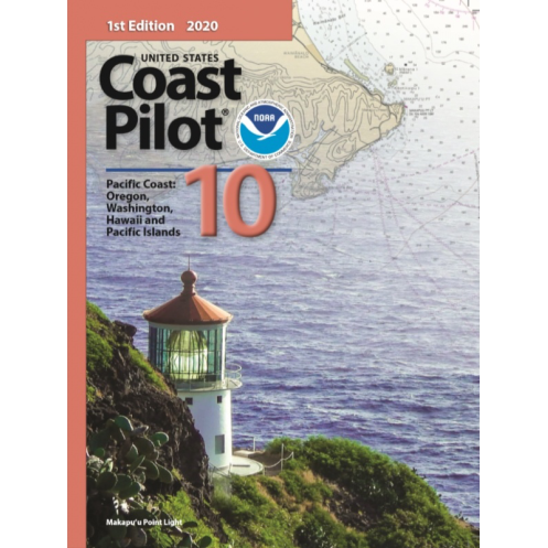



This 2025 Pacific coast guide delivers critical data on tides, currents, hazards, and regulations for Washington, Hawaii, and Pacific Islands. Essential for safe and precise navigation.
Data sheet
Specific References
Navigating the Pacific Coast, from the rugged shores of Washington to the volcanic islands of Hawaii and the remote atolls of the Pacific, demands precision, local knowledge, and reliable data. The United States Coast Pilot 10 delivers exactly that—an authoritative, up-to-date nautical reference designed for mariners who require more than just charts. This official publication bridges the gap between raw cartographic data and real-world navigation, offering critical insights that ensure safety, efficiency, and compliance in one of the world’s most dynamic maritime regions.
While nautical charts provide the foundational framework for navigation, they cannot capture the full complexity of coastal environments. This guide fills that void with detailed, location-specific information that charts alone cannot convey. From the shifting sandbars of the Columbia River to the deep-water channels of Honolulu Harbor, it offers comprehensive descriptions of channels, anchorages, and navigation aids. It also includes real-time data on tidal heights, water levels, and currents—critical factors for vessels of all sizes, from commercial freighters to private sailboats. Weather patterns, ice conditions, and local pilotage requirements are also covered, giving mariners a complete operational picture before they even set sail.
This publication is not a casual sailing companion—it is a professional tool built for those who operate in the maritime industry. Commercial vessel operators, fishing fleets, tugboat crews, and maritime logistics teams rely on its accuracy to plan routes, avoid hazards, and comply with federal regulations. The guide includes essential details on towing operations, traffic separation schemes, and port infrastructure, ensuring that every voyage adheres to the highest standards of safety and efficiency. With its focus on practical, actionable information, it is an indispensable resource for anyone responsible for the safe passage of vessels along the Pacific Coast.
Designed for use in the demanding environment of a ship’s bridge or a dockside planning session, this paperback edition is built to withstand frequent handling. Its 8½ x 11-inch format provides ample space for clear, legible text and diagrams, while its lightweight yet sturdy construction ensures it remains a reliable reference for years. The 2025 edition reflects the latest updates, with revisions published regularly to account for changes in navigation aids, port developments, and regulatory requirements. Whether you’re navigating the busy shipping lanes of Puget Sound or the remote waters of the Northwestern Hawaiian Islands, this guide ensures you have the most current information at your fingertips.
Navigating federal waters requires adherence to a complex web of regulations, and this guide simplifies compliance by consolidating critical legal and operational requirements. It includes amalgamated navigation rules, federal guidelines, and local ordinances, allowing mariners to operate with confidence and avoid costly violations. For vessels entering U.S. ports, this publication is often a required reference, ensuring that every crew member has access to the same standardized, authoritative information. With its focus on clarity and precision, it minimizes risk and maximizes operational efficiency—making it a cornerstone of safe maritime practice.
The Pacific Coast is a region of constant change, where natural forces and human activity continually reshape the maritime landscape. This guide is updated regularly to reflect those changes, ensuring that mariners always have access to the most accurate and relevant information. Whether it’s a new buoy placement, a revised traffic separation scheme, or an updated weather advisory, the United States Coast Pilot 10 evolves alongside the waters it describes. For those who depend on the Pacific Coast for commerce, recreation, or transportation, this publication is more than a book—it’s a lifeline to safer, smarter navigation.
Navigate the Pacific Coast with Unmatched Precision and Confidence
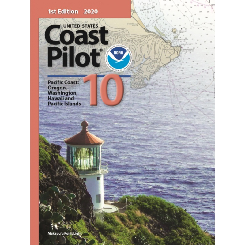
The United States Coast Pilot 10 is the definitive nautical reference for mariners operating along the Pacific Coast, covering Washington, Hawaii, and the Pacific Islands. This official publication goes beyond standard charts, providing the detailed, location-specific information that professionals need to navigate safely and efficiently. Whether you're a commercial vessel operator, a fishing fleet captain, or a maritime logistics coordinator, this guide delivers the critical insights required to plan routes, avoid hazards, and comply with federal regulations in one of the most challenging maritime environments in the world.
Comprehensive Coverage for Complex Waters
From the intricate waterways of Puget Sound to the deep-water channels of Honolulu Harbor, this guide offers unparalleled detail on channels, anchorages, and navigation aids. It includes real-time data on tidal heights, water levels, and currents—essential for vessels of all sizes. Weather patterns, ice conditions, and local pilotage requirements are also covered, ensuring you have a complete operational picture before setting sail. The 2025 edition reflects the latest updates, with revisions published regularly to account for changes in navigation aids, port developments, and regulatory requirements.
Built for Professional Use and Durability
Designed for the demanding environment of a ship’s bridge, this paperback edition is built to withstand frequent handling. Its 8½ x 11-inch format provides ample space for clear, legible text and diagrams, while its lightweight yet sturdy construction ensures it remains a reliable reference for years. Weighing just 1.8 kg, it’s easy to store and transport, making it an ideal companion for both onshore planning and onboard navigation. The guide’s durable binding and high-quality paper ensure it stands up to the rigors of daily use in a maritime setting.
Ensure Compliance and Operational Efficiency
Navigating federal waters requires adherence to a complex web of regulations, and this guide simplifies compliance by consolidating critical legal and operational requirements. It includes amalgamated navigation rules, federal guidelines, and local ordinances, allowing mariners to operate with confidence and avoid costly violations. For vessels entering U.S. ports, this publication is often a required reference, ensuring that every crew member has access to the same standardized, authoritative information. With its focus on clarity and precision, it minimizes risk and maximizes operational efficiency—making it an indispensable tool for safe maritime practice.
The United States Coast Pilot 10 is a paperback edition published in 2023, featuring the 2025 (6th edition) update. It measures 8½ x 11 inches (21.59 x 27.94 cm) and weighs 1.8 kg, making it a practical and portable reference for professional mariners. The guide is written in English and covers the Pacific Coast, including Washington, Hawaii, and the Pacific Islands. Regular updates ensure the information remains current, reflecting changes in navigation aids, port developments, and regulatory requirements.
For over a century, this organization has been the leading authority on maritime navigation in the United States, providing accurate, up-to-date nautical information to mariners worldwide. Their publications are trusted by commercial and recreational navigators alike, offering the precision and reliability needed to navigate safely in even the most challenging waters. With a commitment to continuous updates and innovation, they remain at the forefront of maritime safety and efficiency.
This guide covers the Pacific coast, including Washington, Oregon, Hawaii, and other Pacific Islands, with detailed navigation information for these regions.
Updates are published regularly throughout the year to ensure the most current and accurate navigation information.
It provides details on channels, anchorages, tide heights, currents, weather conditions, ice, pilotage, towing, federal regulations, small boat facilities, hazards, routes, traffic separation schemes, dock descriptions, and prominent landmarks.
Yes, it is designed to be an indispensable resource for all navigators, whether professional or recreational, due to its comprehensive and detailed content.
The guide measures approximately 8½ x 11 inches (21.59 x 27.94 cm) and is paperback.
Yes, it includes an amalgamated version of navigation rules for easy reference.
The printed guide weighs approximately 1.8 kg.
You might also like



























































![Admiralty - NP054 - Sailing directions: North Sea [West]](https://www.nautic-way.com/68595-home_default/admiralty-np054-sailing-directions-north-sea-west-maritime-bookshop-nautic-way.jpg)
![Admiralty - NP055 - Sailing directions: North Sea [East]](https://www.nautic-way.com/90871-home_default/admiralty-np055-sailing-directions-north-sea-east-maritime-bookshop-nautic-way.jpg)