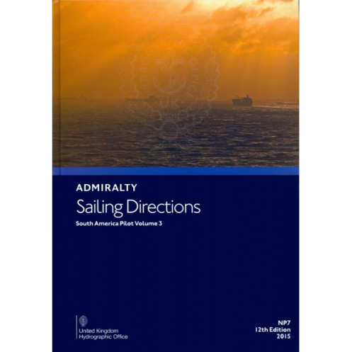




Essential nautical guide for safe navigation along South America’s western coast, from Cabo Ráper to Punta Mariato. Covers hazards, markings, port facilities, and weather conditions in precise detail.
Data sheet
Specific References
Designed for commercial mariners, shipping operators, and naval professionals, this authoritative nautical publication delivers precise, up-to-date sailing directions for the western coastal waters of South America. Covering critical maritime routes from Cabo Ráper to Punta Mariato—including the expansive marine area extending to 100°W—this volume ensures safe and efficient navigation through some of the most challenging and strategically important waters in the region. Whether navigating commercial vessels, conducting maritime operations, or ensuring compliance with international regulations, this guide provides the detailed intelligence needed to traverse these waters with confidence.
This publication offers in-depth coverage of high-traffic and remote maritime zones, including the Archipiélago de Colón (Galápagos Islands) and other isolated islands. These areas present unique navigational challenges, from unpredictable currents to limited infrastructure, making accurate and reliable guidance indispensable. The guide includes critical details on navigation hazards, such as reefs, shallow waters, and uncharted obstacles, as well as seasonal variations in currents, ice conditions, and climate patterns that can impact vessel safety and operational efficiency.
Beyond basic navigation, this volume provides essential data on port facilities, pilotage requirements, and local maritime regulations. Mariners will find comprehensive information on berthing options, cargo handling capabilities, and logistical support available at key ports along the route. The guide also outlines pilotage procedures, including mandatory reporting points, communication protocols, and local maritime authority requirements, ensuring seamless compliance with regional regulations and minimizing delays during port calls.
Constructed to withstand the rigors of life at sea, this hardback edition is built for durability, with high-quality materials designed to resist moisture, wear, and frequent handling. Its robust binding ensures longevity, making it a dependable resource for repeated use in demanding maritime environments. The publication is also available in a digital format (e-NP), offering flexibility for integration with electronic navigation systems and onboard digital libraries, ensuring accessibility whether in the wheelhouse or on the bridge.
As part of a 76-volume series, this publication upholds a legacy of precision and reliability, trusted by mariners worldwide for over a century. It is meticulously updated to reflect the latest hydrographic data, ensuring that navigators have access to the most current and accurate information available. Whether used for voyage planning, real-time navigation, or emergency preparedness, this guide is an indispensable tool for professionals who demand the highest standards of safety and operational excellence in their maritime operations.
Navigate South America’s Western Coasts with Unmatched Precision and Confidence
This essential nautical publication provides mariners with detailed sailing directions for the western coastal waters of South America, spanning from Cabo Ráper to Punta Mariato, including the critical marine zone extending to 100°W. Weighing 1.9 kg, this hardback edition is engineered for durability, ensuring it withstands the demands of life at sea while delivering reliable, up-to-date navigation intelligence. As the 14th edition (2022), it reflects the latest hydrographic data, making it an indispensable resource for commercial shipping, naval operations, and maritime logistics in one of the world’s most complex and high-traffic maritime regions.
Engineered for Professional Mariners and Maritime Operations
Designed specifically for professionals in the merchant marine, this guide offers more than just basic navigation instructions. It includes critical details on navigation hazards, such as reefs, shallow waters, and unmarked obstacles, as well as seasonal variations in currents, ice conditions, and climate patterns that can impact vessel safety. The publication also provides comprehensive information on port facilities, pilotage requirements, and local maritime regulations, ensuring compliance and operational efficiency during port calls and transits through regulated waters.
Comprehensive Coverage of High-Risk and Remote Maritime Zones
This volume covers some of the most challenging and remote areas in South American waters, including the Archipiélago de Colón (Galápagos Islands) and other isolated islands. These regions present unique navigational challenges, from unpredictable currents to limited infrastructure, making accurate guidance essential for safe passage. The guide’s detailed charts and descriptions help mariners anticipate and mitigate risks, ensuring smooth and secure navigation through these critical but often hazardous waters.
Built for Durability and Accessibility in Demanding Environments
Constructed with a hardback binding, this publication is designed to endure the harsh conditions of maritime use, resisting moisture, wear, and frequent handling. Its robust design ensures longevity, making it a reliable companion for repeated use on the bridge or in the wheelhouse. For added convenience, the guide is also available in a digital format (e-NP), allowing seamless integration with electronic navigation systems and onboard digital libraries, ensuring accessibility whether in paper or digital form.
This nautical publication provides detailed sailing directions for the western coastal waters of South America, covering the region from Cabo Ráper to Punta Mariato, including the marine area extending to 100°W. Weighing 1.9 kg, this hardback edition is part of a 76-volume series, offering comprehensive navigation guidance in English. The 14th edition (2022) includes critical data on navigation hazards, port facilities, pilotage requirements, and seasonal variations in currents, ice, and climate conditions, ensuring safe and efficient maritime operations in high-risk and remote areas.
With a legacy spanning over a century, this series of nautical publications is recognized globally as the gold standard for maritime navigation. Trusted by commercial mariners, naval professionals, and shipping operators worldwide, these guides are meticulously updated to reflect the latest hydrographic data, ensuring accuracy and reliability in even the most challenging maritime environments. Designed for durability and precision, they are an essential tool for professionals who demand the highest standards of safety and operational excellence.
This volume covers the western coastal waters of South America from Cabo Ráper to Punta Mariato, including the marine area up to 100°W, the Archipiélago de Colón, and other isolated islands.
Yes, it provides comprehensive information on navigational hazards, as well as buoyage, pilotage, regulations, port facilities, seasonal currents, ice, and climatic conditions.
The publication weighs 1.9 kg.
Yes, it is available in both paper and digital (e-NP) formats.
This book features a hardback binding.
This series consists of 76 volumes in total.
The current edition is the 14th edition, published in 2022.
You might also like



























































![Admiralty - NP054 - Sailing directions: North Sea [West]](https://www.nautic-way.com/68595-home_default/admiralty-np054-sailing-directions-north-sea-west-maritime-bookshop-nautic-way.jpg)
![Admiralty - NP055 - Sailing directions: North Sea [East]](https://www.nautic-way.com/90871-home_default/admiralty-np055-sailing-directions-north-sea-east-maritime-bookshop-nautic-way.jpg)