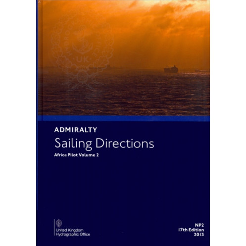




Your trusted companion for West African waters, this sailing guide delivers vital port and coastal insights from the Bakasi Peninsula to Cape Agulhas. Perfect for merchant vessels and safe navigation.
Data sheet
Specific References
Sailing Directions: Africa Vol. 2 is a critical navigational tool designed for merchant vessels of all classes, offering comprehensive guidance for safe and efficient coastal navigation and port entry along the western coast of Africa. Covering key regions from the Bakassi Peninsula to Cape Agulhas, this publication includes vital details for navigating the Gulf of Biafra islands, Ascension Island, Saint Helena, the Tristan da Cunha group, and Gough Island. As a trusted companion to standard nautical charts, it ensures mariners have access to the most accurate and up-to-date information for their voyages.
This volume provides in-depth information on coastal features, harbors, anchorages, and navigational hazards, enabling ship captains and navigators to plan and execute their routes with confidence. Whether navigating busy commercial shipping lanes or remote island passages, Sailing Directions: Africa Vol. 2 delivers the essential data needed to avoid risks and optimize voyage efficiency. Its detailed descriptions and practical insights make it an indispensable resource for maritime professionals operating in African waters.
Developed by a leading authority in hydrographic services, this publication adheres to the highest standards of accuracy and reliability. The 19th edition, updated in 2022, reflects the latest navigational data, ensuring compliance with international maritime regulations. Its durable hardcover format guarantees longevity, even in the demanding conditions of life at sea. For mariners who prioritize safety and precision, Sailing Directions: Africa Vol. 2 is the go-to reference for navigating one of the world’s most critical maritime regions.
Designed to complement standard nautical charts, this volume enhances situational awareness by providing contextual information that charts alone cannot offer. From tidal patterns to local regulations, it equips navigators with the knowledge needed to make informed decisions in real time. Whether used for voyage planning or on-the-spot reference, Sailing Directions: Africa Vol. 2 bridges the gap between raw chart data and practical, actionable insights.
Engineered for the rigors of maritime use, this paper version is built to withstand frequent handling, exposure to moisture, and the wear and tear of life onboard. Its clear, concise layout ensures quick access to critical information, while its lightweight yet sturdy design makes it easy to store and transport. For professionals who demand reliability, this publication delivers unmatched performance in even the most challenging environments.
Navigate Africa’s Western Coast with Confidence
Sailing Directions: Africa Vol. 2 is the definitive navigational guide for merchant vessels operating along the western coast of Africa, from the Bakassi Peninsula to Cape Agulhas. This essential publication provides mariners with detailed, up-to-date information on coastal navigation, port entries, and critical hazards, ensuring safe and efficient voyages in one of the world’s most trafficked maritime regions. Whether navigating the Gulf of Biafra, Ascension Island, or the remote Tristan da Cunha group, this volume delivers the precise data needed to plan and execute routes with accuracy.
Trusted by Maritime Professionals Worldwide
As part of a 76-volume series, this 19th edition (2022) is meticulously updated to reflect the latest hydrographic data, ensuring compliance with international maritime standards. Weighing just 1.9 kg, its durable hardcover format is designed to endure the demands of life at sea, from frequent handling to exposure to harsh conditions. The publication’s clear, structured layout allows for quick reference, making it an indispensable tool for ship captains, navigators, and maritime operators who prioritize safety and efficiency.
Comprehensive Coverage for Every Voyage
Sailing Directions: Africa Vol. 2 covers a vast geographic area, including key commercial shipping lanes and remote island passages. It provides detailed descriptions of harbors, anchorages, tidal patterns, and local regulations, enabling mariners to make informed decisions in real time. By integrating seamlessly with standard nautical charts, this volume enhances situational awareness, offering contextual insights that charts alone cannot provide. For vessels of all classes, it is the ultimate resource for navigating Africa’s western coast with confidence.
Sailing Directions: Africa Vol. 2 is a hardcover publication in its 19th edition, updated in 2022 to ensure the most current navigational data. Weighing 1.9 kg, it is designed for durability and ease of use in maritime environments. Available in English, this volume is part of a 76-volume series and covers latitudes from 4°32'N to 45°S and longitudes from 20°W to 20°E, encompassing critical regions along Africa’s western coast.
For over two centuries, this hydrographic authority has set the global standard for maritime navigation, providing accurate and reliable data to commercial and naval fleets worldwide. Their publications are trusted by mariners for their precision, durability, and adherence to international maritime regulations, making them an essential resource for safe and efficient navigation.
This volume covers the west coast of Africa from the Bakasi Peninsula to Cape Agulhas, including the Gulf of Biafra islands, Ascension Island, St. Helena, the Tristan da Cunha group, and Gough Island.
Yes, it is designed for merchant vessels of all classes and covers all aspects of navigation in the specified regions.
The publication is available in both paper format and as a digital version (e-NP).
The latest edition is the 19th, published in 2022. Updates are released periodically to ensure accuracy and relevance.
The printed version weighs approximately 1.9 kg.
Yes, it provides essential details for port entry and coastal navigation in the covered regions.
The complete series consists of 76 volumes.
You might also like


























































![Admiralty - NP054 - Sailing directions: North Sea [West]](https://www.nautic-way.com/68595-home_default/admiralty-np054-sailing-directions-north-sea-west-maritime-bookshop-nautic-way.jpg)
![Admiralty - NP055 - Sailing directions: North Sea [East]](https://www.nautic-way.com/90871-home_default/admiralty-np055-sailing-directions-north-sea-east-maritime-bookshop-nautic-way.jpg)





































































































