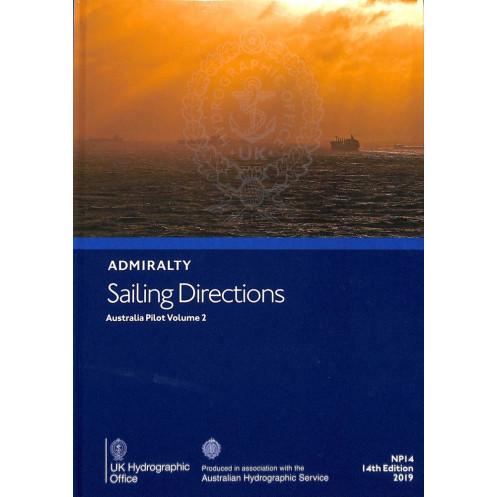




Ensure safe voyages along Australia’s southern and eastern shores with this detailed nautical pilot. Includes hazards, buoyage, port info, and weather insights for Bass Strait, Tasmania, and beyond.
Data sheet
Specific References
Navigating the complex waters of Australia’s southern, southeastern, and eastern coastlines demands precision, local knowledge, and reliable data. Sailing Directions: Australia Vol. 2 delivers an authoritative, in-depth resource tailored for mariners operating between Green Cape and Port Jackson, including Bass Strait and Tasmania. This official nautical publication provides critical insights into coastal and port navigation, ensuring vessels can safely approach, enter, and maneuver through some of Australia’s most trafficked and challenging maritime regions.
Designed for commercial shipping, fishing fleets, and maritime professionals, this volume is an indispensable tool for passage planning and real-time decision-making. It consolidates essential information on navigational hazards, aids to navigation, pilotage requirements, and local regulations, allowing crews to anticipate risks and optimize routes. The publication also details port facilities, seasonal currents, climatic conditions, and ice advisories, offering a complete operational picture for vessels of all sizes.
Beyond textual data, Sailing Directions: Australia Vol. 2 includes high-quality diagrams and photographs that provide visual confirmation of landmarks, buoys, and coastal features. These visual aids complement official Admiralty charts, reinforcing bridge awareness and reducing the risk of misidentification in high-stakes environments. Whether navigating narrow channels, congested harbors, or remote coastal stretches, mariners gain an additional layer of confidence through these detailed references.
As part of a 76-volume global series, this publication adheres to the highest standards of maritime cartography and hydrography. Each volume is meticulously updated to reflect the latest hydrographic surveys, port developments, and regulatory changes, ensuring compliance with international maritime safety protocols. The modular structure of the series allows operators to acquire only the volumes relevant to their routes, making it a cost-effective solution for fleets with specific geographic needs.
Unlike generic navigational guides, Sailing Directions: Australia Vol. 2 is engineered for professional maritime operations. Its structured format prioritizes clarity and accessibility, with information organized for quick reference during high-pressure scenarios. From tidal streams to local traffic separation schemes, every detail is presented to support efficient, safe, and compliant navigation in one of the world’s most dynamic maritime regions.
Navigate Australia’s Southern and Eastern Coasts with Confidence
Sailing Directions: Australia Vol. 2 is a vital nautical publication for mariners requiring precise, up-to-date guidance for Australia’s southern, southeastern, and eastern coastlines. Covering the critical stretch from Green Cape to Port Jackson—including Bass Strait and Tasmania—this volume provides the detailed intelligence needed to safely approach ports, avoid hazards, and comply with local maritime regulations. Weighing 1.9 kg, this 15th edition (2025) is the latest in a globally recognized series of 76 volumes, offering unmatched reliability for commercial and professional navigation.
Engineered for Professional Maritime Operations
This paperback edition is designed to withstand the demands of bridge environments, delivering essential data on navigational dangers, aids to navigation, pilotage procedures, and port infrastructure. It also includes critical environmental insights, such as seasonal currents, climatic patterns, and ice conditions, enabling crews to plan passages with accuracy. High-resolution diagrams and photographs further enhance situational awareness, ensuring seamless integration with official Admiralty charts for a comprehensive navigational toolkit.
Tailored for Commercial Shipping and Maritime Fleets
Whether operating container ships, fishing vessels, or offshore support craft, mariners rely on this publication to mitigate risks and optimize operational efficiency. The volume’s structured layout allows for rapid access to information, from local traffic regulations to port entry protocols, making it an indispensable resource for bridge teams. Updated to reflect the latest hydrographic surveys and port developments, it ensures compliance with international maritime safety standards while providing the flexibility to purchase only the volumes relevant to specific routes.
Sailing Directions: Australia Vol. 2 is a 1.9 kg paperback publication, featuring the 15th edition (2025) in English. It covers Australia’s southern, southeastern, and eastern coastlines from Green Cape to Port Jackson, including Bass Strait and Tasmania, with detailed navigational data, diagrams, and photographs. Part of a 76-volume global series, this official Admiralty publication is designed for professional maritime use, offering precise geographic coverage between latitudes 33.82°S to 53°S and longitudes 140.87°E to 160°E.
With over two centuries of expertise in hydrography and maritime safety, this publisher sets the global standard for nautical publications. Their comprehensive series of sailing directions and charts are trusted by commercial fleets, navies, and maritime authorities worldwide, ensuring accuracy, reliability, and compliance with international navigation protocols.
This volume covers the southern, southeastern, and eastern coasts of Australia, from Green Cape to Port Jackson, including Bass Strait and Tasmania.
Yes, it provides details on seasonal currents, along with climatic conditions and ice hazards in the covered regions.
Yes, it includes high-quality diagrams and photographs to assist with passage planning and situational awareness.
The paperback edition weighs 1.9 kg.
This is the 15th edition, published in 2025, ensuring up-to-date navigational information and regulations.
It is designed to be used alongside official nautical charts for comprehensive navigation and safety.
The series consists of 76 volumes, offering global coverage for flexible purchasing.
You might also like


























































![Admiralty - NP054 - Sailing directions: North Sea [West]](https://www.nautic-way.com/68595-home_default/admiralty-np054-sailing-directions-north-sea-west-maritime-bookshop-nautic-way.jpg)
![Admiralty - NP055 - Sailing directions: North Sea [East]](https://www.nautic-way.com/90871-home_default/admiralty-np055-sailing-directions-north-sea-east-maritime-bookshop-nautic-way.jpg)





































































































